


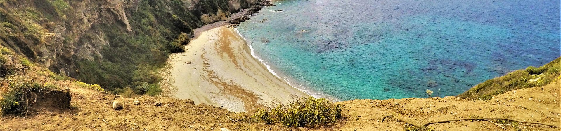
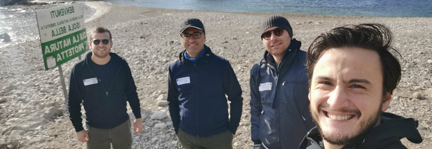
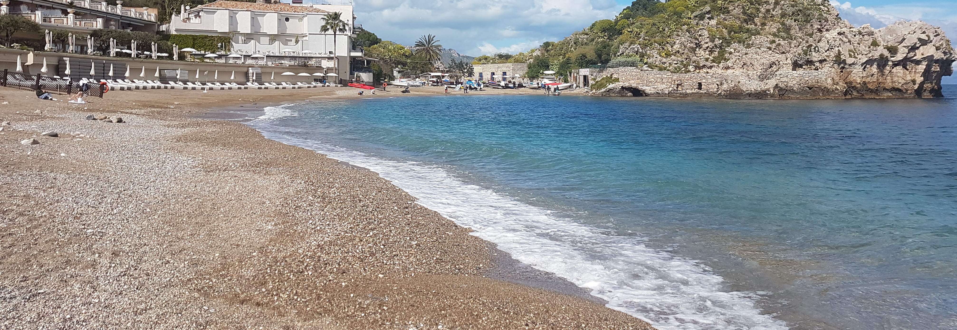
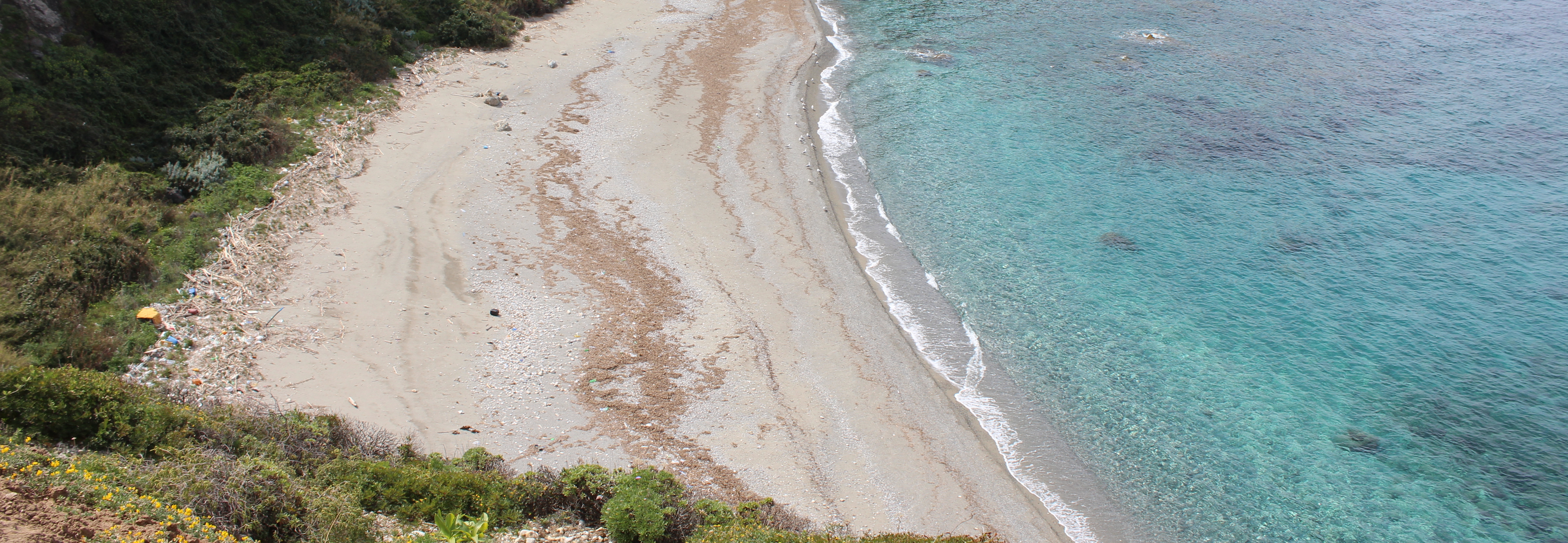
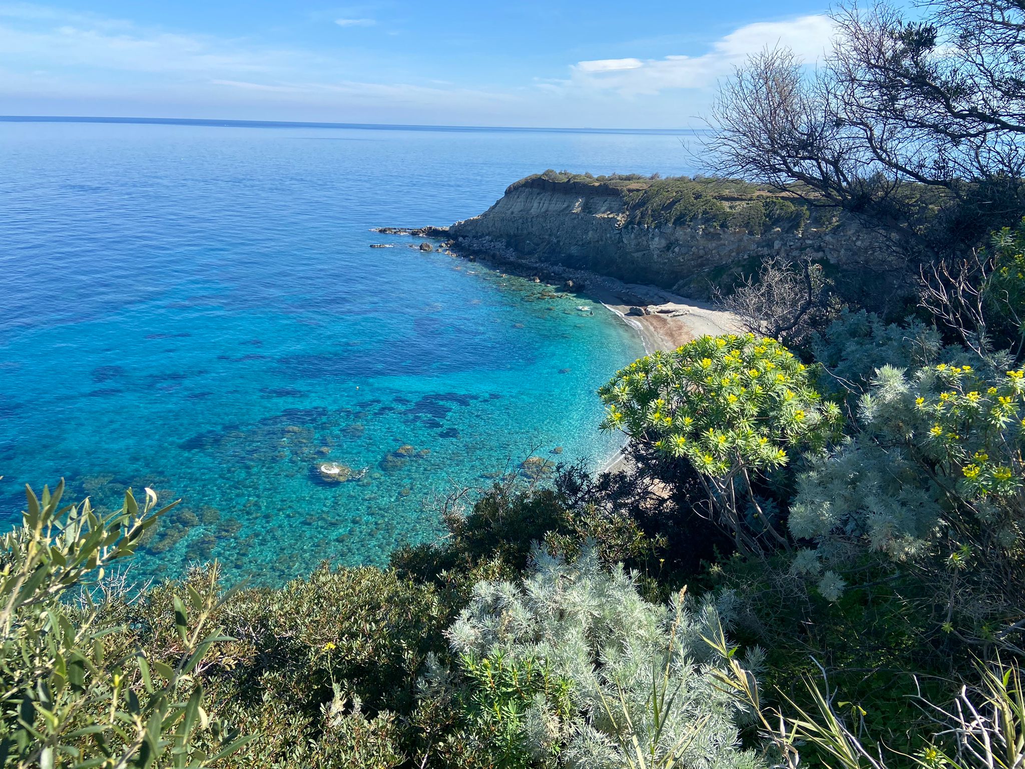
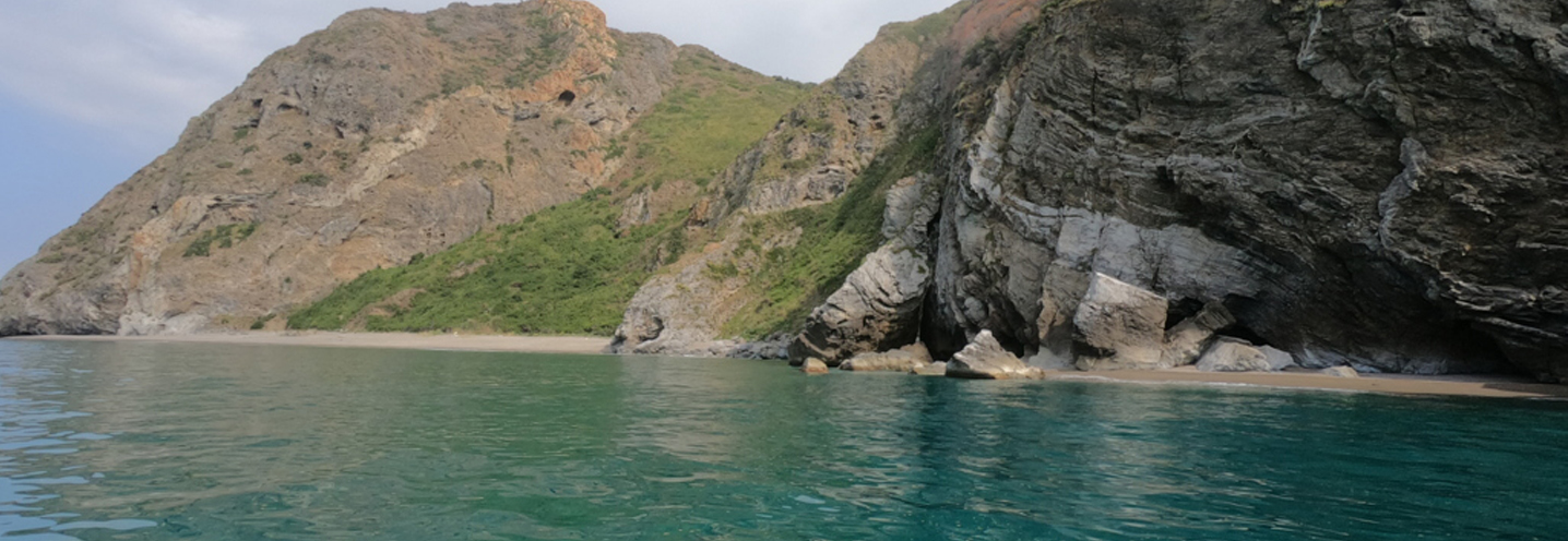
- Taormina – Isola Bella
Pocket beach code: SIC01ME01_02
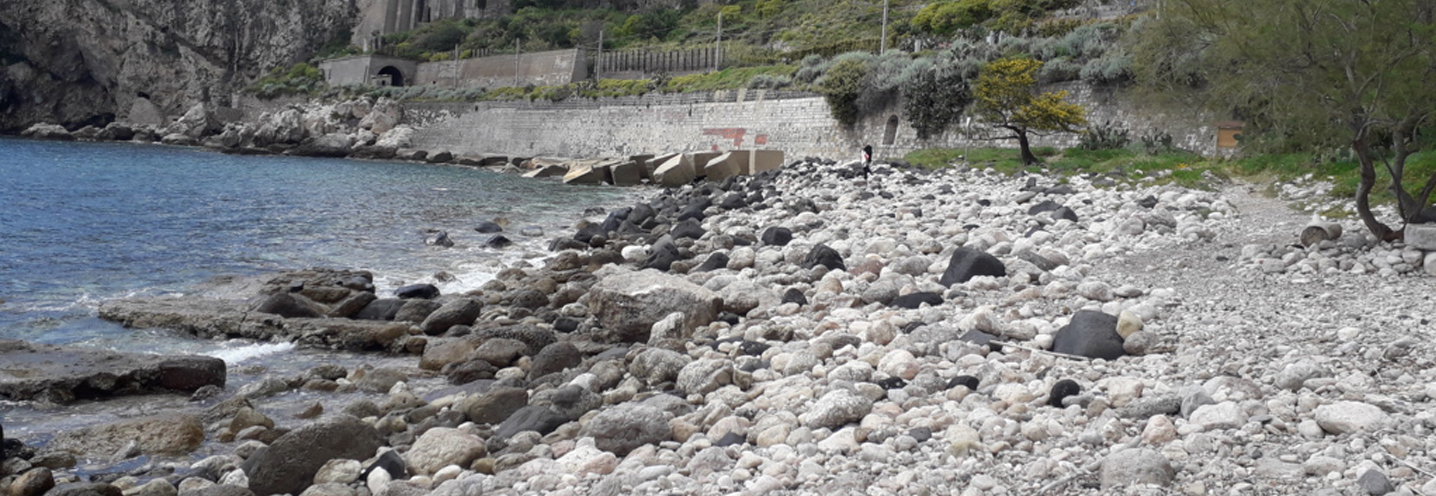
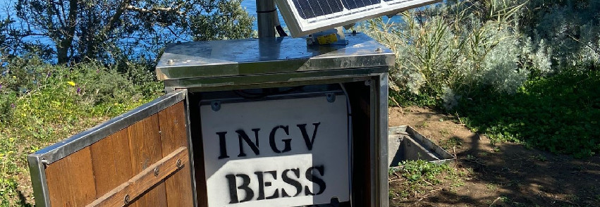
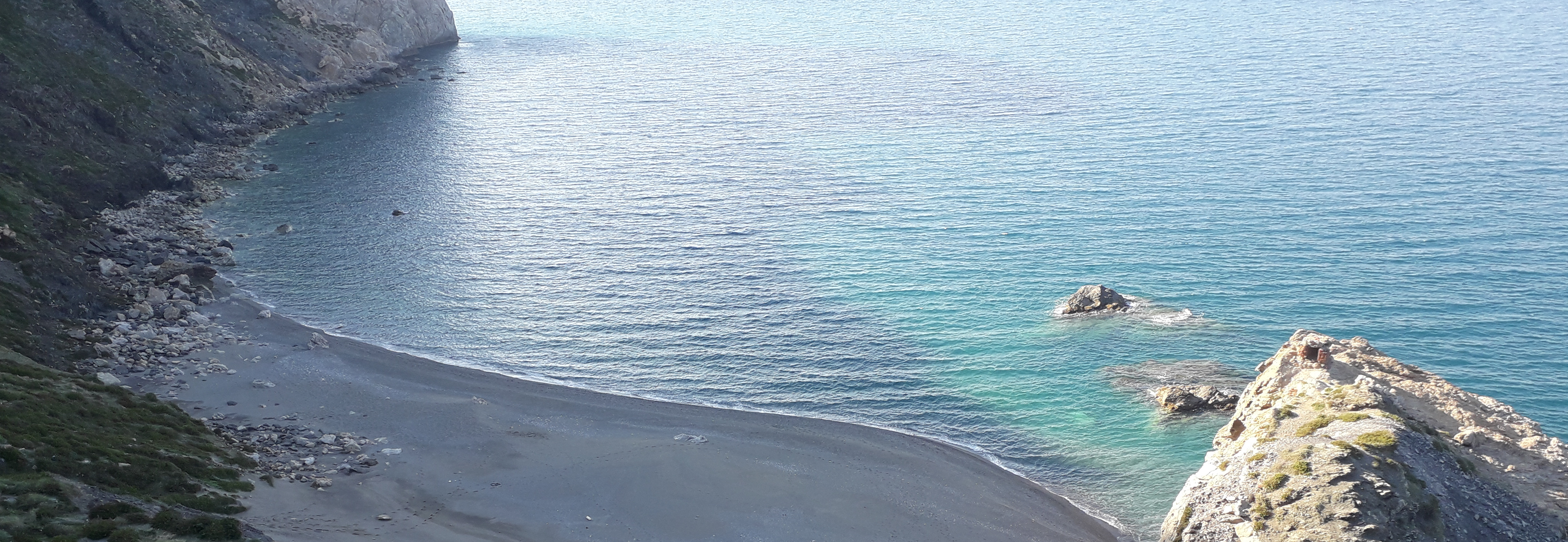
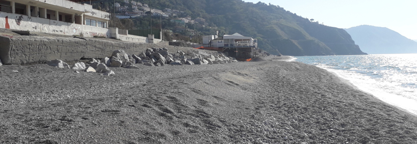
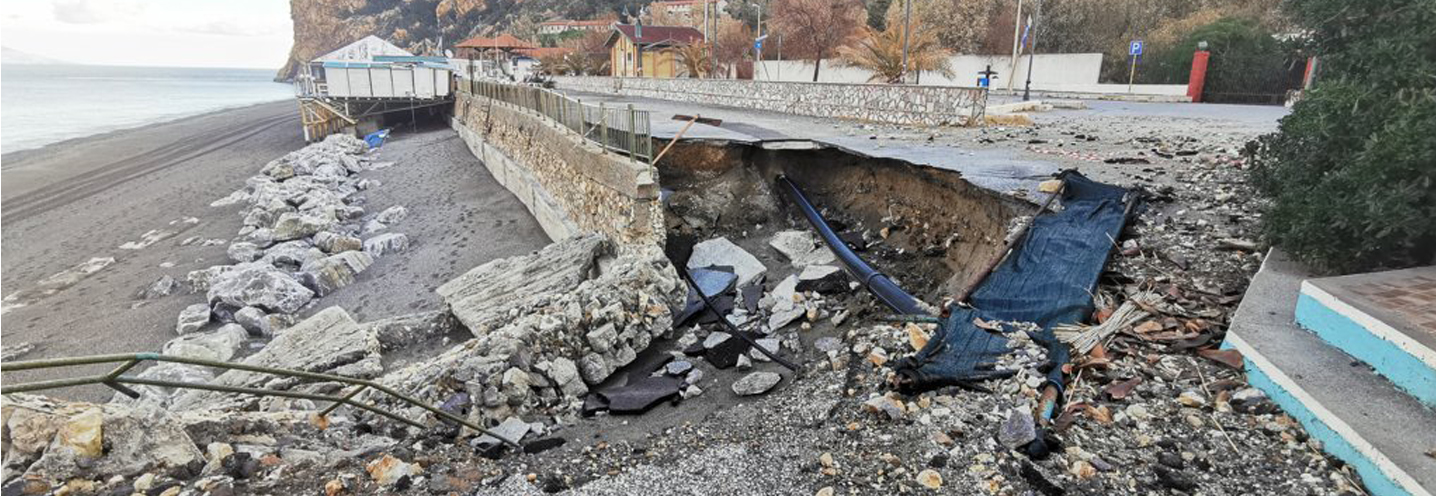
Isola Bella represents the emblem of the BESS project, located in eastern Sicily, more specifically in the southern area of the province of Messina, nestled in the coast of Taormina. It is part of the PAI Physiography Unit 3, between Capo Schisò and Capo Scaletta.
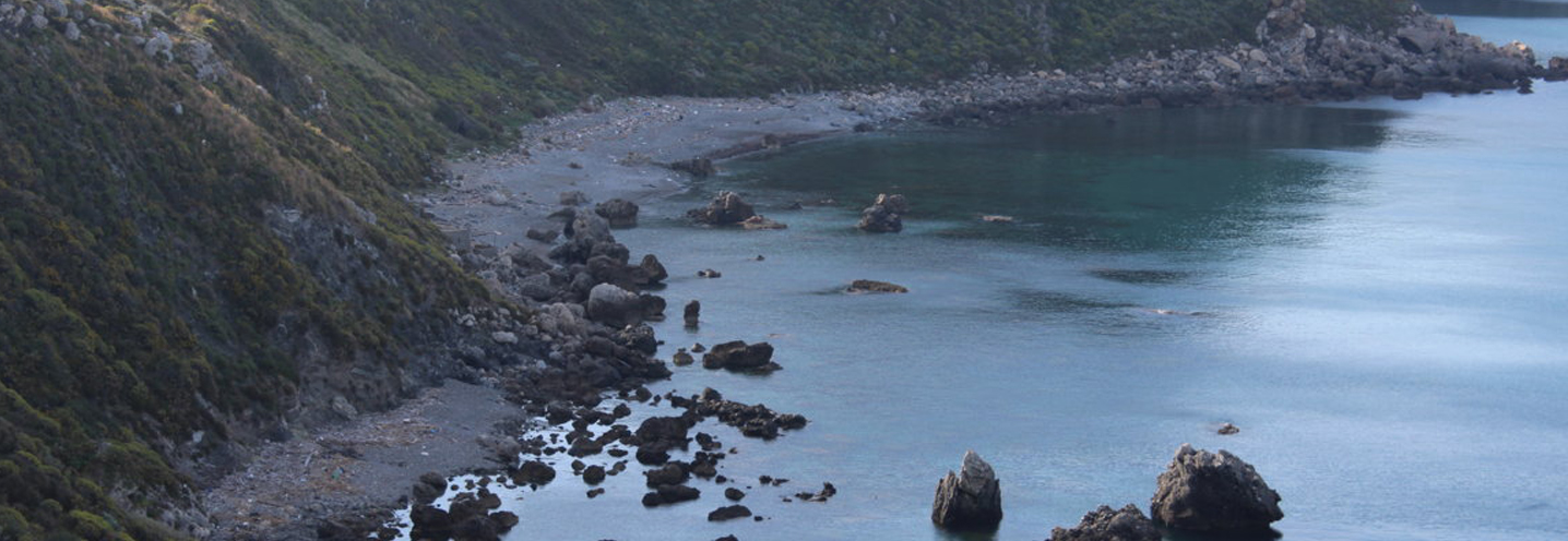
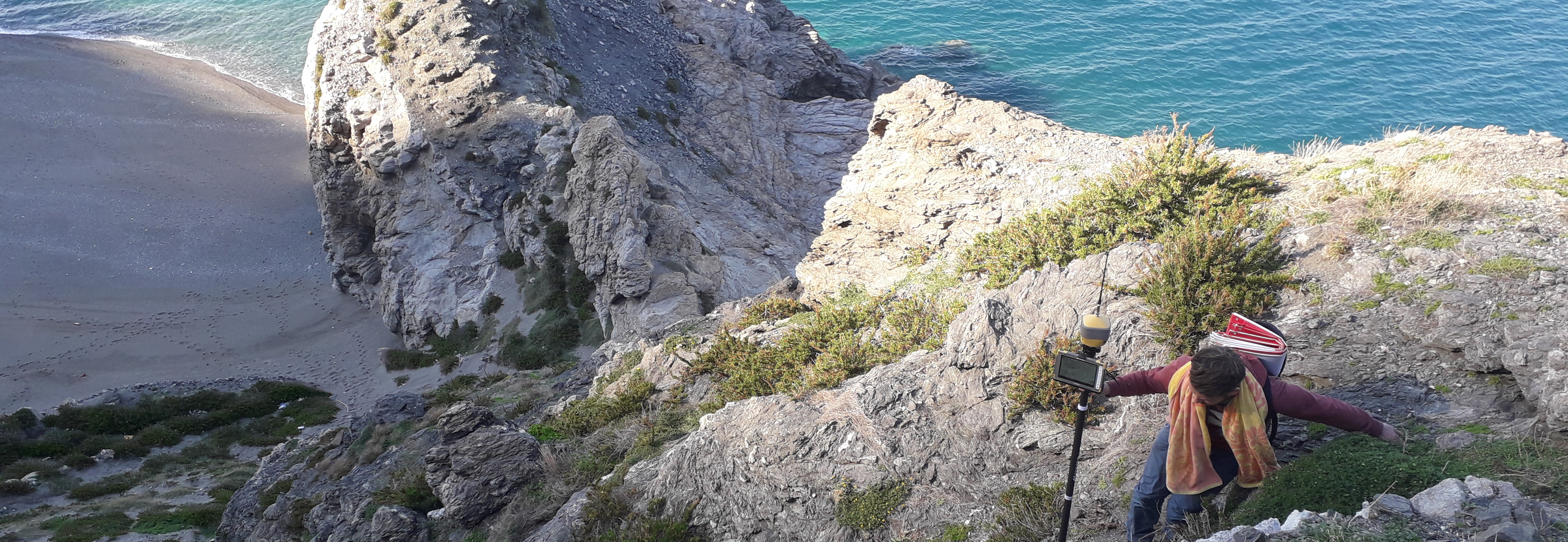
Specifically, the Pocket Beaches (PB) of Isola Bella are enclosed between Capo Sant’Andrea in the north and Capo Taormina in the south. The peculiarity of these PBs is represented by the tombolo that connects the islet, from which the bay takes its name, to the mainland. The cliff back to the south reaches up to 60 m.
The PBs are part of the Isola Bella Oriented Nature Reserve, established on November 4, 1998, which has an area of 10.49 hectares.
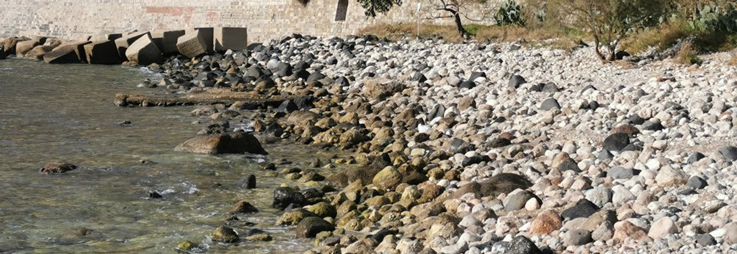
Capo Taormina and Isola Bella are made up of dolomites and dolomitic limestones, while Capo Sant’Andrea is made up of sandstones, conglomerates and limestones. The northwest cliff is characterised by metamorphic lithologies, in particular semi-schists.
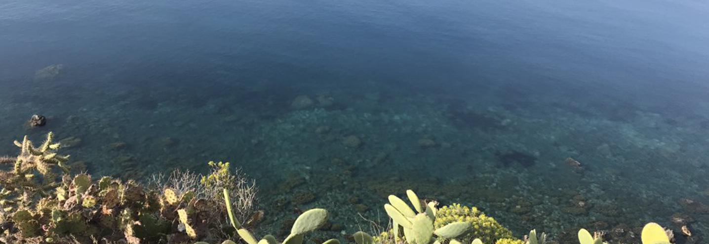
The sediments that characterise the PBs are heterometric. In fact coarse sands, gravels, pebbles and boulders are found, whose composition is given by quartz and medium-high grade, rounded metamorphic fragments.
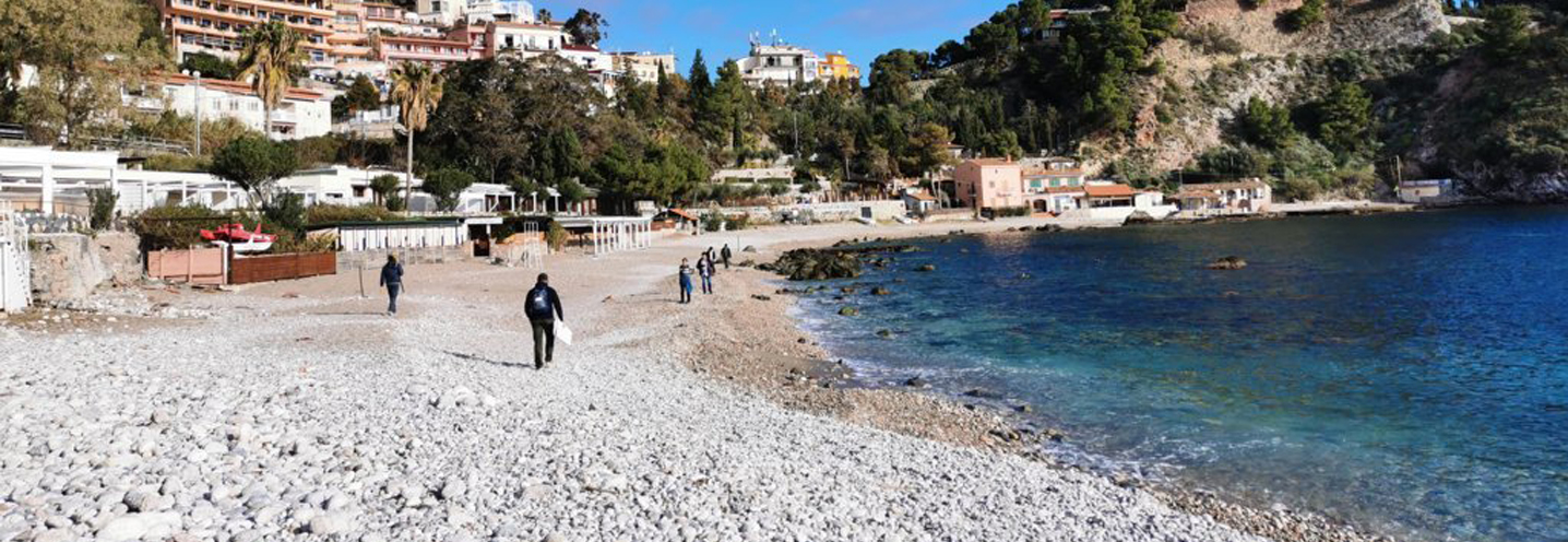
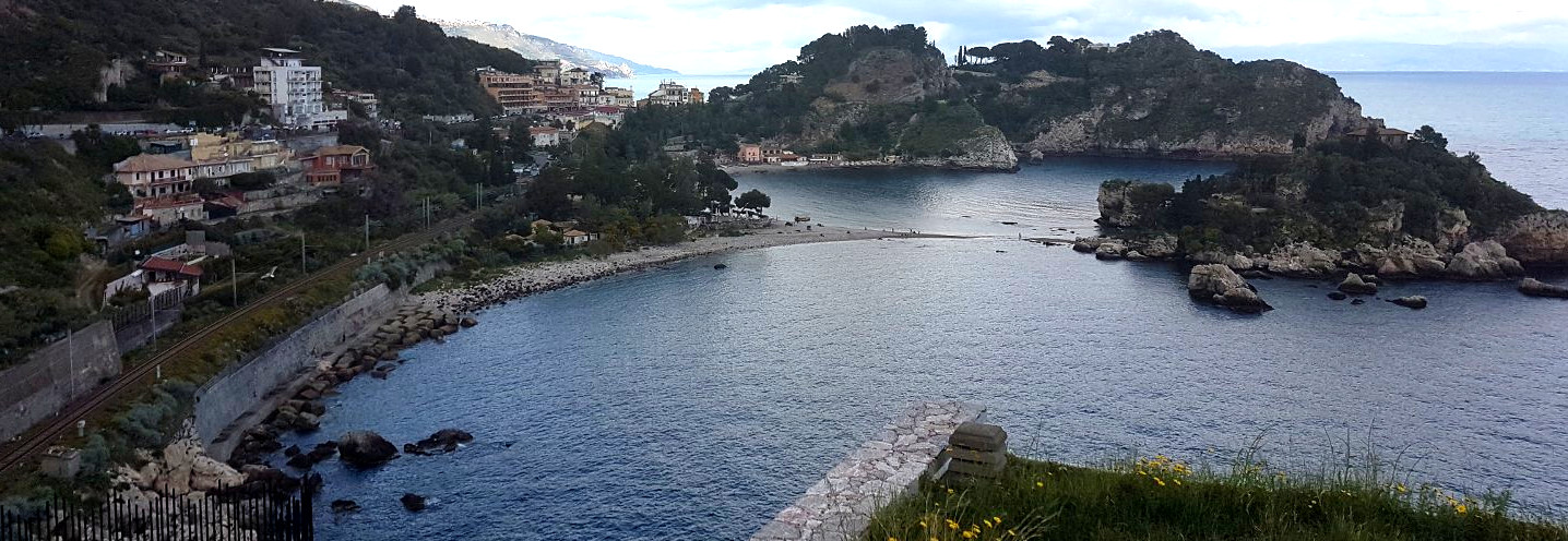
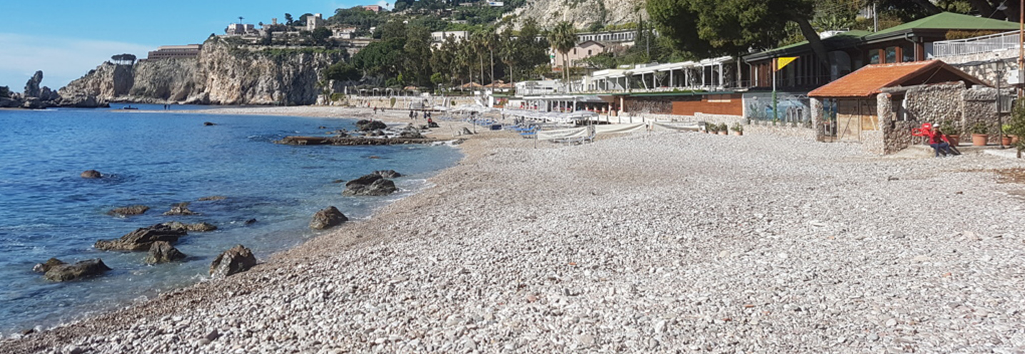
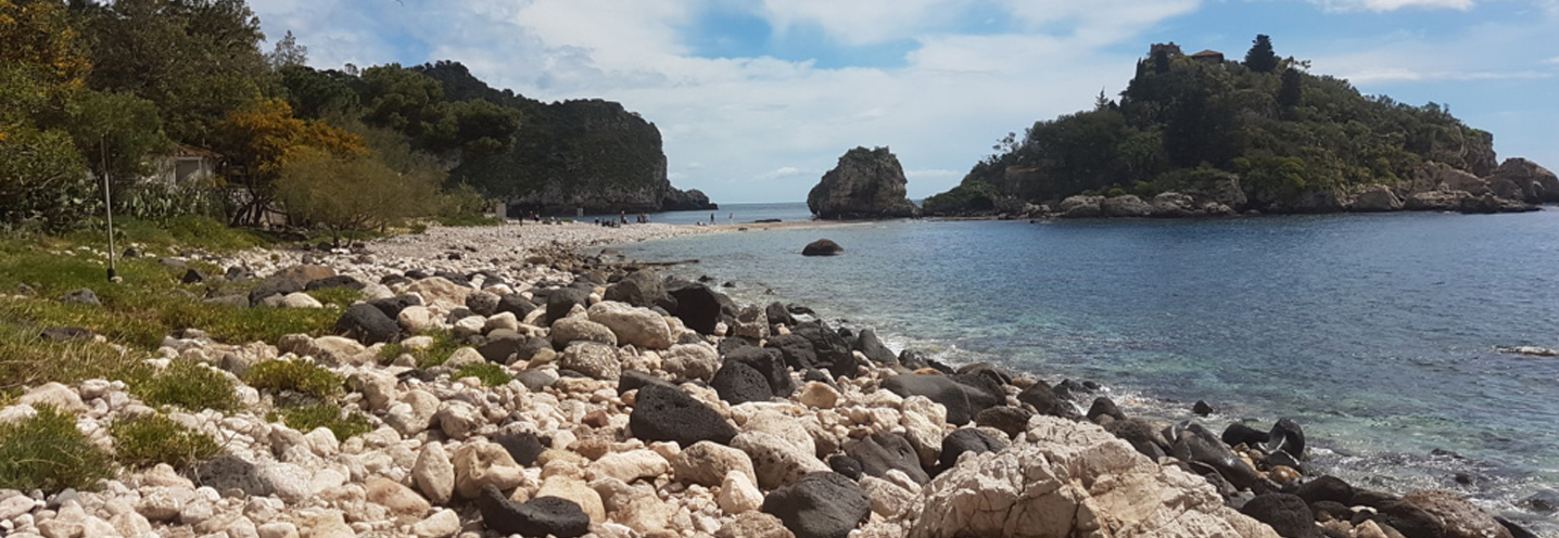
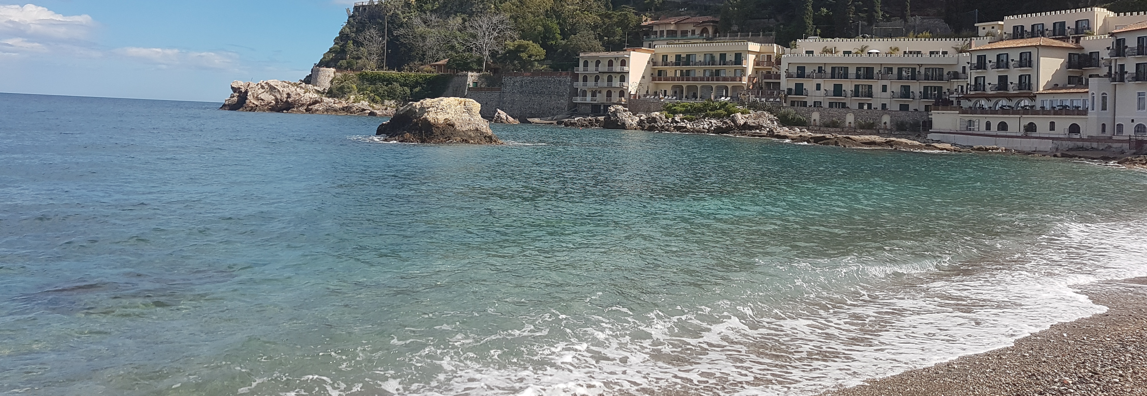
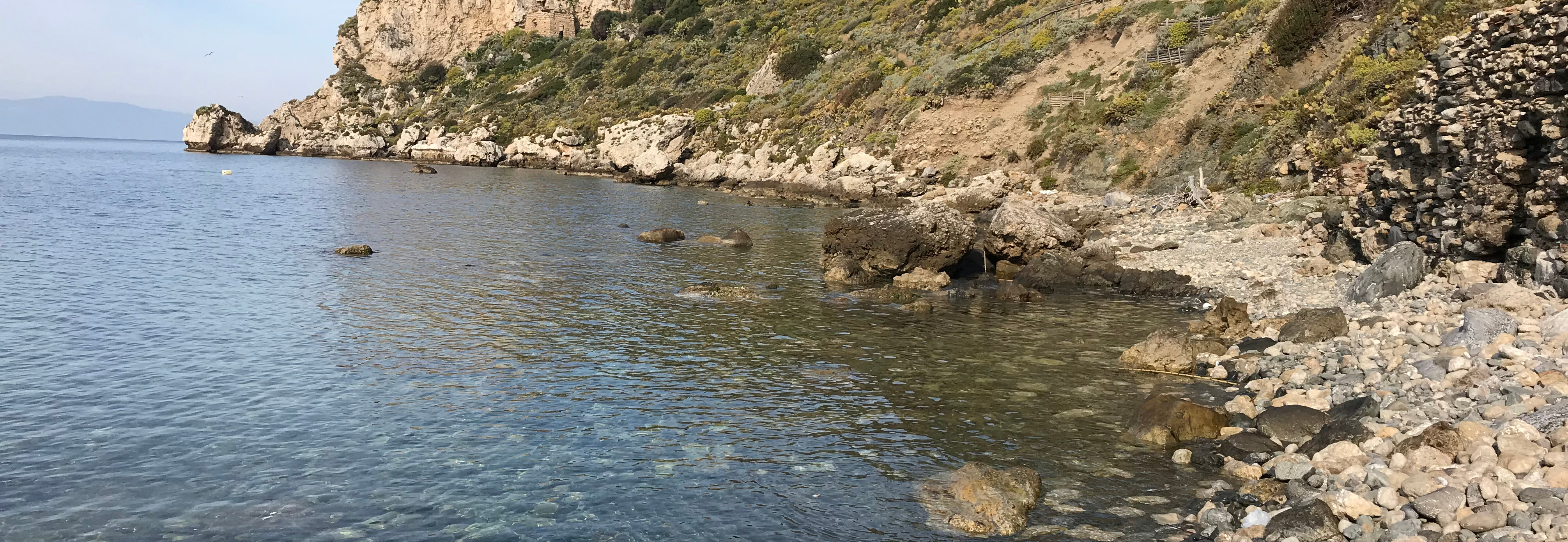
- Taormina – Mazzarò
Pocket beach code: SIC02ME03
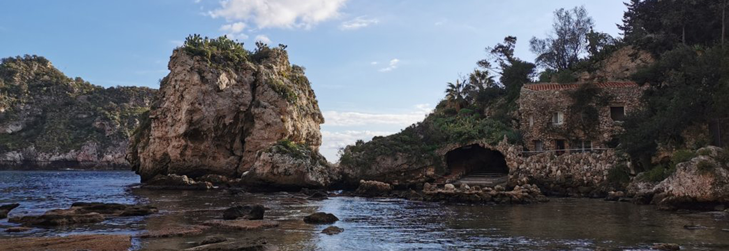
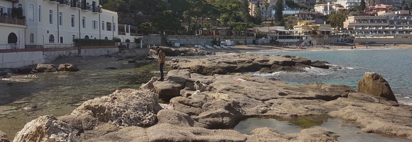
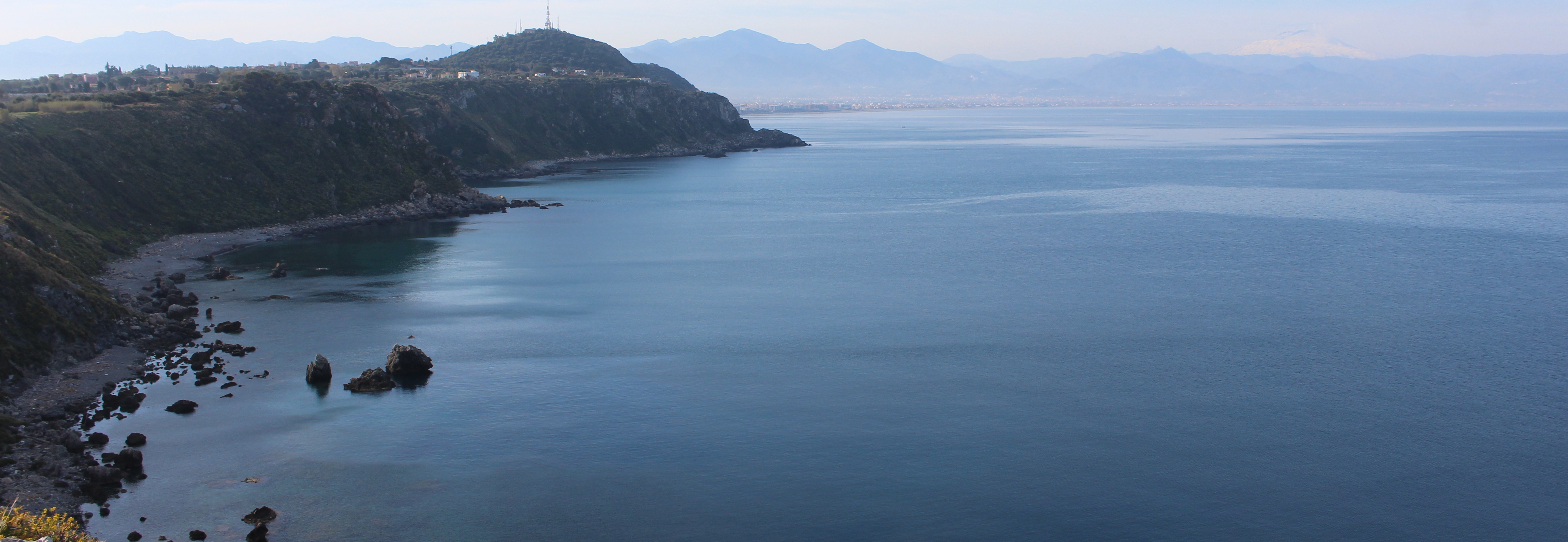
The Pocket Beach (PB) of Mazzarò, which falls within the Isola Bella Oriented Nature Reserve, established on November 4, 1998, is located just north of the famous bay of Isola Bella, in the municipality of Taormina and is bounded by Capo Sant’Andrea in the southeast and by Capo Castelluccio in the northwest. The whole coast is bordered by a cliff that rises, at times, over 30 meters above sea level.
Both headlands are lithologically made up of sandstones, conglomerates and massive limestones, while in the area to the west of the PB semi-schists emerge alternating with quartzites. There are also fluvio-marine terraced floods with infralittoral macro-faunas.
The sediments that constitute the PB vary from coarse sands to fine pebbles, the composition of which is represented by quartz and medium-high grade metamorphic lithic elements.
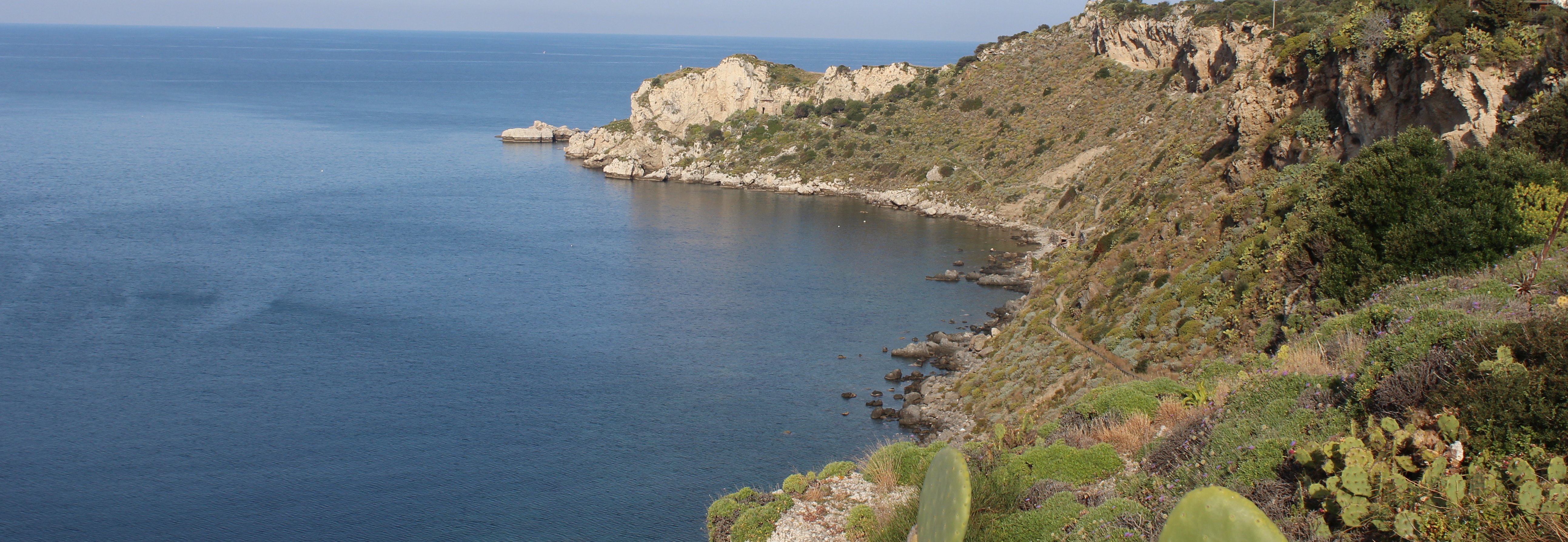
- Milazzo – Capo Milazzo
Pocket beach code: SIC03ME04_05_06
The three Pocket Beaches (PB) of Milazzo are located in northern Sicily in the province of Messina, and are set in the promontory of Capo Milazzo, which represents the boundary between the two Physiographic Units, Capo Milazzo-Capo Peloro (N. 1), and Capo Milazzo-Capo Calavà (N. 21) . At the base of the promontory, about 40 m high, the beaches are sometimes inaccessible by land.
The PBs are also delimited by less pronounced promontories, in particular that of the West (SIC03ME06) develops between Capo Milazzo and Punta Lacci, the northern one (SIC03ME05) between Punta Baldassarre and Punta Mazza, while the eastern one (SIC03ME04) between Punta di Mastro Stefano and Punta Cirucco.
The immediate geological context sees the presence of grey paragneiss passing through dark-grey mica schists. The highest portion of the relief behind the PB is a terraced marine deposit, consisting of discontinuous strips of sand and conglomerates containing shellfish from the coastal environment and reddish-brown cinerites. There are also limestone and calcarenite outcrops.
The PBs are part of the Marine Protected Area of Capo Milazzo, established on 17 May 2018, with an area of 754.00 ha. It is considered a natural fish farm.
From the granulometric point of view, the beaches consist of sediments that vary from fine pebbles to boulders, while compositionally they consist of metamorphic lithotypes.
- Patti – Capo Tindari
Pocket beach code: SIC03ME04_05_06
The Pocket Beaches (PB) of Capo Tindari fall within the territory of Patti, in the province of Messina, and are located in the center of the Gulf of Patti, in northeastern Sicily. This group of three PBs falls within the Physiographic Unit between Capo Milazzo and Capo Calavà (n ° 21).
The largest of the PBs, the westernmost one (SIC04ME09), is known by the locals as “Tindari Valley Beach”, while the other two are known as “Cala Don Mariano” (SIC04ME08) and “Cala Serpente” (SIC04ME07).
The PBs are set between the coves in the Capo Tindari promontory, which represents a high structure with cliffs that reach more than 100 m behind the PBs.
The headlands are made up of metamorphic lithologies. In detail the most important outcrops consist of two mica marbles and garnet (white-grayish color, medium-fine grain and oriented texture), and grey paragneiss passing through shale.
The PB of Valle Tindari, the only one of the three accessible by land, is crossed by the Tindari stream and is characterised by the presence of abundant deposits of the coastal plain, represented by gravel sands and heterometric and polygenic clasts.
The beach has a variable granulometry from coarse sand to pebbles, with mineral clasts given by quartz and rounded medium-high grade metamorphic lithic stones.
These PBs are part of the Oriented Natural Reserve of Laghetti di Marinello, established in 1998, which has an area of 401.25 ha.
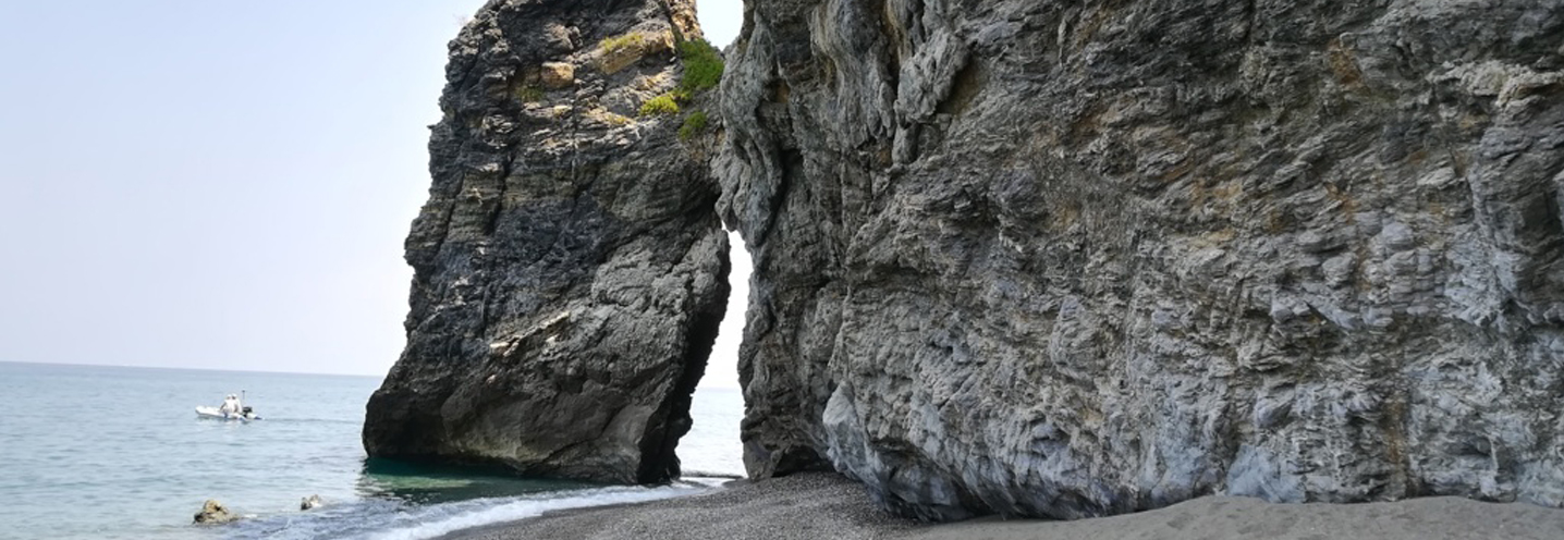
- Gioiosa Marea – Capo Calavà Est
Pocket beach code: SIC05ME10
The Pocket Beach (PB) of Capo Calavà Est falls in the municipality of Gioiosa Marea (Messina), in northeastern Sicily. It is located to the east of the homonymous cape, which represents the boundary between two Physiographic Units (UF), Capo Milazzo-Capo Calavà (n ° 21) and Capo d’Orlando-Capo Calavà (n ° 20) and, in particular, it represents the first western beach of the UF n ° 21.
It is the smallest of two neighboring bays, and is difficult to reach except through a steep and very rough path. The naturalistic spectacle is one of the most beautiful that can be admired along the SS 113.
The beach is limited to the northwest by Capo Calavà and to the southeast by a small, less pronounced headland, at the base of a slope whose summit exceeds 200 m above sea level. The area is affected by gravitational processes that cause numerous collapses and overturns.
The promontories consist of Paleozoic plutonites in bodies and strands of considerable size, while the slope of paragneisses passing through mica schists.
The beach is made up of sediments that vary from gravel to pebbles, whose composition is mainly given by fragments of metamorphites.
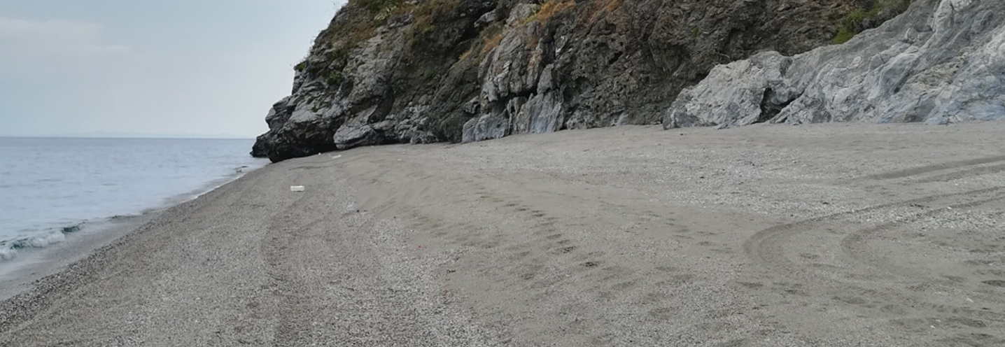
- Gioiosa Marea – Capo Calavà Ovest
Pocket beach code: SIC06ME11
Pocket Beach (PB), known by locals as “Capo Calavà beach”, is located in the municipality of Gioiosa Marea (Messina), in northeastern Sicily, and represents the easternmost beach of the Physiographic Unit between Capo d’Orlando and Capo Calavà (n ° 20).
The PB is bounded by Capo Calavà in the northeast and by Capo Schino in the southwest, and represents one of the favorite destinations of beach tourism in the province of Messina.
Capo Calavà is made up of late Varisic plutonites, while Capo Schino is made up of grey, medium-large grain gneiss, oriented texture and the presence of porphyroclasts.
In the area behind the PB, there are abundant deposits of slope, rarely cemented, made up of heterometric and angular material.
The PB is crossed by the Calavà stream and is made up of gravels and pebbles, mostly rounded, with clasts of quartz and medium-high grade metamorphic lithic fragments.
The beach is in constant erosion, so much that it jeopardises the neighboring accommodation facilities.
- Lipari – Isola di Vulcano – Punta dell’Asino
Pocket beach code: SIC07ME12
The pocket beach (PB) is located near Gelso, a town on the island of Vulcano (municipality of Lipari), in the Aeolian archipelago and falls within the Physiographic Unit related to the Aeolian Islands (n ° 26).
The PB, known by the locals as “donkey beach”, is bounded by Punta dell’Asino in the east and by the pier of the Gelso district in the west. This beach is located at the base of a steep slope more than 100 m above sea level
Being a volcanic island, the lithologies are all attributable to a volcanic mineralogical nature. Specifically Punta dell’Asino, the eastern promontory, is made up of volcanoclastic rocks.
On the back side of the PB, pyroclastic successions emerge (grey-yellowish layers and parallel and crossed lamination), shoshonite lava flows and brown and grey ash banks of varying thickness.
The PB is characterized by a current beach deposit whose composition is of volcanic origin.
- Lipari – Isola di Vulcano – Punta Bandiera
Pocket beach code: SIC08ME13
The pocket beach (PB) in question is located near Cannitello, a town on the island of Vulcano (municipality of Lipari), in the Aeolian archipelago and falls within the Physiographic Unit related to the Aeolian Islands (n°26).
This PB is known by locals as “Cannitello beach” and is bordered by Punta Bandiera in the northeast and Punta dell’Ufala in the southwest. The rear cliff reaches 60 m above sea level.
The most projecting portions of the aforementioned headlands are made up of lava flows, while the rest of the area is made up of pyroclastic successions up to 20 m thick.
The PB is characterised by a current beach deposit whose composition is of volcanic origin.
- Lipari – Isola di Lipari – La Forbice
Pocket beach code: SIC09ME14
The pocket beach (PB), known as “La Forbice beach”, is located in the southern area of the island of Lipari (archipelago of the Aeolian Islands) and falls within the Physiographic Unit related to the Aeolian Islands (n ° 26).
The PB is bounded to the north by “La Forbice” promontory and to the south by “Punta di costa”, and is located at the base of a cliff about 100 m above sea level.
The promontories are characterised by a lithology attributable to endogenous domes rich in xenocrystals, and by massive reddish-brown ashes and tuffs.
In the area behind the PB, the abundant accumulation of detrital material deriving from the dismantling of the surrounding areas by rainwater is evident.
The PB is characterised by a current beach deposit whose composition is of volcanic origin.
- Lipari – Isola di Lipari – Pignataro di Fuori
Pocket beach code: SIC10ME15
The pocket beach (PB) is located at the eastern end of the island of Lipari (archipelago of the Aeolian Islands), known as the “Pignataro di Fuori beach” and falls within the Physiographic Unit related to the Aeolian Islands (n ° 26).
It is limited by slightly accentuated promontories consisting of a scoriaceous pyroclastic breach, with tuff-lapilli intercalations and discontinuous lava flows. In the area immediately behind the beach, however, there is a reddish-brown tuff, formed by millimetric glass fragments.
The cliff behind reaches, in some points, the altitude of 200 m above sea level
The PB is characterized by a current beach deposit whose composition is of volcanic origin.
- Lipari – Isola di Lipari – Spiagge Bianche
Pocket beach code: SIC11ME16
The pocket beach (PB), located in Canneto (Lipari), is known as the “white beach”: it is located on the northeastern side of the island and falls within the Physiographic Unit related to the Aeolian Islands (n ° 26).
The PB is limited to the south by Punta di Sparanello and to the north by another slightly more pronounced promontory; the cliff behind it has a height ranging from 30 to 40 m above sea level.
Behind the beach, the first outcrops encountered are related to a large endogenous dome-flow rich in obsidian and with clearly visible foliation.
Equally recurring is the pumice succession (up to 150 m thick), which consists mainly of coherent and medium-layered tuff-lapilli. It is precisely from this outcrop of white pumice, that the sediments that make up the beach come from and from which the beach takes its name.
- Lipari – Isola di Lipari – Lido Blu
Pocket beach code: SIC12ME17
The pocket beach (PB), known as Spiaggia della Papesca, is located in the northeastern sector of the Island of Lipari (Archipelago of the Aeolian Islands) and falls within the Physiographic Unit related to the Aeolian Islands (n° 26).
This PB is delimited by two slightly accentuated promontories high around 30 m above sea level.
The most proximal outcrops to the PB are that relating to the Pomiciazzo formation, characterised by a large endogenous dome-flow rich in obsidian, and the pumice succession up to 150 m thick consisting of coherent and medium-layered tuff-lapilli.
The PB is characterized by a current beach deposit whose composition is of volcanic origin.
- Malfa- Isola di Salina – Punta Scario
Pocket beach code: SIC13ME18
The pocket beach (PB), located in the municipality of Malfa (Salina Island), in the archipelago of the Aeolian Islands, is known as the “Scario beach” and falls within the Physiographic Unit related to the Aeolian Islands (n°26).
The PB is bounded to the east by Punta di Scario, a very accentuated promontory consisting of the lava flows of Monte dei Porri (pyroxene andesites), which reaches 30 m above sea level, and to the west by a promontory of the same composition and altitude.
The cliff, which reaches 40-50 m above sea level, consists of the tuffs of the initial eruptions of Pollara and the tuffs of white pumice with biotite and hornblende, while in the town of Malfa, alluvial deposits are predominant, covering a large part of the area.
The PB is characterized by a current beach deposit whose composition is of volcanic origin.
- Malfa- Isola di Salina – Pollara
Pocket beach code: SIC14ME19
The pocket beach (PB), known as “postman’s beach”, is located in Pollara, a hamlet in the municipality of Malfa, northwest of the island of Salina and falls within the Physiographic Unit related to the Aeolian Islands (n ° 26 ).
The context is very interesting because the PB is located at the base of the ancient Pollara crater, and the cliff behind it, over 50 m high, consisting of remodeled pumice material covering the bottom of the Pollara crater, appears cut by some incisions due to the passage of very small streams.
A faraglione stands out in the body of water in front of the PB, as well as the beautiful natural arch of Punta di Perciato (northwest of Pollara), consisting of the lavas of the Pollara crater.
In the middle of the town of Pollara, outcrops of white pumice with biotite and hornblende become predominant, leaving only a few small lava flow outcrops from Monte dei Porri visible. The area to the west, on the other hand, is characterised by outcrops of the denuded centers of the ancient basic volcanoes, formed mainly by a dense network of dikes.
The PB is characterized by a current beach deposit whose composition is of volcanic origin.
- Lipari- Isola di Panarea – Zimmaro
Pocket beach code: SIC15ME20
The pocket beach (PB), called caletta dei Zimmari, is located on the southern side of the island of Panarea (municipality of Lipari), in the archipelago of the Aeolian islands and falls within the Physiographic Unit related to the Aeolian Islands (n ° 26).
The PB is delimited by the southwestern promontory called “punta milazzese”, while in the northeast by a less accentuated promontory. The cliff behind reaches the maximum height of about 65 m above sea level on the western promontory.
The formation of the Castle, consisting of lava flows with an Andesitic composition, constitutes the promontory located west of the PB, while the other promontory consists of lava domes in banks, small outcrops of ancient coastal deposits (consisting of gravel and pebbles) and the brown tuff of the Punta Torrione formation, locally rich in clinopyroxene crystals and basaltic andesite composition.
The area behind the pocket beach consists of wind sand deposits, as well as a series of debris cones.
The PB is characterised by a current beach deposit whose composition is of volcanic origin.
- Lipari- Isola di Panarea – Preistorico
Pocket beach code: SIC16ME21_22_23
The group of three pocket beaches (PB) is located in the southwestern part of the island of Panarea (municipality of Lipari), belonging to the archipelago of the Aeolian Islands and falls within the Physiographic Unit related to the Aeolian Islands (n ° 26).
The most famous of the three PBs is undoubtedly the beach of Cala Junco (SIC16ME22), which is located in the middle of this small area. The three PBs are bordered to the southeast by Punta Milazzese and to the northwest by a less pronounced promontory. The cliff surrounding the PBs reaches 30 m above sea level, especially on the western side. Each PB represents an inlet of this bay. In the central-southern portion of the bay emerges the Bastimento rock.
This area of the island, in addition to being considered a naturalistic excellence, also houses a prehistoric village of high archaeological value.
The promontories consist mainly of the formation of the Castle, represented by lava flows with an andesitic composition, while in the area behind the PB emerges abundantly the tuff-brown outcrops, locally rich in clinopyroxene crystals and of the Andesitic basaltic composition. Furthermore, small outcrops of ancient coastal deposits, consisting of gravel and pebbles, are present at times along the coast.
The PB is characterized by a current beach deposit whose composition is of volcanic origin.
- Lipari- Isola di Filicudi – Le Punte
Pocket beach code: SIC17ME24
The pocket beach (PB) is located on the southeastern side of the island of Filicudi (municipality of Lipari), in the archipelago of the Aeolian Islands. The PB is known by locals as the “beach of the peaks”. It does not have very pronounced promontories and the cliff behind it does not exceed, at any point, 10 m above sea level.
The Le Punte formation, present in the southeastern area of the PB, consists of an elongated endogenous dome with the presence of metamorphic and volcanic xenoliths, while along the eastern handland emerges a conglomerate with rounded pebbles (poorly classified and clasto-supported).
The dominant lithology in the area behind the PB is undoubtedly the massive reddish-brown tuff of the Pianoconte formation, formed by millimeter glass fragments rich in clinopyroxene crystals.
The PB is characterized by a current beach deposit whose composition is of volcanic origin.