


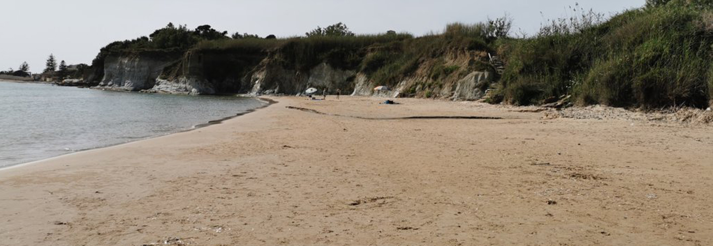
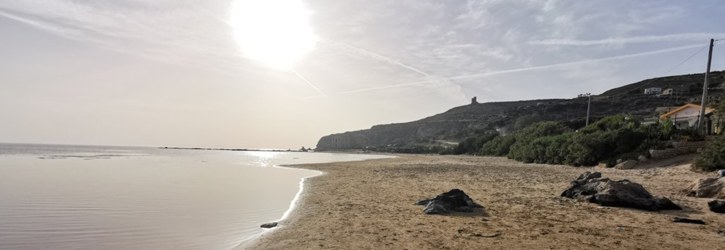
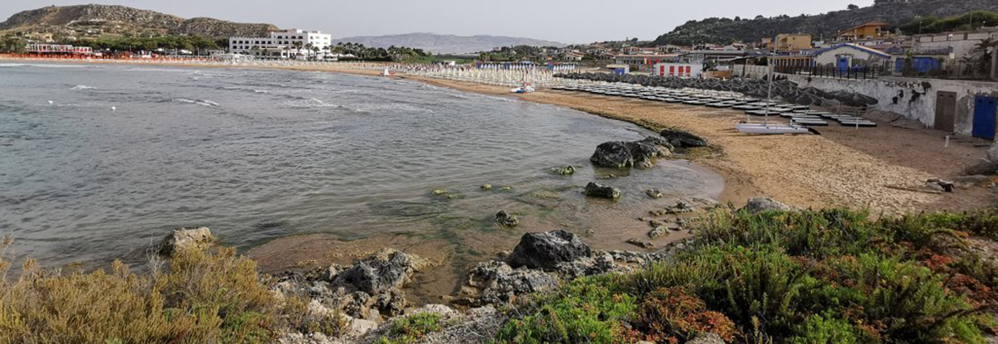
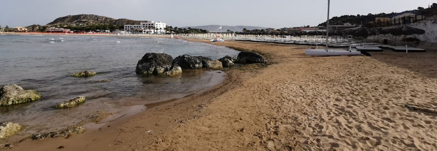
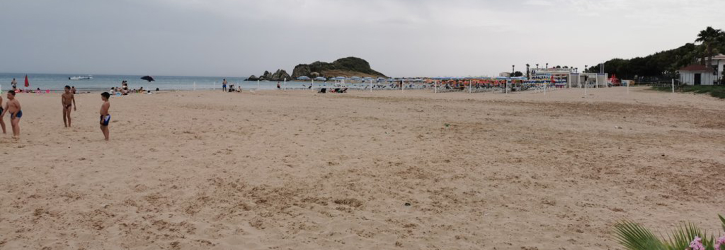
- Sciacca – Maragani
Pocket beach code: SIC45AG01_SIC46AG02
The two Pocket Beaches (PB) are located in southwestern Sicily, in the province of Agrigento, more precisely in the municipality of Sciacca in the Maragani area. They fall into the PAI Physiographic Unit 12, which has Capo Granitola as its western end and Capo San Marco as its eastern end.
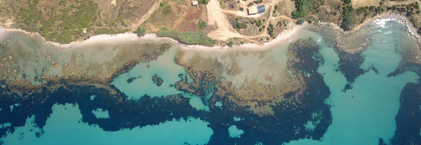
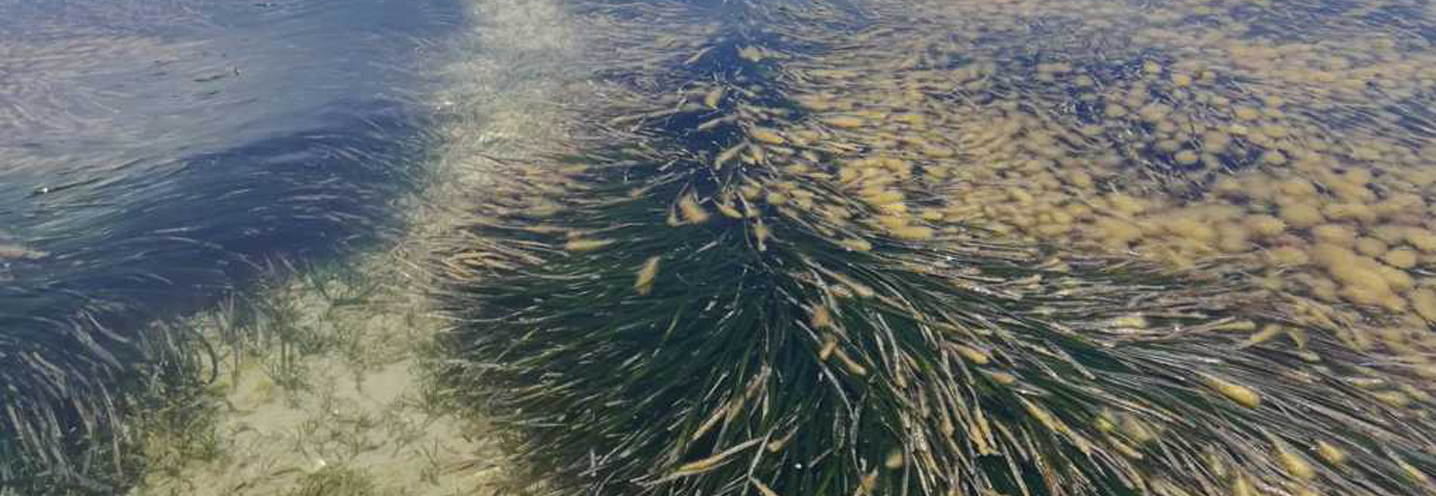
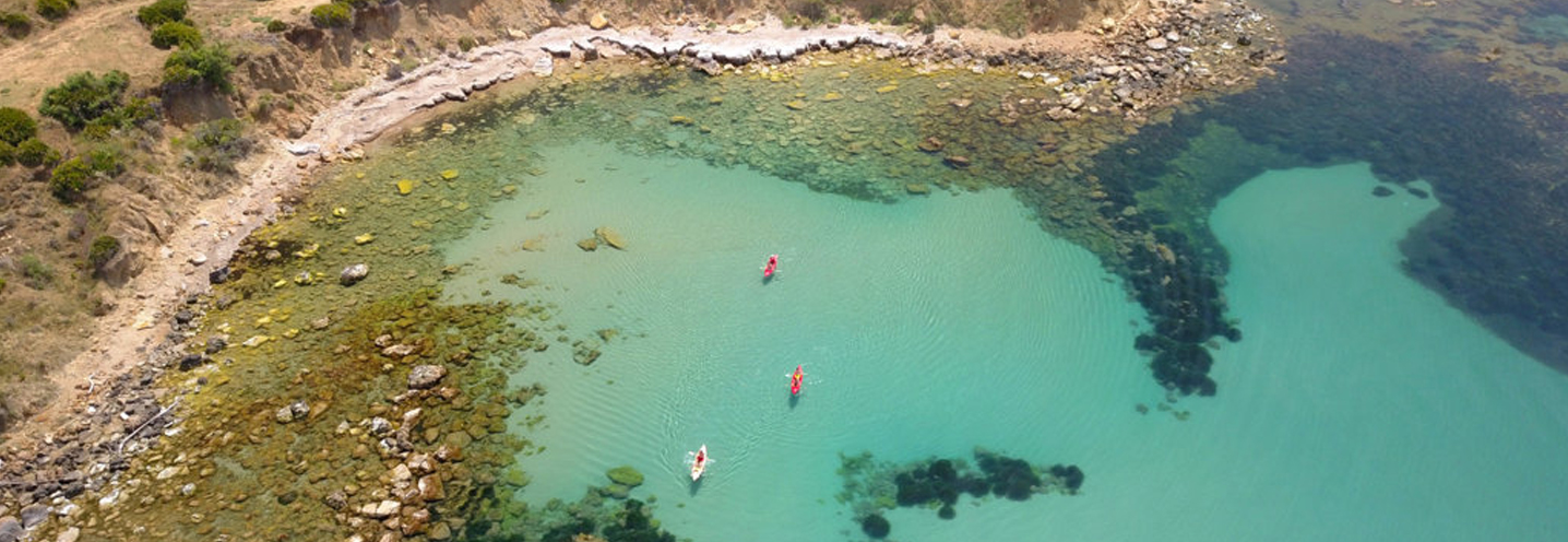
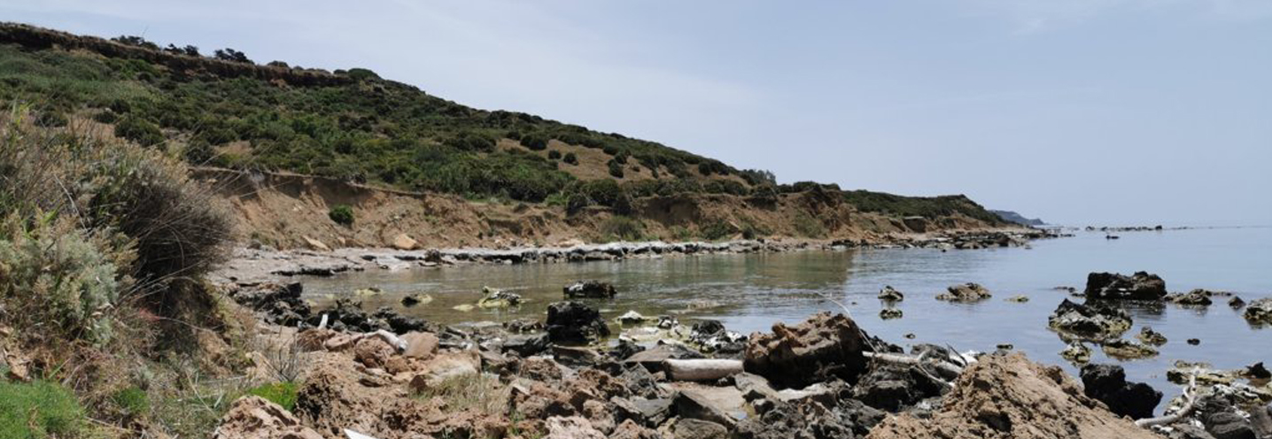
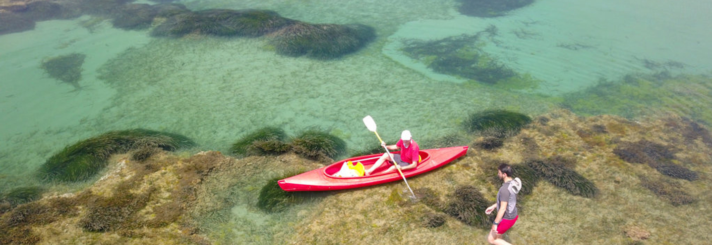
The PBs are surrounded by a cliff that reaches 60 m above sea level and by poorly pronounced promontories. The waters are crystal clear and there is an extensive prairie of Posidonia oceanica.
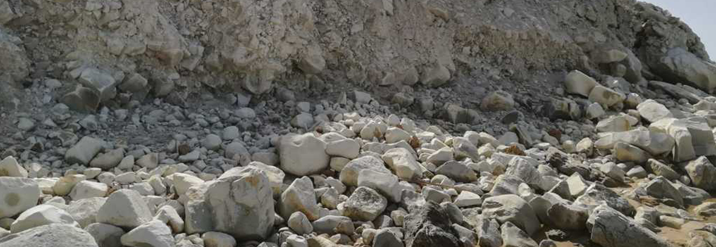
Along the coast blue-grey clays emerge. Towards the mountain a marine terrace consisting of sandstones, sands and more or less cemented conglomerates emerge, while in the southeast, the reddish-colored fossil calcarenite closes the geological picture.
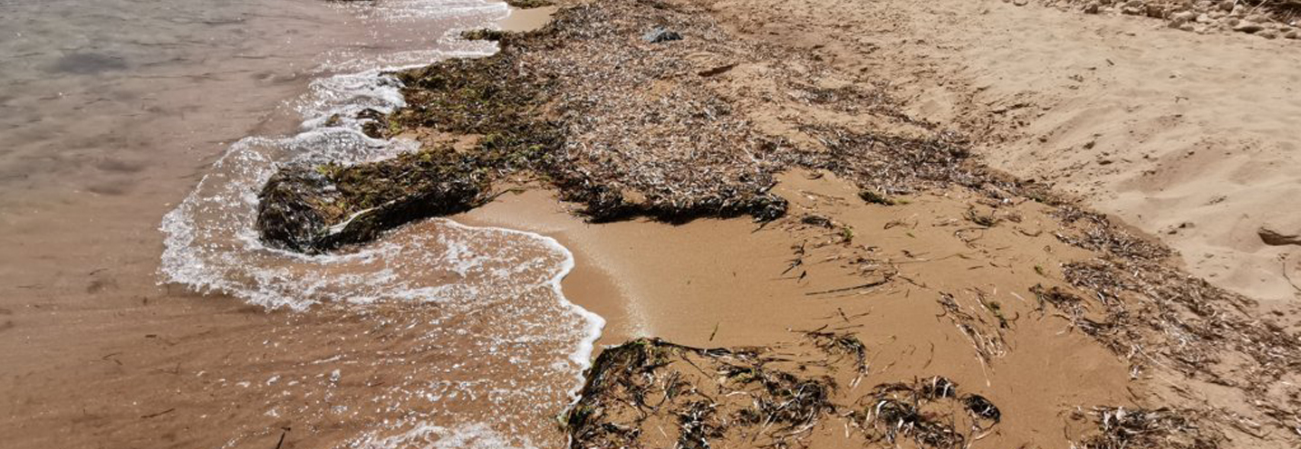
The sediments that make up the beach are made up of sands and gravels, mainly composed of organogenic limestones.
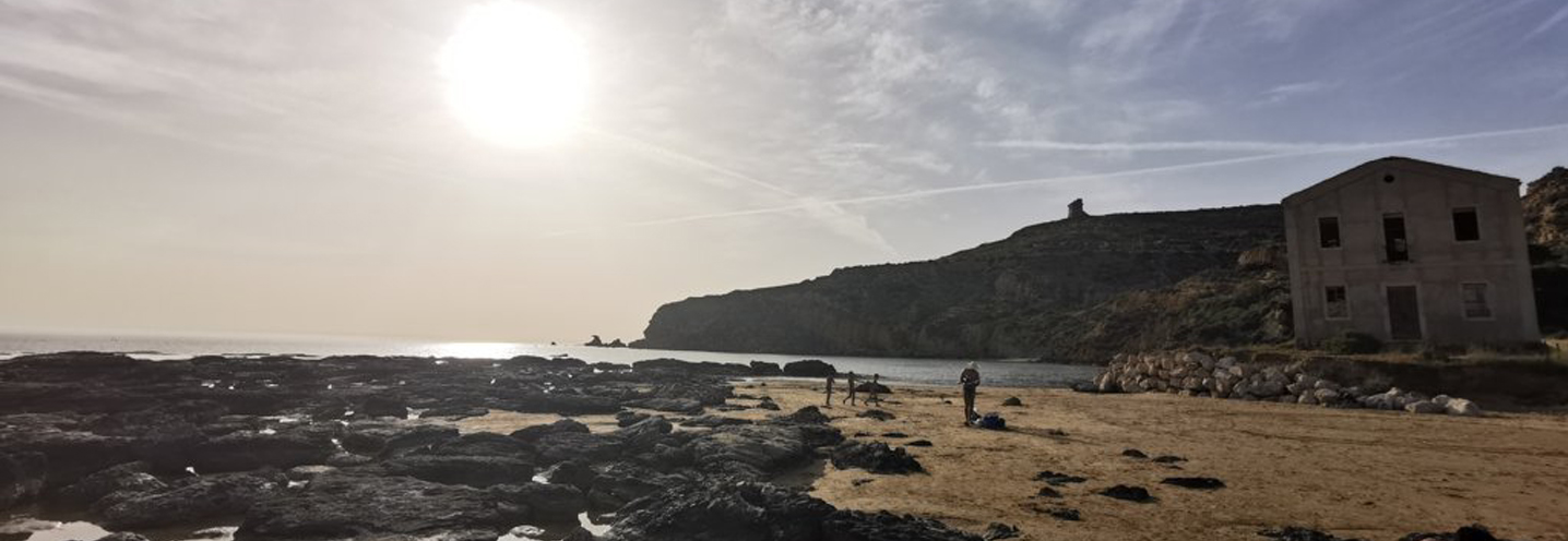
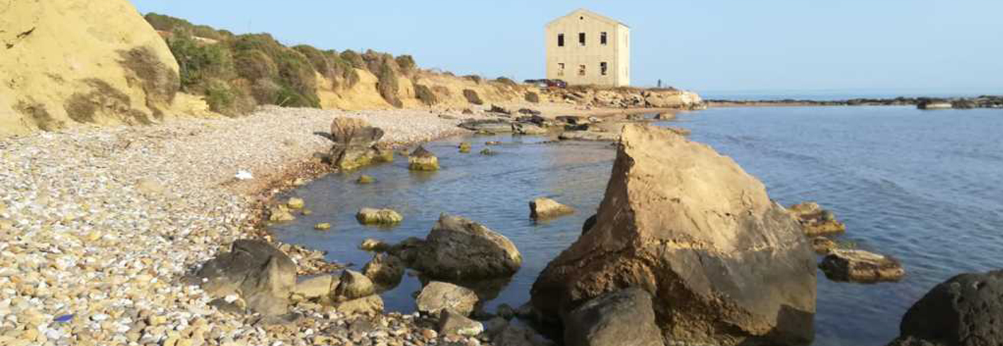
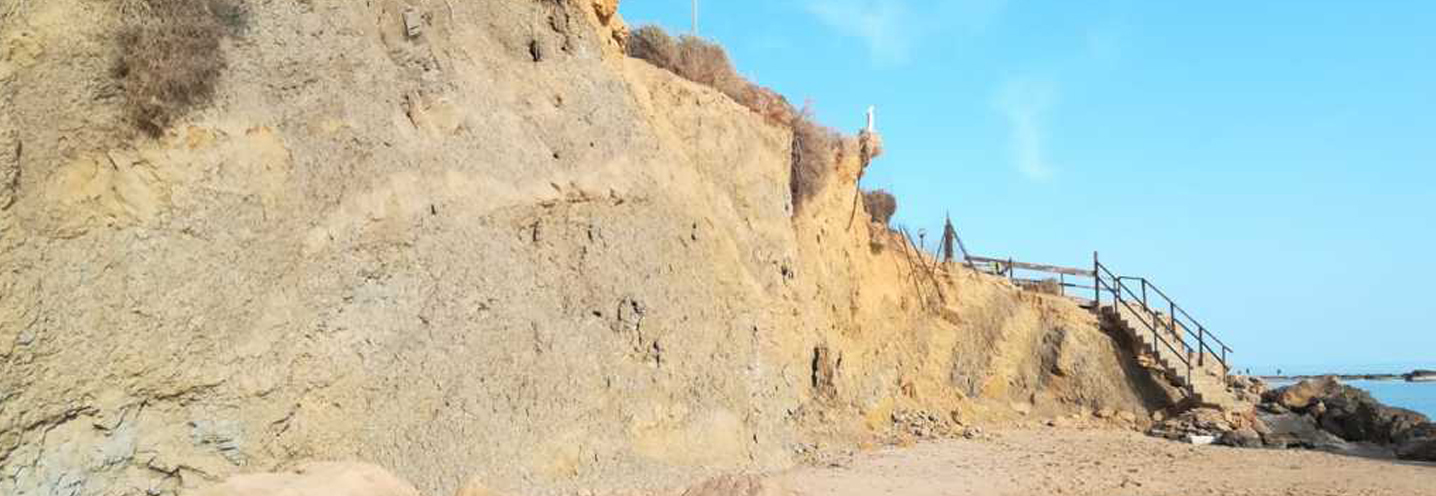
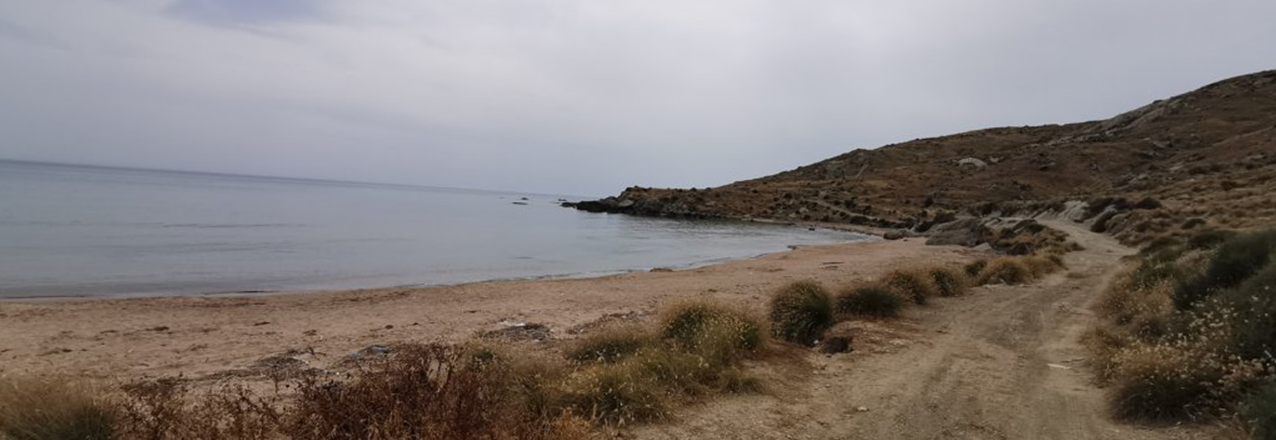
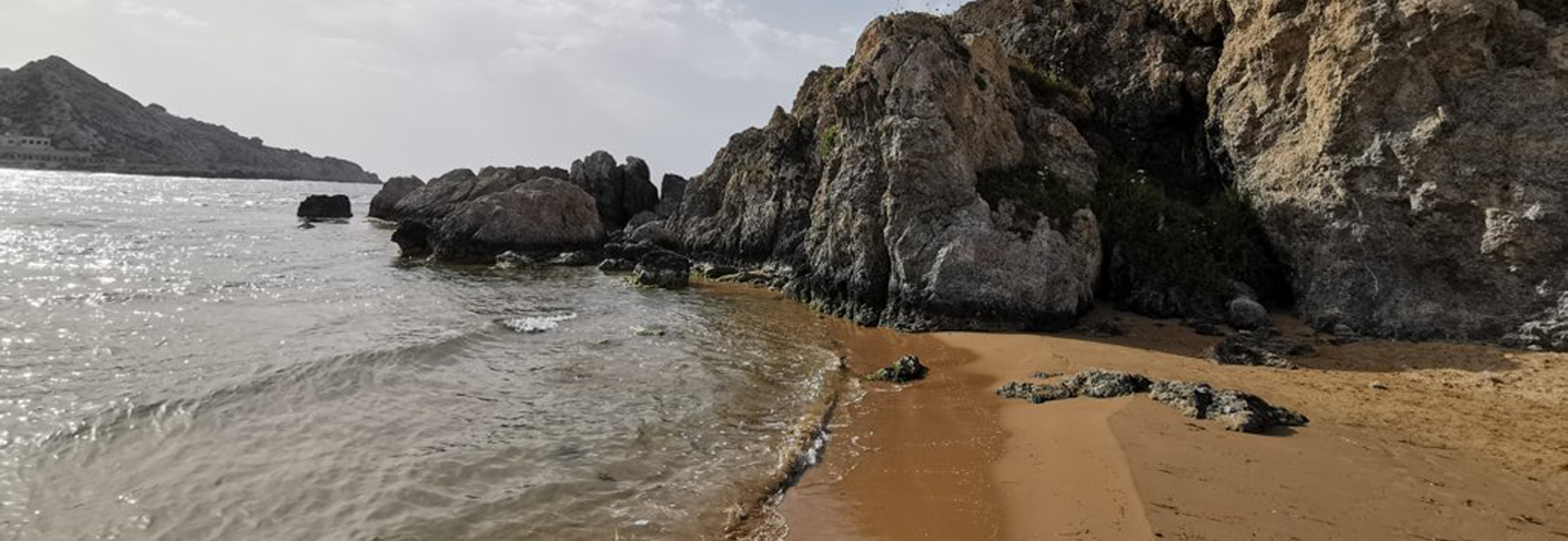
- Sciacca – Rogana
Pocket beach code: SIC47AG03
The Pocket Beach (PB) is located in southwestern Sicily, in the province of Agrigento, and more precisely in the municipality of Sciacca, in the Rogana area. It is part of the PAI Physiographic Unit 12, which has Capo Granitola as its western end and Capo San Marco as its eastern end.
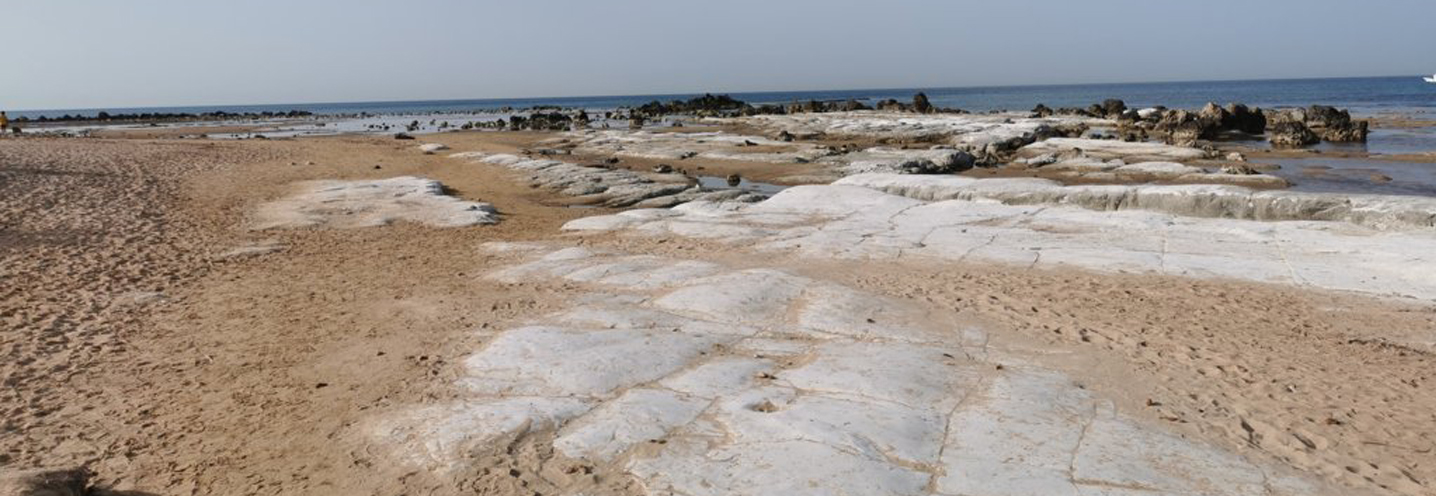
It is located just west of Capo San Marco, delimited by two small promontories and at the base of a cliff that has a maximum height of 50 m above sea level. The waters are crystal clear and there is an extensive prairie of Posidonia oceanica.
The immediate geological context is characterised by reddish fossiliferous calcarenite, which constitutes both the cliff and the promontories. More internally there is a marine terrace consisting of sandstones, sands and more or less cemented conglomerates. The more distal areas, to the north and east of the PB, show blue-grey sandy clays.
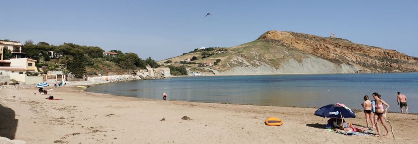
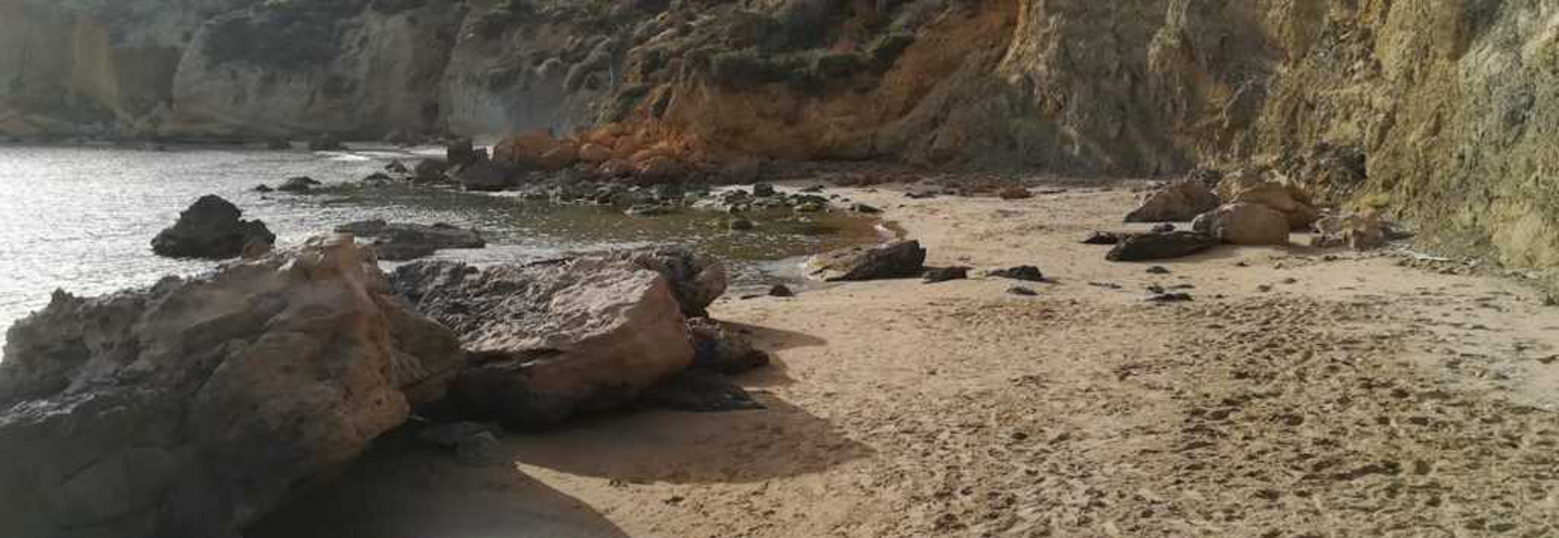
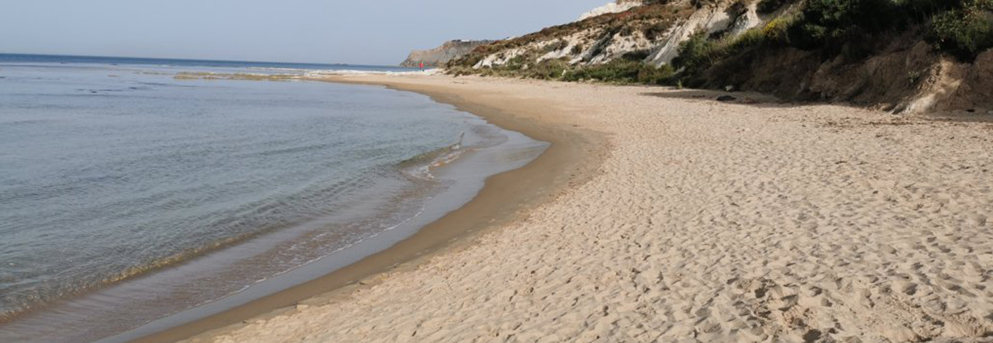
- Realmonte – Giallonardo
Pocket beach code: SIC48AG04
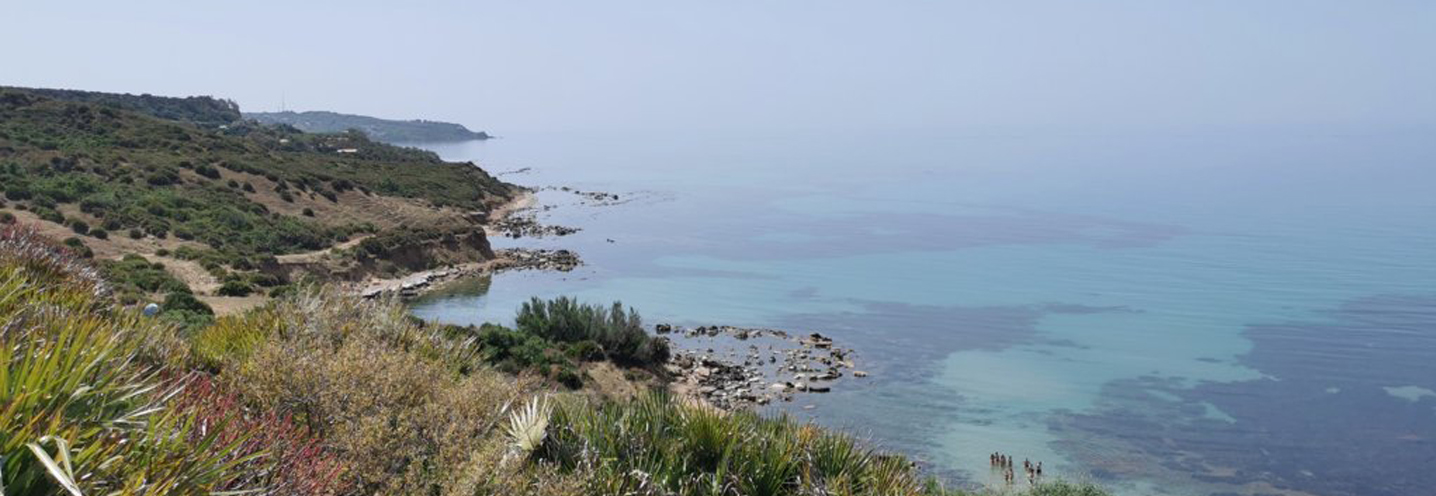
The Pocket Beach (PB) of Giallonardo (Realmonte) is located in southern Sicily, in the province of Agrigento. It falls within the Physiographic Unit PA no. 11, which is delimited to the northwest by Capo San Marco and to the southeast by Capo Rossello.
The PB has Punta Secca as its northwestern limit, which does not have a considerable height, unlike the southeastern promontory, which exceeds 100 m above sea level on the apical part. The cliff behind it has a height that grows moving southeast up to 140 m above sea level. In addition, there are two small streams.
The most spectacular outcrop is that of more or less silty blue-grey clay marls, which emerge on a large part of the cliff and show signs of gravitational processes. To the southwest, another important deposit of more or less coarse cross-layered calcarenites with sandy intercalations emerges. To the northeast, on the other hand, globigerine and calcareous marls emerge, as well as coastal sands and silty-micaceous clays. On the whole range there are marine terraces.
The sediments of PB fall, from the granulometric point of view, in the fine sands class.
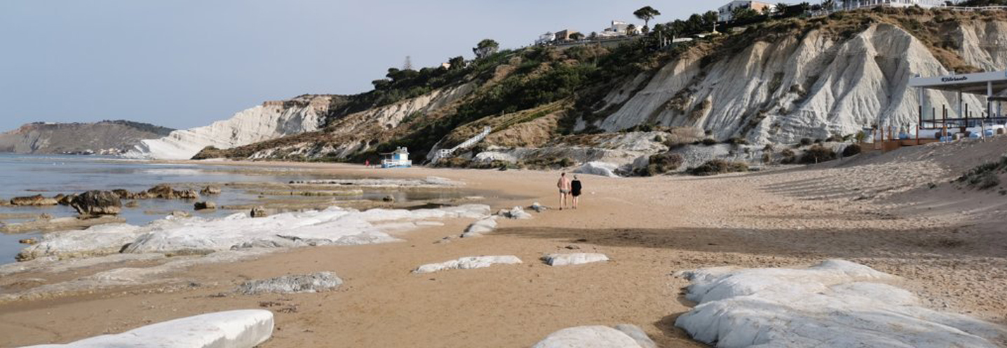
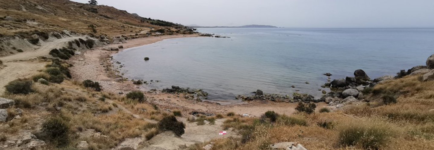
- Realmonte – Pergole
Pocket beach code: SIC45AG05_06_07
The group of 3 Pocket Beaches (PB) is located in southern Sicily, in the province of Agrigento, and more precisely in the municipality of Realmonte, in the Pergole area. They fall into the PAI Physiographic Unit n 11, which is delimited to the northwest by Capo San Marco and to the southeast by Capo Rossello.
The 3 PBs are delimited by pronounced promontories; the most sheltered is the western PB (SIC49AG05), while the other two (SIC49AG06_07) have a smaller shaded area.
Only the western PB has a real cliff (about 130 m above sea level), while the other two have steep slopes behind them. The central PB is the only one to have a small stream running through it.
The westernmost promontory, as well as the portions of the slope closest to the central and western PB, are made up of blue-grey clay marls interspersed and in lateral heterotopia with calcarenites. The whole area behind it, on the other hand, is made up of more or less coarse calcarenites with cross stratification and sandy intercalations. In addition, there are 4 marine terraces on the northern slope.
The sediments of the PBs have a particle size ranging from fine sands to coarse sands.
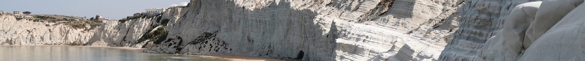
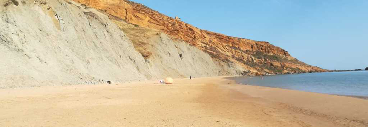
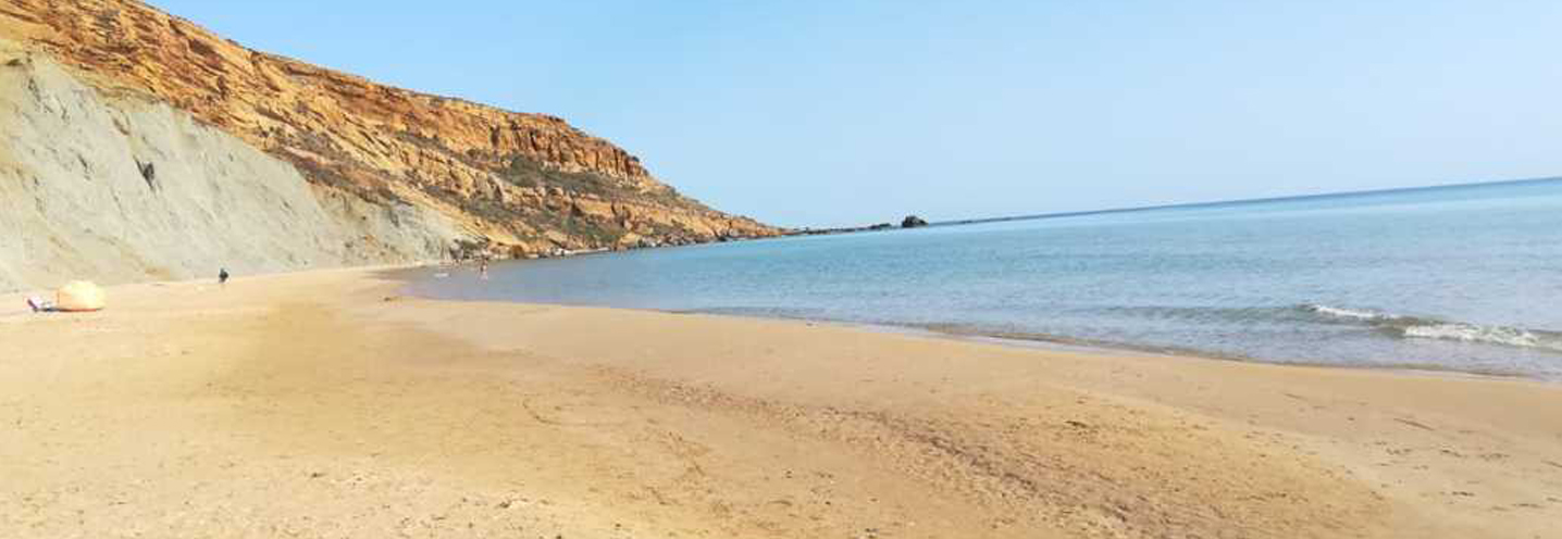
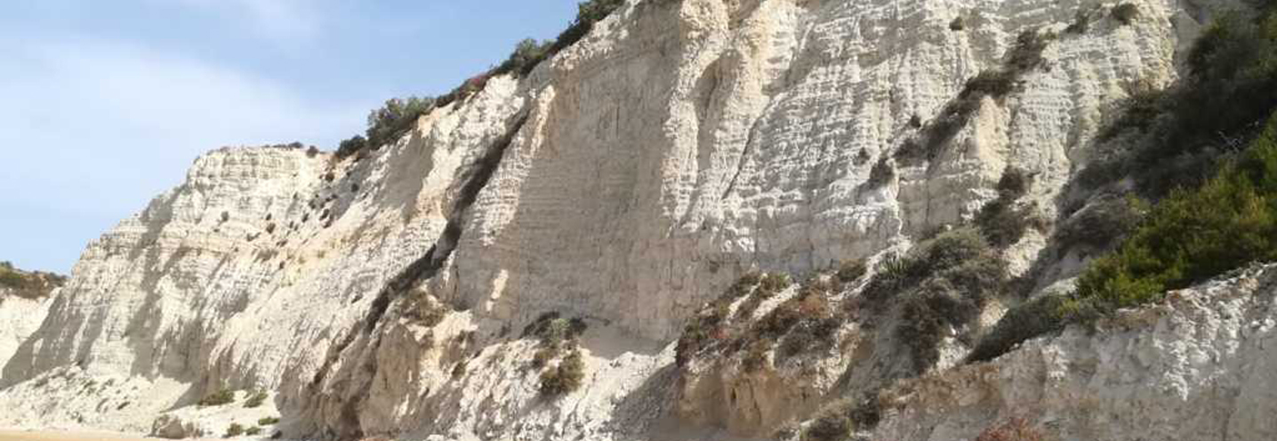
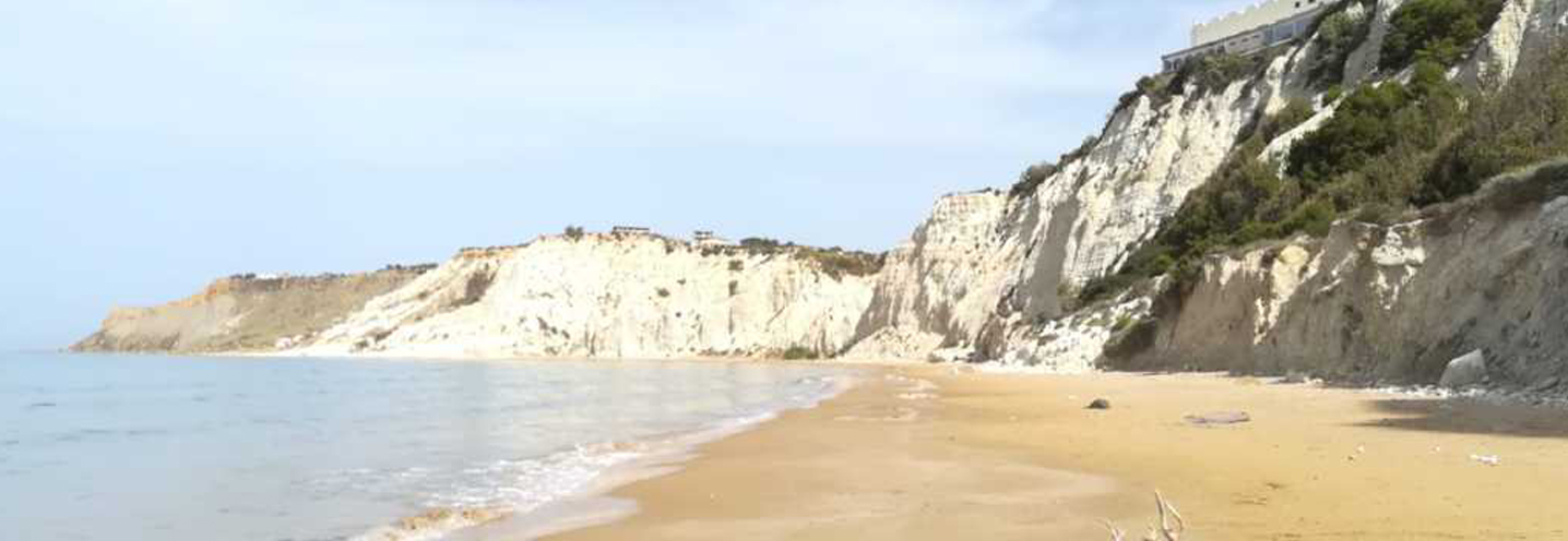
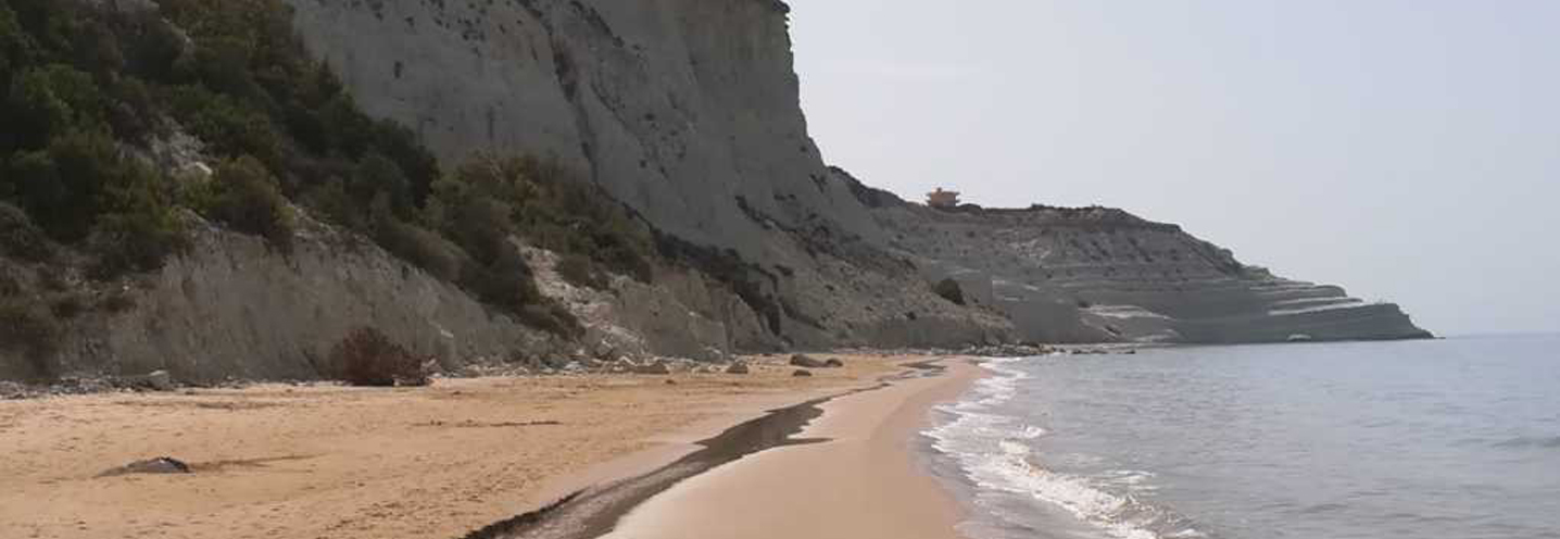
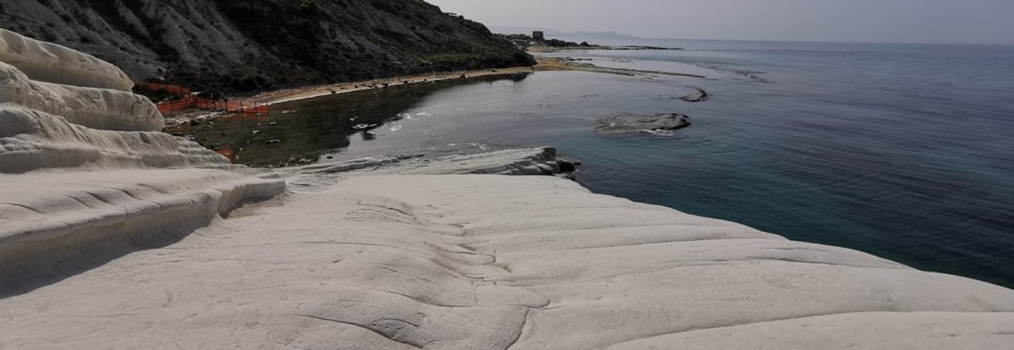
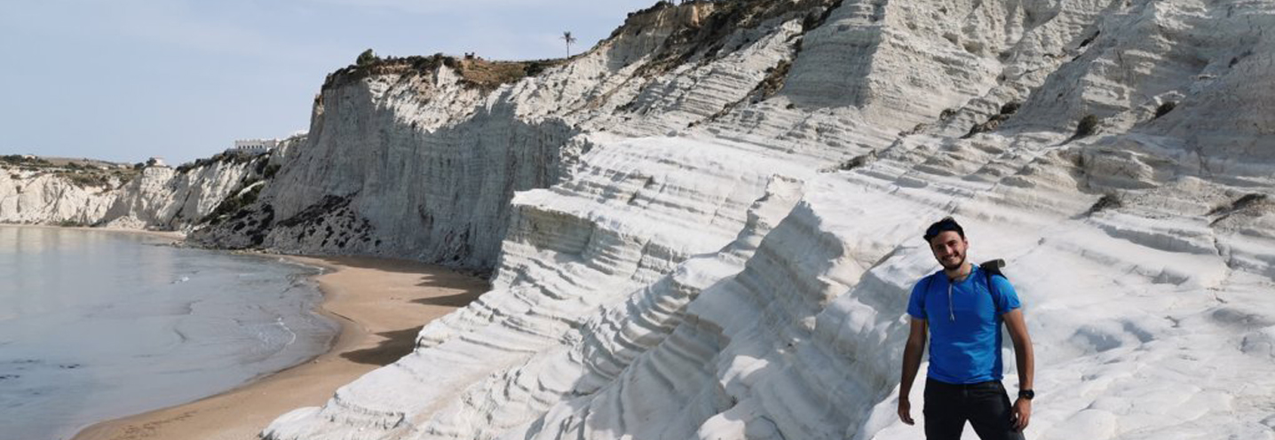
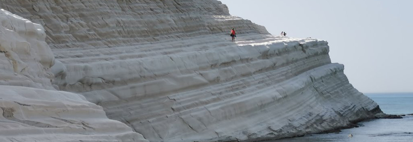
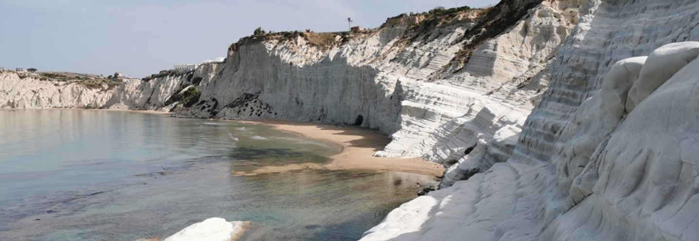
- Realmonte – Scala dei Turchi
Pocket beach code: SIC50AG08_09_10
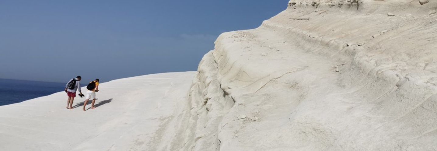
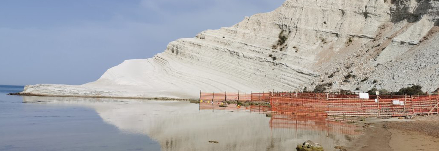
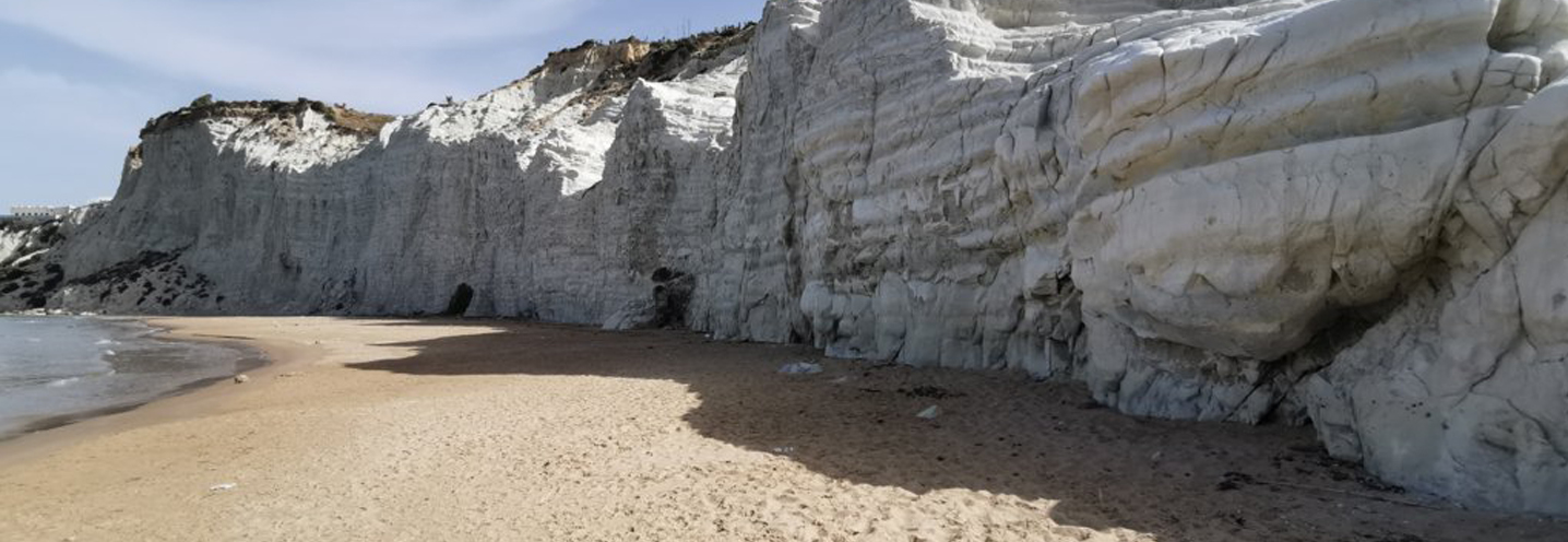
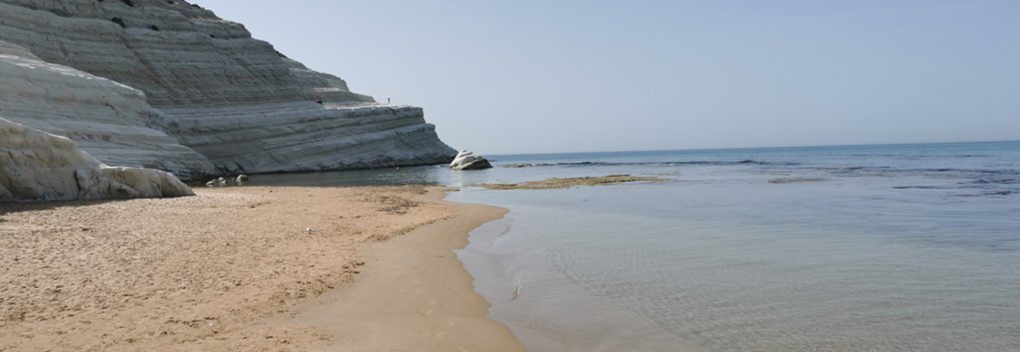
The group consists of 3 Pocket Beaches (PB) located in southern Sicily, in the province of Agrigento, precisely in the municipality of Realmonte. They represent one of the most beautiful places in the entire Sicilian coast. They fall into the PAI physiographic unit n.10, which is delimited to the west by Capo Rossello and to the southeast by Punta Bianca.
The promontories that divide the PB, from West to East, are: Capo Rossello, Punta di Maiata (better known as Scala dei Turchi) and Punta Grande. All the beaches are surrounded by a spectacular white cliff that has a height of about 50-60 m above sea level. There are no waterways.
The cliff consists mainly of stratified marl and calcareous marl, where collapse phenomena are often activated. Precisely for this reason, the coveted tourist destination has been banned from the public to safeguard its safety.
To the east, coastal sands and current dunes emerge, as well as more or less silty blue-grey clay marls. To the north of the PB, straterellated chalks emerge, with large crystals and saccharoids, with clay-marly intercalations. Finally, there are numerous marine terraces present on the entire area.
- Palma di Montechiaro – Punta Bianca
Pocket beach code: SIC51AG11
The Pocket Beach (PB) is located in southern Sicily, in the province of Agrigento, and more precisely in the municipality of Palma di Montechiaro, in Punta Bianca. It falls within the Physiographic Unit of PAI No. 9, which has Punta Bianca as its western limit and the port of Licata as its eastern limit.
The PB is delimited to the west by the Punta Bianca promontory, and to the east by a slightly accentuated promontory. The cliff behind is about 50 m above sea level and there are no streams.
The cliff behind and the eastern promontory are made up of stratified blue-grey marly clays containing limonitic levels. The western promontory (Punta Bianca) has limestone marls and white marly limestones with concoid fracturing; secondly there are laminated chalks and selenitic chalks with large twin crystals of the Messinian. Further away, to the NE, there is a medium-sized outcrop of vacuolar brecciated limestones and white-grey limestones with parallel lamination.
- Palma di Montechiaro – Cala a Vicinzina
Pocket beach code: SIC52AG12_13
The group of two Pocket Beach (PB) is located in southern Sicily, in the municipality of Palma di Montechiaro (Agrigento) and precisely in Cala Vicinzina. They are part of the Physiographic Unit of PAI n 9, which has Punta Bianca as its western limit and the port of Licata as its eastern limit.
The two PBs are delimited by slightly accentuated promontories and by a very developed cliff at the rear (sometimes over 70 m above sea level).
The geological context is quite varied, with the western part consisting of stratified blue-grey marly clays containing limonitic levels, the central one with the so-called basic limestones, i.e. vacuolar brecciated limestones and white-greyish limestones with parallel lamination, and finally laminated chalks and chalks selenitic stones with large twin crystals, which characterise the eastern portion.
The trubi emerge on the eastern promontory, forming splendid cliffs of limestone marl and white marly limestone with concoid fracture that overlook the sea.
- Palma di Montechiaro – Castello
Pocket beach code: SIC53AG14
The Pocket Beach (PB) is located in southern Sicily, in the province of Agrigento, and more precisely in the municipality of Palma di Montechiaro, just south of the castle of Montechiaro. It falls within the Physiographic Unit of PAI No. 9, which has Punta Bianca as its western limit and the port of Licata as its eastern limit.
The promontories that delimit the PB are very pronounced and expose the beach to winds from the west. The cliff behind it reaches its peak (about 100 m above sea level) on the northern portion. There is a small stream.
The Licata Formation surrounds the whole PB and represents the dominant lithology, consisting of stratified blue-grey marly clays containing limonitic levels.
Even the limestones of houses emerge in abundance in the area, especially to the north and northeast of the PB, and consist of vacuolar brecciated limestones and white-grey limestones with parallel lamination.
There are also numerous outcrops of the Tripoli Formation, that is white diatomites, sometimes clay and bituminous (to the north and northeast). Finally, two large marine terraces are present in the immediate hinterland.
- Palma di Montechiaro – A Sud-Est di Marina di Palma
Pocket beach code: SIC54AG15
The Pocket Beach (PB) is located in southern Sicily, in the municipality of Palma di Montechiaro (province of Agrigento), just southeast of Marina di Palma. It falls within the Physiographic Unit of PAI No. 9, which has Punta Bianca as its western limit and the port of Licata as its eastern limit.
The PB is exposed to the southwest and is delimited by two poorly pronounced promontories and by a very steep slope that exceeds 100 m above sea level.
The geological situation of the area is quite complex, with different lithologies. Laminated chalks and selenitic chalks with large twin crystals are the first rocks to emerge near the beach, followed by vacuolar brecciated limestones and white-greyish limestones with parallel lamination belonging to the so-called Base Limestones. More internally, the white leafy diatomites (sometimes clayey and bituminous), as well as the stratified blue-grey marl clays containing limonitic levels, dominate the landscape. The Trubi, i.e. limestone marl and white marly limestone with concoid fracture, are present but in a minority compared to the aforementioned lithologies.
- Palma di Montechiaro – Maferba
Pocket beach code: SIC55AG16
The Pocket Beach (PB) is located in central-southern Sicily, in the municipality of Palma di Montechiaro (Agrigento), in the locality of Maferba. It is part of the Physiographic Unit of PAI n 9, which has Punta Bianca as its western limit and the port of Licata as its eastern limit.
The PB is delimited by two poorly pronounced promontories, and is located at the base of a slope whose peak reaches 100 m above sea level. Furthermore, in this area, 3 tiny streams flow in the rainy periods.
The dominance of the Licata Formation is clear, with stratified blue-grey marl clays containing in the apical part limonitic levels rich in plankton, corresponding to moments of poor pelitic sedimentation that delimit clay parts from 0.1 to 2 m thick. Outcrops of white diatomites, sometimes clay and bituminous, are located at a distance of more than 1 km to the west.
The sediments that make up the PB fall from the granulometric point of view in the class of well-classified medium sands.
- Licata – Mollarella
Pocket beach code: SIC56AG17
The Pocket Beach (PB) is located in central – southern Sicily, in the municipality of Licata (Agrigento), in the locality of Mollarella. It falls within the PAI Physiographic Unit n 9 which develops between the port of Licata in the east and Punta Bianca in the west.
The PB develops between two promontories made up of white leafy diatomites. The western promontory is an islet 10 m above sea level, and is connected to the beach through a sandy tombolo, while the eastern promontory is higher, exceeding 20 m.
In the part behind the PB there is an alluvial plain, in which there is a canal.
The granulometric sediments are made up of fine and medium sands, well classified.
- Isole Pelagie – Lampedusa – Isola dei Conigli
Codice pocket beach: SIC57AG18
La Pocket Beach (PB) è situata nella zona meridionale dell’Isola di Lampedusa, appartenente all’arcipelago delle Isole Pelagie (provincia di Agrigento). Ricade nell’Unità Fisiografica del PAI n 22, nella quale sono incluse tutte le Isole Pelagie.
Si tratta della spiaggia più bella e conosciuta di tutta l’isola, ed è conosciuta dai locali come “Spiaggia dei conigli”. Poco a Sud, sorge un isolotto altrettanto famoso, denominato l’Isola dei Conigli.
La PB, fa parte della Riserva Naturale Orientata dell’Isola di Lampedusa, istituita nel 1995 e vasta 12,12 ha, nonché dell’Area Marina Protetta delle Isole Pelagie, Istituita nel 2003 e con una superficie a terra di 46,28 km2.
La PB è compresa tra promontori alquanto pronunciati e la spiaggia risulta essere protetta parzialmente dall’isolotto antistante. I rilievi retrostanti raggiungono i 70 m s.l.m. e scorre un piccolo rivoletto nei periodi piovosi.
Il promontorio occidentale è costituito da micriti carbonatiche bianche e giallastre con evidenti segni di bioturbazione, biocalcareniti parzialmente dolomitizzate, e superfici terrazzate, mentre in quello orientale affiorano solamente le ultime due summenzionate litologie. L’isola dei conigli, invece è costituita dalle biocalcareniti che sovrastano le micriti. Poco a Nord-Est, infine, affiorano brecce ad elementi carbonatici con matrice di terra rossa e presenza di calcrete.
- Isole Pelagie – Lampedusa – Portu ‘Ntoni
Codice pocket beach: SIC58AG19
La Pocket Beach (PB), conosciuta come spiaggia di Porto ‘Ntoni, si trova nell’area sud-orientale dell’isola di Lampedusa, appartenente all’arcipelago delle Isole Pelagie, in provincia di Agrigento. Ricade nell’Unità Fisiografica del PAI n 22, nella quale sono incluse tutte le Isole Pelagie.
La PB fa parte della Riserva Naturale Orientata dell’Isola di Lampedusa, istituita nel 1995 e vasta 12,12 ha, nonché dell’Area Marina Protetta delle Isole Pelagie, Istituita nel 2003 e con una superficie a terra di 46,28 km2.
I promontori che delimitano le PB (Punta Magajaneddu a Ovest e Punta Guitgia a Est) sono alquanto pronunciati e raggiungono una quota massima di 20 m s.l.m.
L’impluvio retrostante l’arenile è costituito da brecce ad elementi carbonatici con matrice costituita da terra rossa e presenza di calcrete.
Tutto intorno, affiorano le litologie della Formazione Lampedusa. Sui promontori troviamo i calcari oolitici tortoniani alternati con strati ricchi di rodoliti e lumachelle, nonché biomicriti grigio chiare della medesima età. L’entroterra è invece costituito da micriti carbonatiche bianche e giallastre con evidenti segni di bioturbazione.
Sui due promontori, inoltre, affiorano due importanti superfici terrazzate e spianate di abrasione con limitati lembi di ghiaie a strombus bubonius.
- Isole Pelagie – Lampedusa – Guitgia
Codice pocket beach: SIC59AG20
La Pocket Beach (PB si trova nell’area sud-orientale dell’isola di Lampedusa, appartenente all’arcipelago delle Isole Pelagie, in provincia di Agrigento. Rientra nell’Unità Fisiografica del PAI n 22, nella quale sono incluse tutte le Isole Pelagie.
La PB fa parte della Riserva Naturale Orientata dell’Isola di Lampedusa, istituita nel 1995 e vasta 12,12 ha, nonché dell’Area Marina Protetta delle Isole Pelagie, Istituita nel 2003 e con una superficie a terra di 46,28 km2.
La PB è delimitata a Sud da Punta Guitgia e a Nord-Est da Punta Favaloro, molo meridionale del porto di Lampedusa. Pertanto, rientra tra le PB definite come seminaturali. Non è presente la falesia retrostante.
L’impluvio retrostante l’arenile è costituito da brecce ad elementi carbonatici con matrice costituita da terra rossa con presenza di calcrete.
Sui promontori affiorano i calcari oolitici tortoniani alternati con strati ricchi di rodoliti e lumachelle, nonché biomicriti grigio chiare della medesima età. L’entroterra è invece costituito da micriti carbonatiche bianche e giallastre con evidenti segni di bioturbazione.
Su Punta Guitgia, inoltre, affiora un importante superfice terrazzata con limitati lembi di ghiaie a strombusbubonius (Tirreniano).