


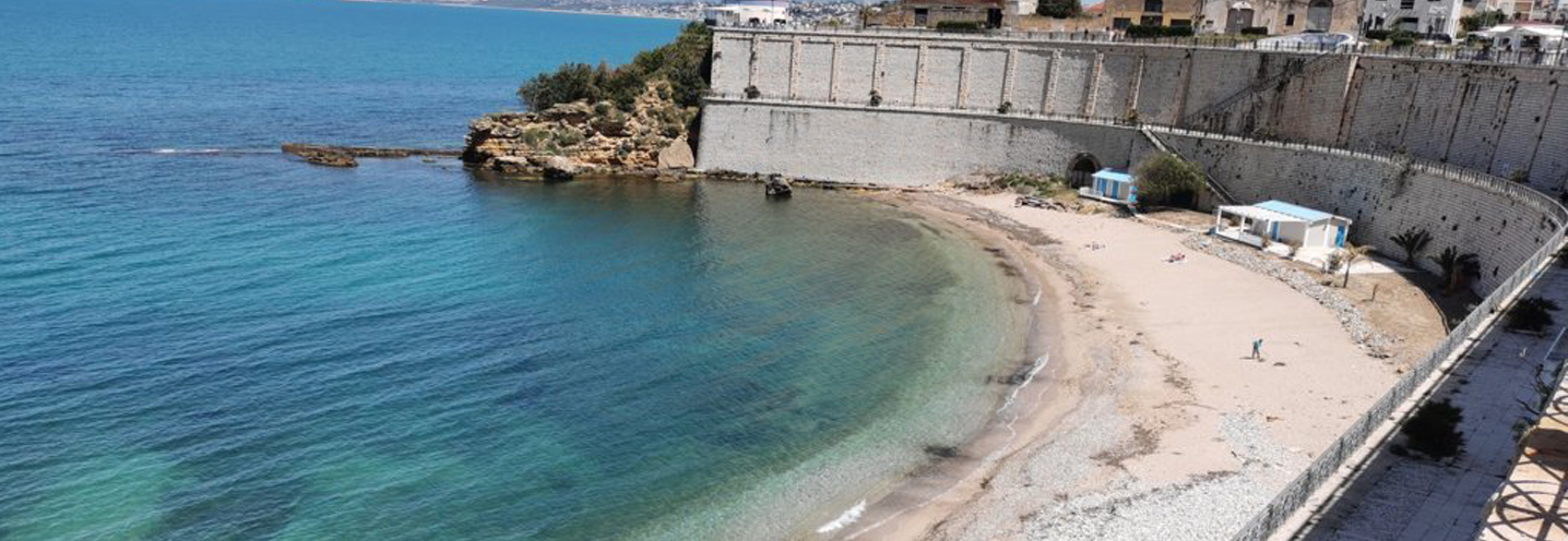
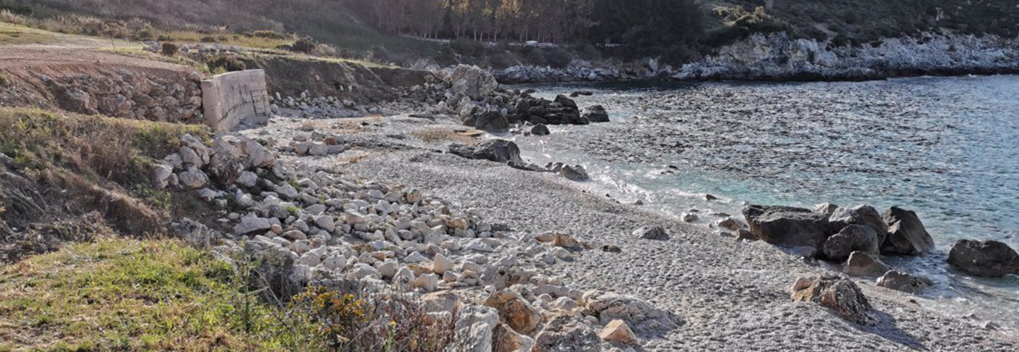
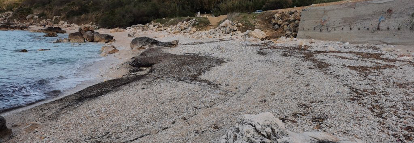
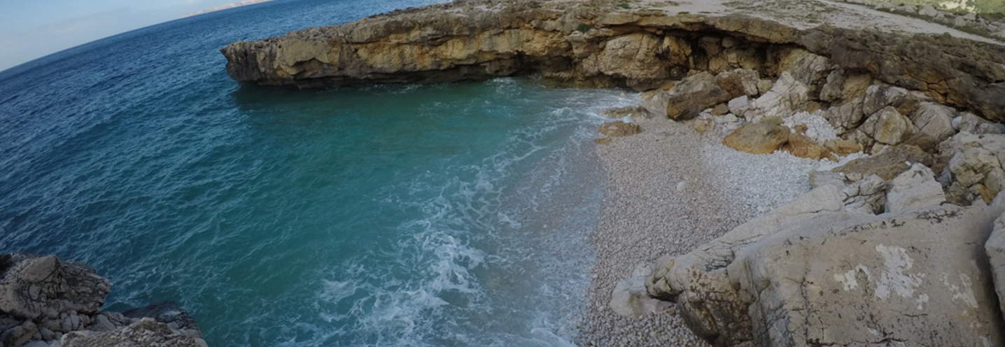
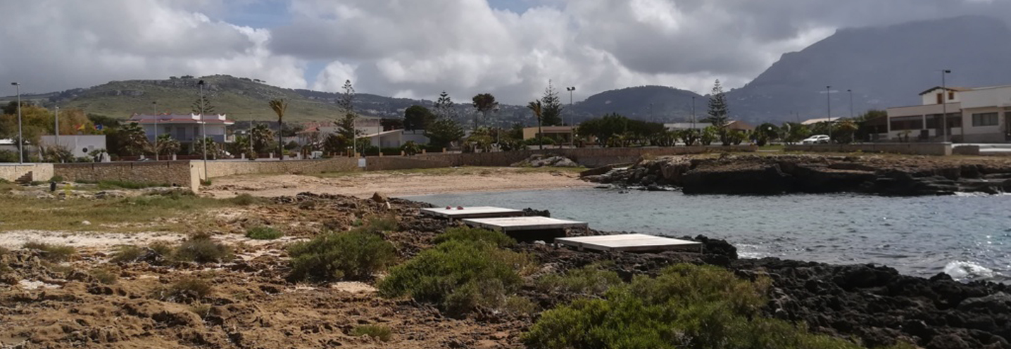
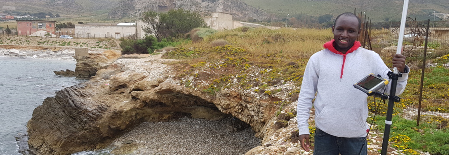
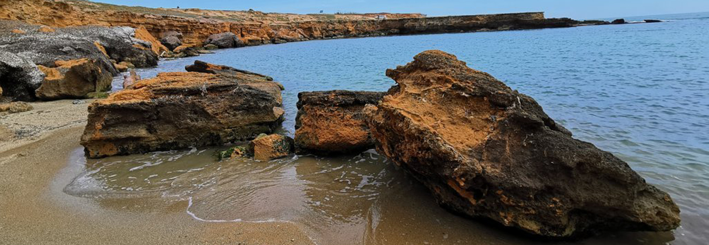
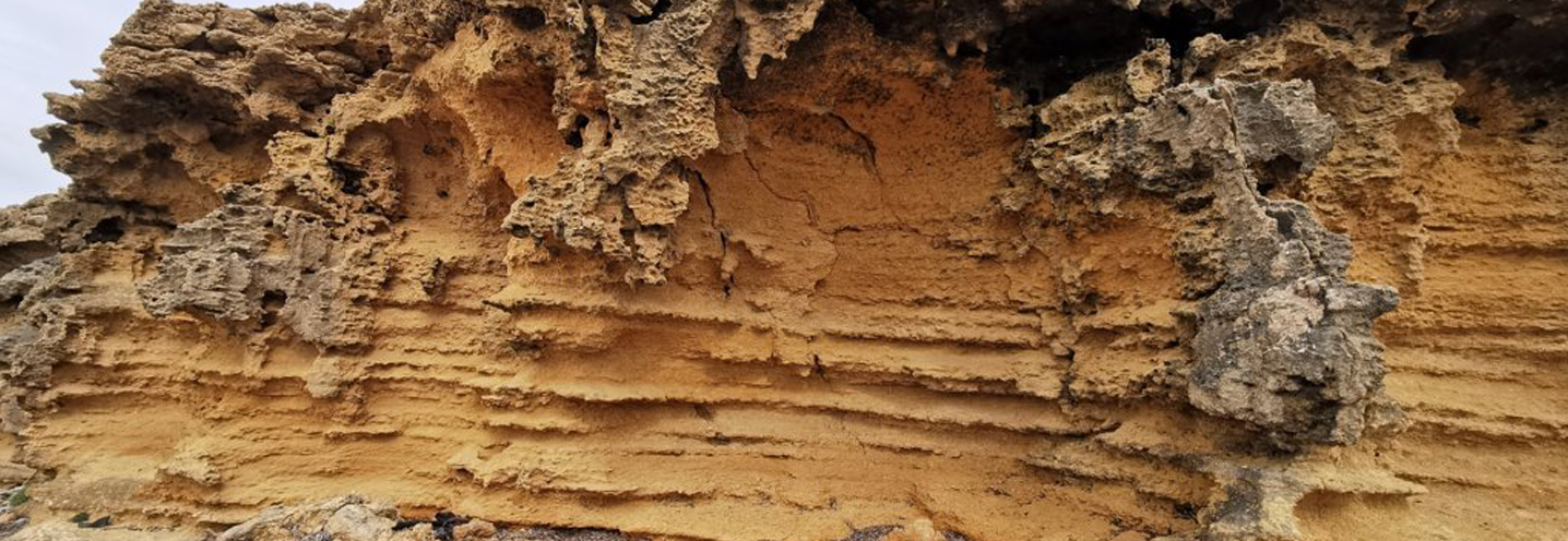
- Castellammare Del Golfo – East Port
Pocket beach code: SIC28TP01
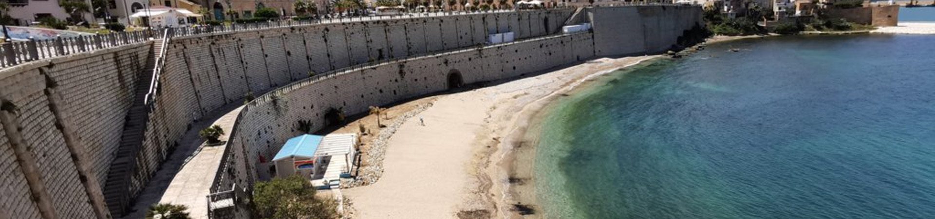
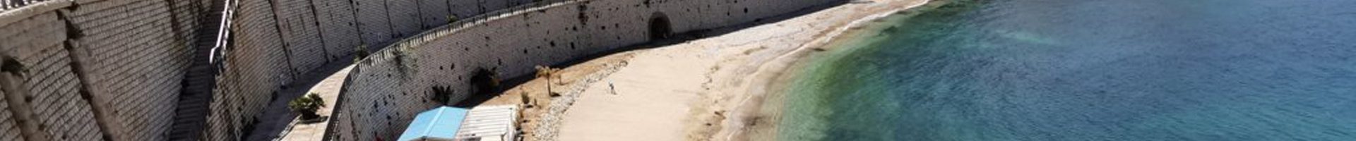
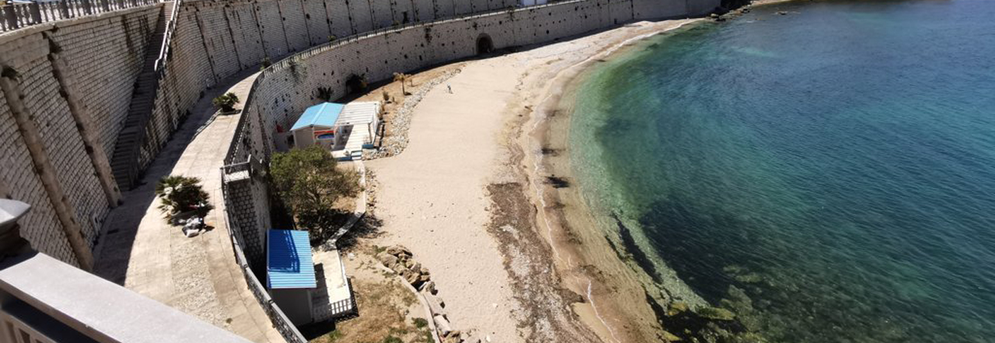
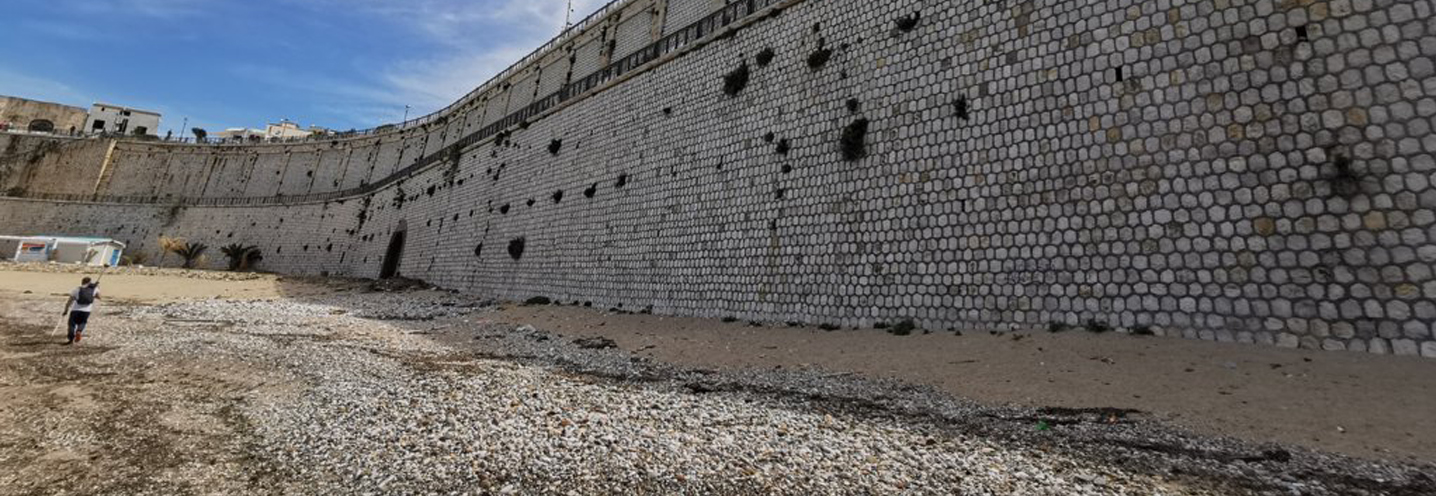
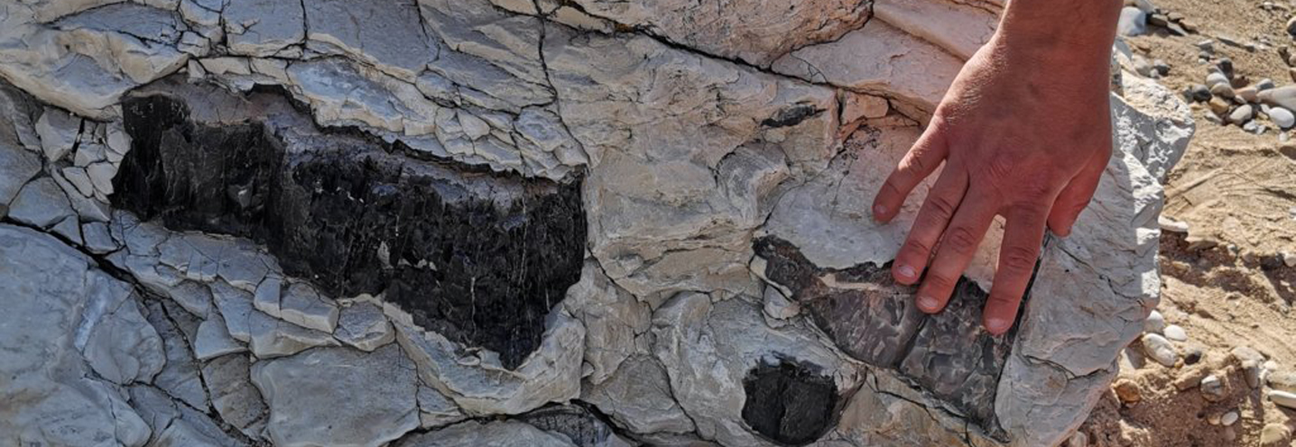
The Pocket Beach (PB) is located in northwestern Sicily, and is the most eastern of the province of Trapani among those studied for the BESS project. It falls within the municipality of Castellamare del Golfo, just east of the port, and falls within the Physiographic Unit of PAI No. 15, which has Capo San Vito as its western limit, and Capo Rama as its eastern limit.The PB is located at the base of the stepped wall 20 m above sea level and is delimited to the east by the promontory which houses the Arab-Norman castle, and to the west by a less pronounced promontory.The lithology outcropping in the area behind the beach and on the western promontory consists of calcarenites, calcirudites and sands, of yellow to orange-reddish color, in decimetric layers. However, inland and on the eastern promontory coastal deposits emerge such as sands and silty sands, conglomerates and siliceous calcarenites.Located to the east of the PB there are numerous stratified groundwater debris cemented with sharp-edged elements, while outcrops of clay and sandy marls from grey to green with planktonic foraminifera are present to the southwest.
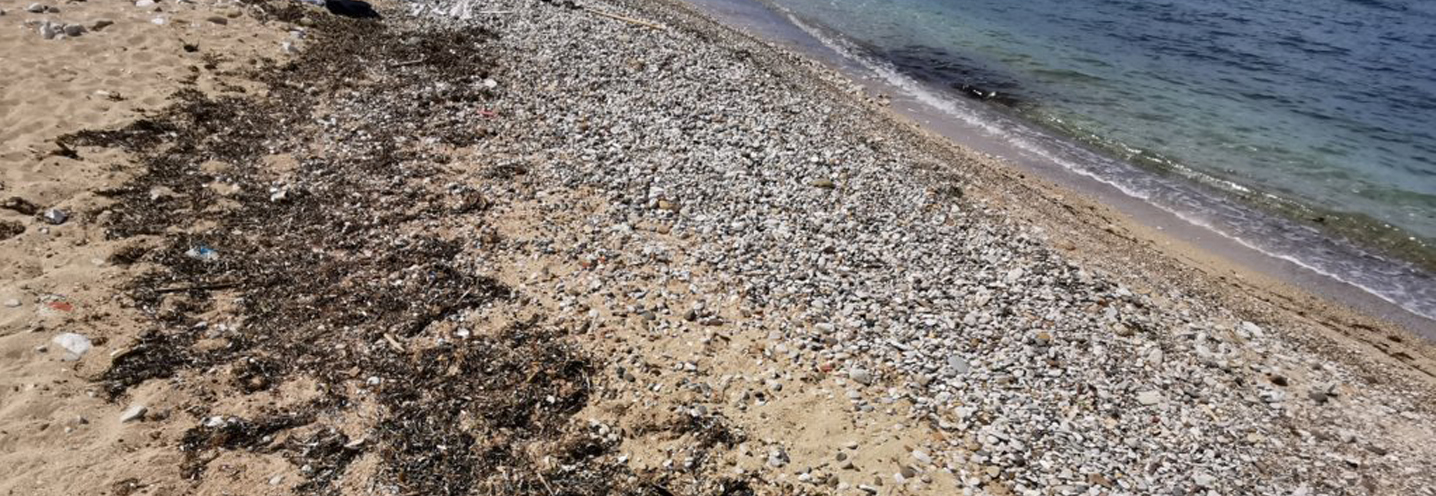
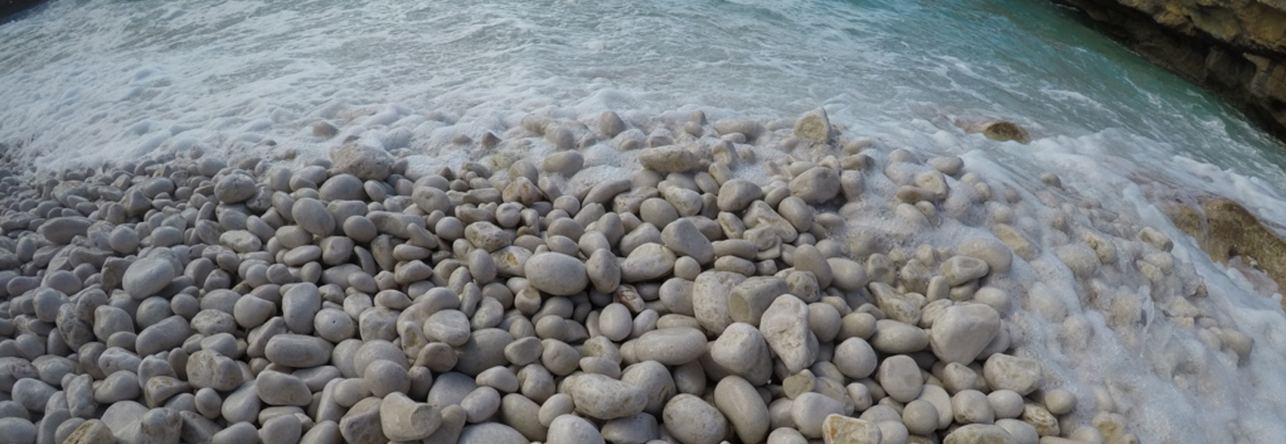
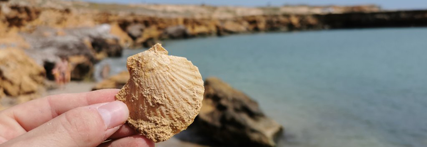
The sediments that make up the PB from a compositional point of view are quite heterogeneous and have grain sizes falling between very coarse sand and gravel.
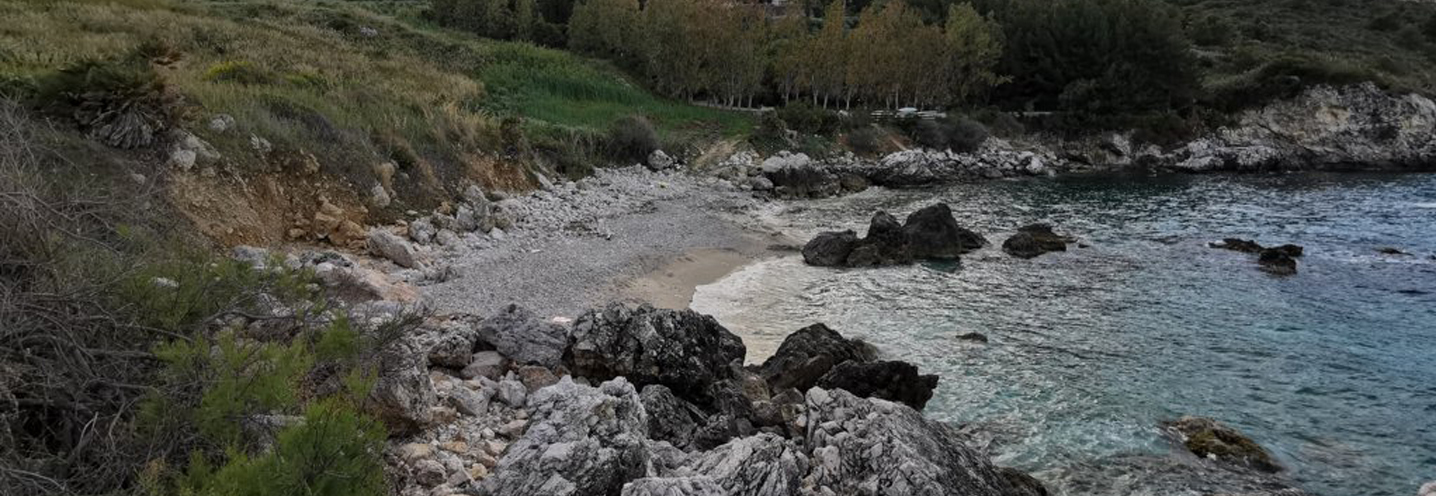
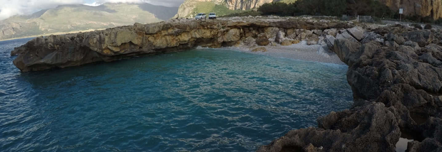
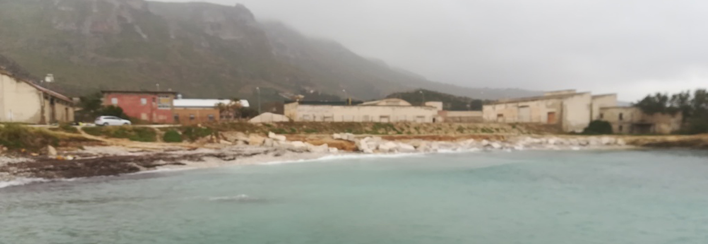
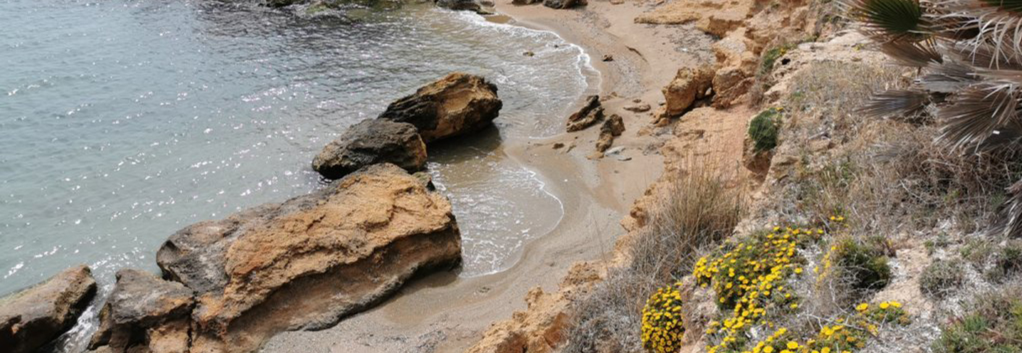
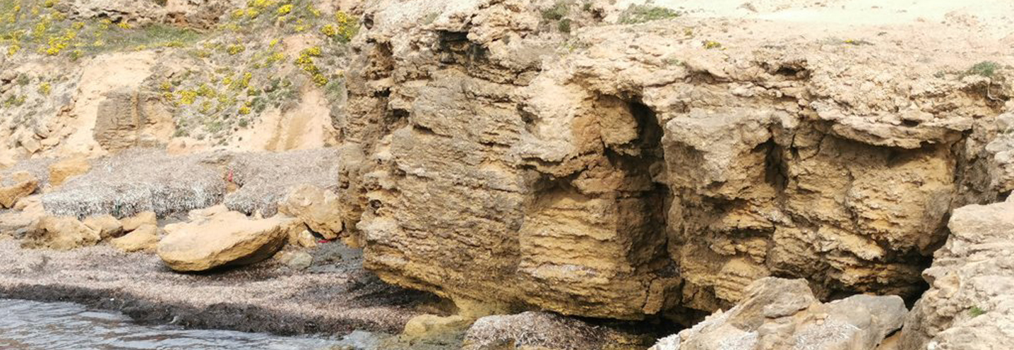
- Castellammare del Golfo – Guidaloca
Pocket beach code: SIC29TP02
The Pocket Beach (PB) of Guida Loca is located in the northwestern sector of Sicily, in the province of Trapani, and falls in the municipality of Castellamare del Golfo, a town with a coast full of beaches and natural beauty. The PB is part of the Physiographic Unit of PAI No. 15, which has Capo San Vito as its western limit, and Capo Rama as its eastern limit.
It is delimited to the northwest by Capo Puntazza and to the east by Punta Gran Marinaro, with a cliff only on the eastern side which reaches a height of around 15-20 m above sea level. There are two small streams called “Fosso Guidaloca” and “Fosso Acqualavite”, both in the central portion of the PB.
Capo Puntazza is made up of white and red calcilutites, alternating with marls and yellowish or red marl limestones. In the other promontory limestone and white Dolomite limestones with algae, oncolites, gastropods and ammonites emerge. The area behind the PB, on the other hand, shows numerous formations such as marly limestones of the Lattimusa Formation, calcarenites and calcirudites, greyish marl calcilutites alternating with thin levels of whitish marls with flint lists and reddish / nodular cephalopod limestones.
From the compositional point of view, the sediments that make up the PB are quite heterogeneous and have grain sizes falling between very coarse sand and medium-fine pebbles.
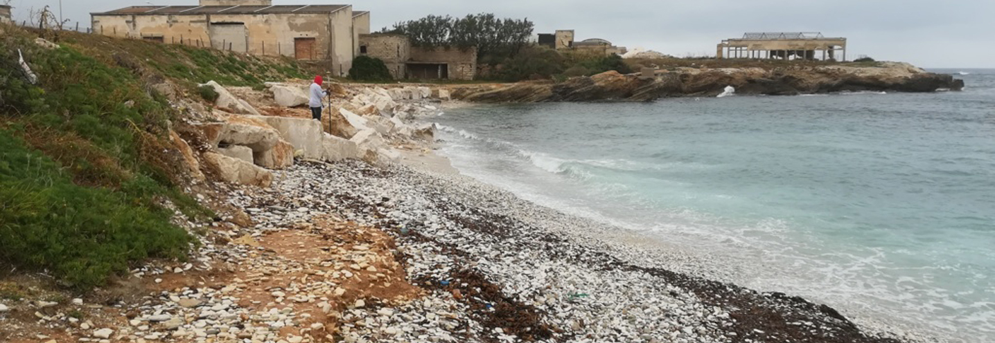
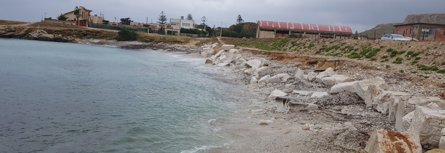
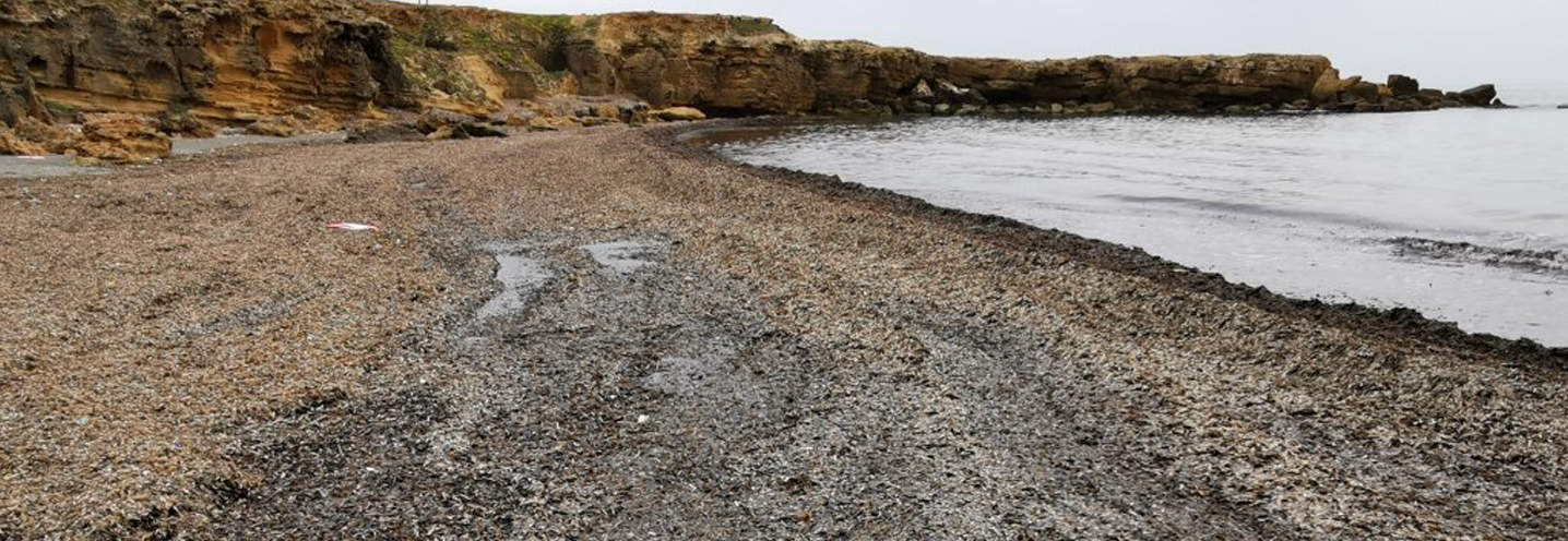
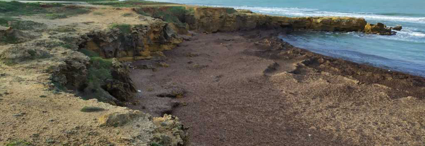
- Castellammare del Golfo – Calamazzo
Pocket beach code: SIC30TP03_04
The group consisting of two Pocket Beaches (PB) is located in northwestern Sicily, in the province of Trapani, in the municipality of Castellamare del Golfo, and precisely in Mazzo di Sciacca. The PB group is part of the PAI Physiographic Unit No. 15, which has Cape San Vito as its western limit, and Cape Rama as its eastern limit.
The PBs are delimited by promontories that do not exceed 20 m above sea level, with a considerable area in distress that dominates a large part of the hinterland for over a km.
The area located to the northwest consists mainly of poorly stratified, graded and laminated dolorudites as well as clays, sandy clays and marly sandstones. In the central-eastern sector, patches, limestones, dolomitic limestones and stromatolitic dolomites emerge.
The sediments that make up the PB are mostly carbonate in nature and fall into the grain size classes between coarse sands and fine pebbles, even if there are metric-sized boulders.

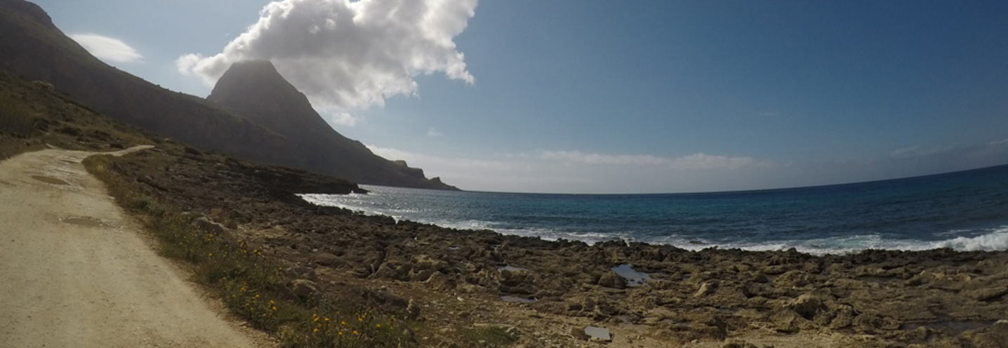
- San Vito Lo Capo – Zingaro Disa
Pocket beach code: SIC31TP05
The Pocket Beach (PB), known as Cala della Disa, is located in the northwestern sector of Sicily, in the province of Trapani, in the municipality of San Vito lo Capo. It is part of the Physiographic Unit of the PAI n 15, which has as western limit Capo San Vito, and as eastern limit Cape Rama. The PB is part of the Oriented Natural Reserve of the Zingaro, which has an area of 1600 ha and was established in 1988.
It is located at the base of a cliff about 20 m above sea level and is delimited by two promontories that enclose it almost completely.
The most immediate outcrop behind the beach is made up of stromatolitic dolomites, calcarenites, dolomitic limestones, breaches and sedimentary strands bordering to the south with a discreet deposit of groundwater debris. To the southeast, towards Punta Leone, limestones, dolomitic limestones and stromatolitic dolomites emerge. Inland, poorly layered, graded and laminated dolorudites emerge.
The sediments that make up the PB are mostly carbonate in nature.
- San Vito Lo Capo – Zingaro Museo
Pocket beach code: SIC32TP06
The Pocket Beach (PB), known as Cala Tonnarella dell’Uzzo, is located in the northwestern sector of Sicily, in the province of Trapani, and falls in the municipality of San Vito lo Capo. It falls within the Physiographic Unit of PAI n 15, which has Capo San Vito as its western limit, and Capo Rama as its eastern limit.
It represents one of the most beautiful beaches of the Zingaro Reserve, and is delimited by two slightly accentuated promontories and at the base of a steep slope where there is also a small stream.
The Oriented Natural Reserve of the Zingaro has an area of 1600 ha and was established in 1988. On the southeastern promontory of the PB there is the museum of marine activities of the reserve.
Near the beach, there is an outcrop of whitish marl and marly calcilutites, while the promontories are made up of: calcilutites, marly calcisiltites and calcarenites and nodules of flint (in the north), and greyish white doloarenites / dolorudites, often vacuolar and floury (in the south).
The hinterland shows more imposing outcrops, in particular we find stromatolitic dolomites, calcarenites, dolomitic limestones and sedimentary strands, with at times substantial detrital deposits.
The sediments that make up the PB are mostly carbonate in nature.
- San Vito Lo Capo – Calampiso
Pocket beach code: SIC33TP07
The Pocket Beach (PB) is located in the northwestern sector of Sicily, in the province of Trapani, in the municipality of San Vito lo Capo and is known as Cala Grottazza. It falls within the Physiographic Unit of PAI n 15, which has Capo San Vito as its western limit, and Capo Rama as its eastern limit.
It is delimited to the north and south by two promontories that make it very sheltered, and is located at the base of a steep slope where there is also a small stream.
The promontories are made up of greyish white doloarenites and dolorudites, often vacuolar and floury, while an imposing outcrop of stromatolitic dolomites, calcarenites, dolomitic limestones, breaches and sedimentary strands dominates the entire internal landscape.
In the area immediately behind the beach, detrital deposits of modest size alternate, as well as brown pelites with subtle intercalations of sands and quartz sandstones in decimetric layers.
The sediments that make up the PB are mostly carbonate in nature.
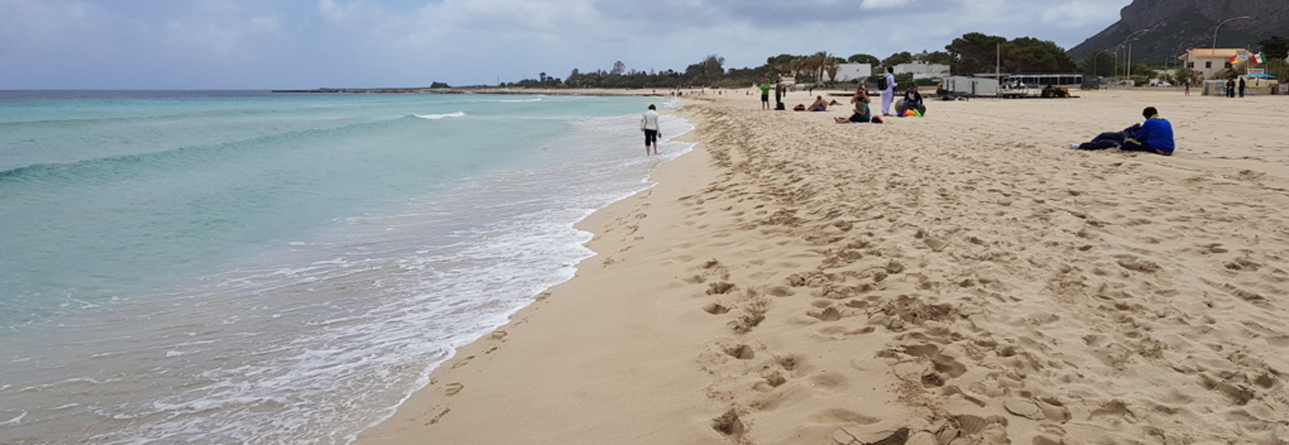
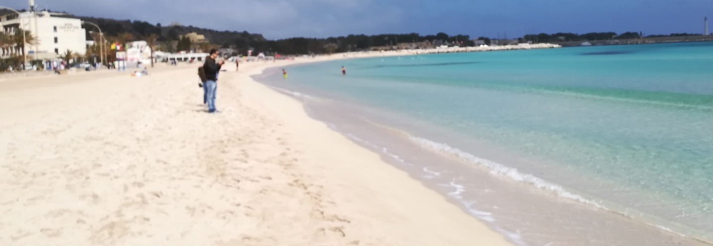
- San Vito Lo Capo – San Vito Lo Capo
Pocket beach code: SIC34TP08
The Pocket Beach (PB), located in the province of Trapani (northwestern Sicily), is part of the bay of San Vito Lo Capo, a well-known tourist resort in Sicily. The bay of San Vito Lo Capo, which is included in the PAI Physiographic Unit No. 15 (Capo San Vito – Capo Rama), extends from the root of the port in the west to the rocky platform of the Saffaglione district in the east.
The PB is confined by the port to the west and extends to the rocky platform of the Saffaglione district to the east. It is therefore a semi-natural PB. It is limited by a rocky platform that has good vegetation, almost continuous on the eastern side, where near the shoreline it gives way to beached Posidonia banks.
The whole area surrounding the PB is made up of carbonate lithologies such as bioclastic calcarenites and conglomerates, as well as planktonic foraminifera calcilutites and marls. The deposit of recent wind sands in the center of Capo San Vito, western promontory of the PB, deserves to be mentioned.
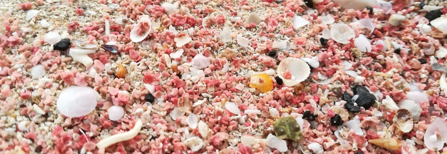
It is one of the most famous and beautiful beaches on the entire island, and attracts thousands of tourists from all over the world every year. The main attraction is given by the white color of the beach.
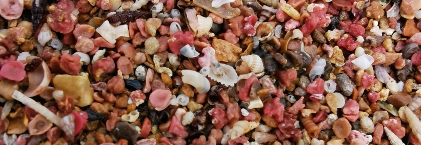
The sediments are of carbonate origin, and coral fragments are found on the shoreline. From the granulometric point of view, it is medium well classified sand.
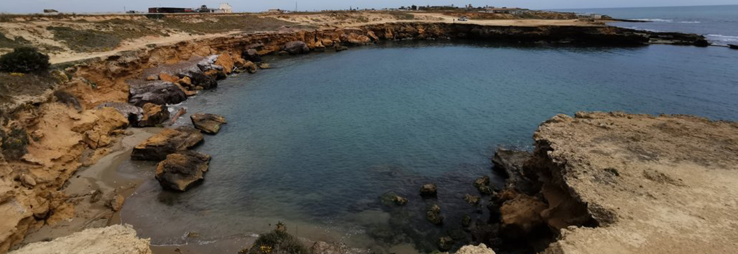
- Custonaci – Agliareddi
Pocket beach code: SIC35TP09
The Pocket Beach (PB), known as “Agliareddi beach” is located in the northwestern sector of Sicily, in the province of Trapani, and is part of the municipality of Custonaci. It is also part of the Physiographic Unit of PAI No. 14, which has Capo Feto as its southern extreme and Capo San Vito as its northern extreme.
It is part of the Monte Cofano Oriented Natural Reserve, which has an area of 537.5 ha and was established in 1997.
It is one of the smallest PBs designed for the BESS project and is located in a tiny inlet between two small promontories. The cliff behind it does not exceed 5 m in height and is very unstable due to gravitational processes. There are no streams.
The cliff is made up of stromatolitic and calcarenite dolomites and around it, limestone aeolian dunes. Both to the east and west of the beach, there are also bioclastic calcarenites and conglomerates with arenitic matrix, as well as abundant detrital deposits that lap the aforementioned lithologies. Moving away from the shoreline, the geological context closes outcrops of calcarenites, breccias and calcarenites with crinoids and flint nodules.
The sediments inside the small inlet are given by coarse, very rounded and carbonate pebbles with a light color (grey-whitish).
- Valderice – Cortigliolo
Pocket beach code: SIC36TP10
The Pocket Beach (PB) of Cortigliolo is located in the northwestern area of Sicily, in the province of Trapani and in the municipality of Valderice. It is also part of the Physiographic Unit of PAI No. 14, which has Capo Feto as its southern extreme and Capo San Vito as its northern extreme.
The PB is delimited by two accentuated promontories and has a cliff about 5 m above sea level. There are no streams.
The cliff, as well as the central and western sector within the PB, is made up of shell breaches with Pecten Jacobeaus and OstreaEdulis. To the east, on the other hand, calcilutite and foraminifera marls, bioclastic calcarenites, conglomerates and wind-powered dune calcarenite emerge.
The sediments that make up the PB have granulometries between the large sands and the fine pebbles, and compositionally are mainly carbonate clasts.
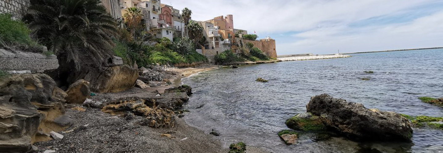
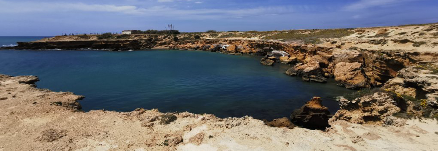
- Erice – Pizzolungo Est
Pocket beach code: SIC37TP11
The Pocket Beach (PB) of Pizzolungo Est is located in western Sicily, in the province of Trapani, in the municipality of Erice and more precisely is located between the villages of Pizzolungo (in the east) and Crocefissello (in the west). It falls within the Physiographic Unit of PAI n 14, which has Capo Feto as its southern extremity and Capo San Vito as its northern extremitiy.
It is surrounded by two promontories that make it very sheltered and by a cliff about 10 m above sea level, which shows signs of numerous collapses. There are no streams.
The geological context is very simple, in fact the whole surrounding area has greyish or cerulean semicrystalline limestones, often with crinoids. To a lesser extent, to the west of the PB, shell breches with Pecten Jacobeaus and OstreaEdulis emerge.
The sediments of PB fall into the particle size class of medium-coarse pebbles of carbonate composition. The beach has a low amount of sediment and abundant deposits of beached Posidonia oceanica.
- Erice – Pizzolungo Ovest
Pocket beach code: SIC38TP12
The pocket beach (PB) of Pizzolungo Ovest is located in western Sicily, in the province of Trapani, in the municipality of Erice and more precisely it is located between the villages of Pizzolungo (to the east) and Crocefissello (to the west). It is part of the Physiographic Unit of PAI No. 14, which has Capo Feto as its southern extreme and Capo San Vito as its northern extreme.
It is surrounded by two promontories and by a cliff about 5/10 m above sea level, which shows signs of numerous collapses. There are no streams.
The geological context is very simple. In fact the whole surrounding area has greyish or cerulean semicrystalline limestones, often with crinoids. To a lesser extent, to the west of the PB, shell breaches with Pecten Jacobeaus and Ostrea Edulis emerge.
The sediments of PB fall into the particle size class of medium-fine pebbles of carbonate composition. The beach has a low amount of sediment, which has a white to beige color. The white pebbles derive from the dismantling of an embattled roadbed made up of marble blocks in contrast to the local geological context.
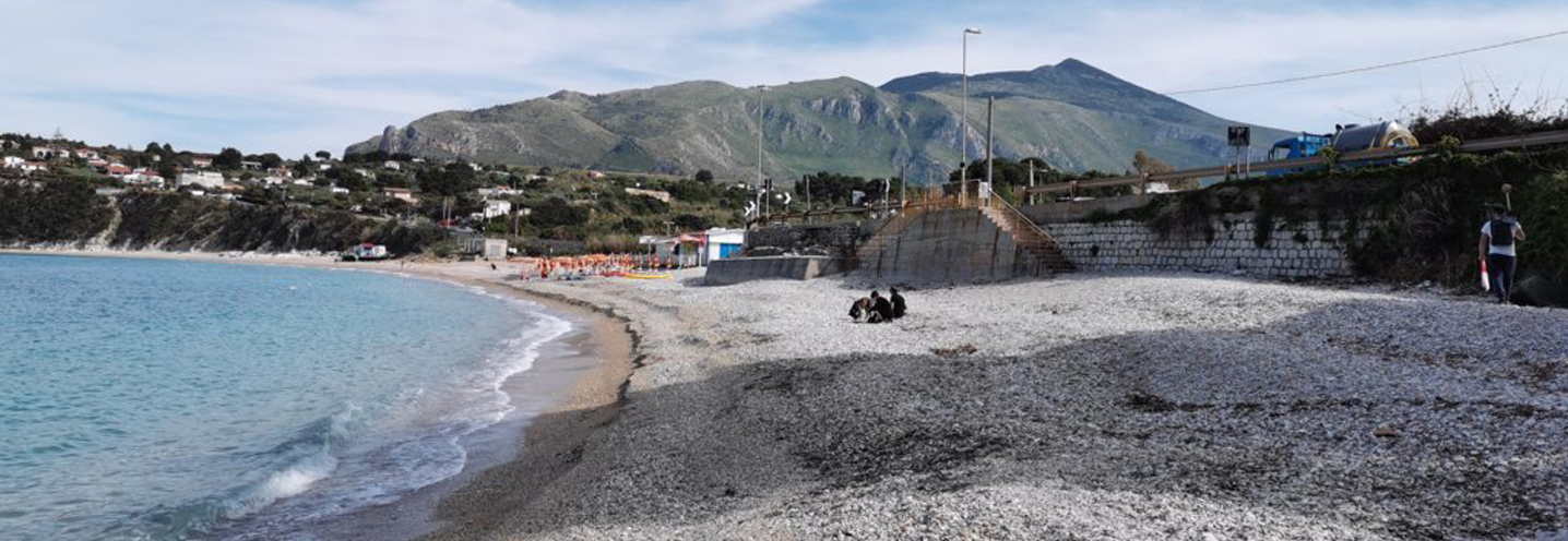
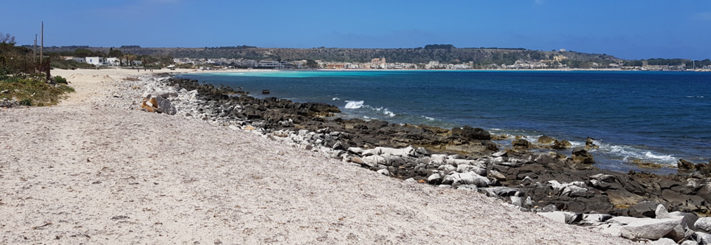
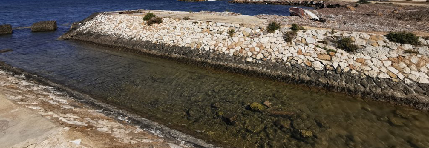
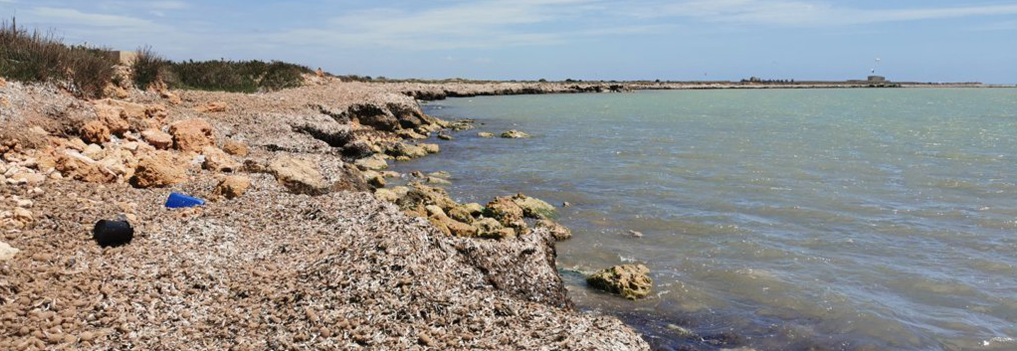
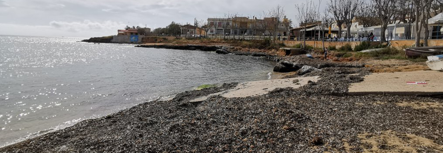
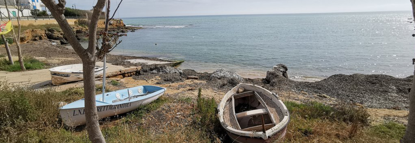
- Petrosino – Torre Sibiliana
Pocket beach code: SIC39TP13
The Pocket Beach (PB) is located in western Sicily, in the province of Trapani, in the municipality of Petrosino. It falls within the Physiographic Unit of PAI No. 14, which has Capo Feto as its southern extreme and Capo San Vito as its northern extreme.
It is delimited to the north and south by two promontories, respectively that of Torre Sibiliana and that of Punta Parrino Sibiliana and there is no cliff behind it. The Margi-Milo steam flows on the central-northern side and there are two marinas, one on each side of the PB.
The promontories are both marine terraces made up of yellowish calcarenite, while the rear part of the PB consists of marsh deposits made up of black soils and more or less sandy greyish clays.
The sediments, compositionally carbonate, have granulometries mainly falling in the class of large sands, rarely in the class of gravels. There are abundant deposits of Posidonia oceanica and there are small colored deposits of corals on the shoreline.
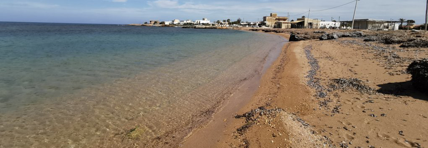
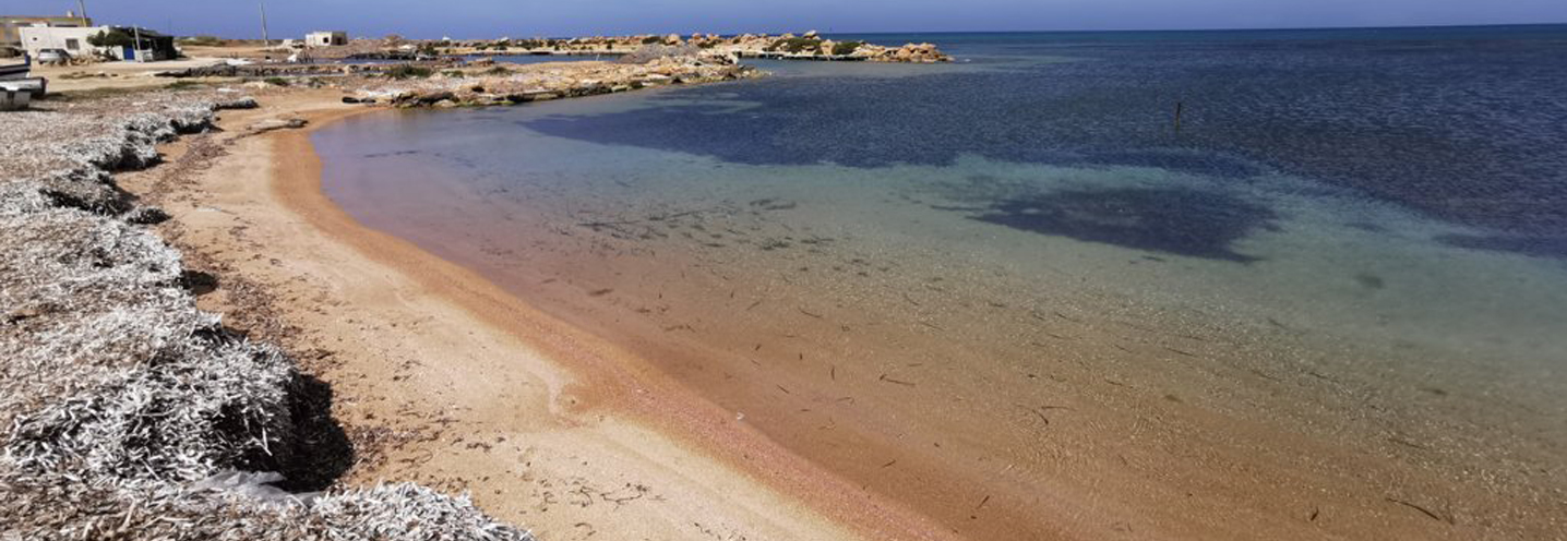
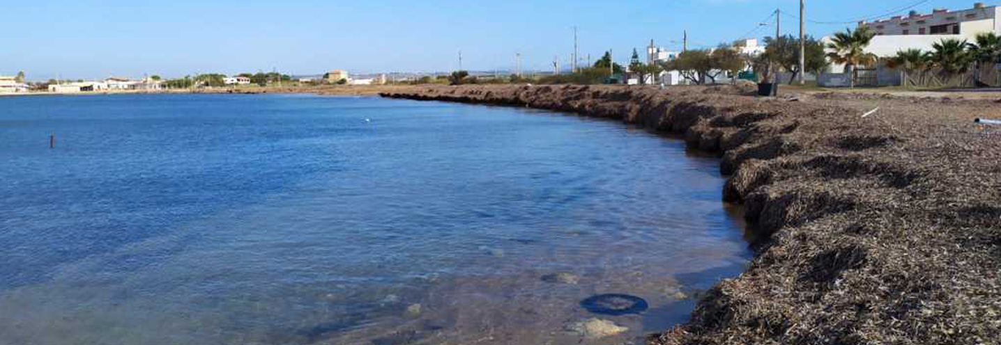
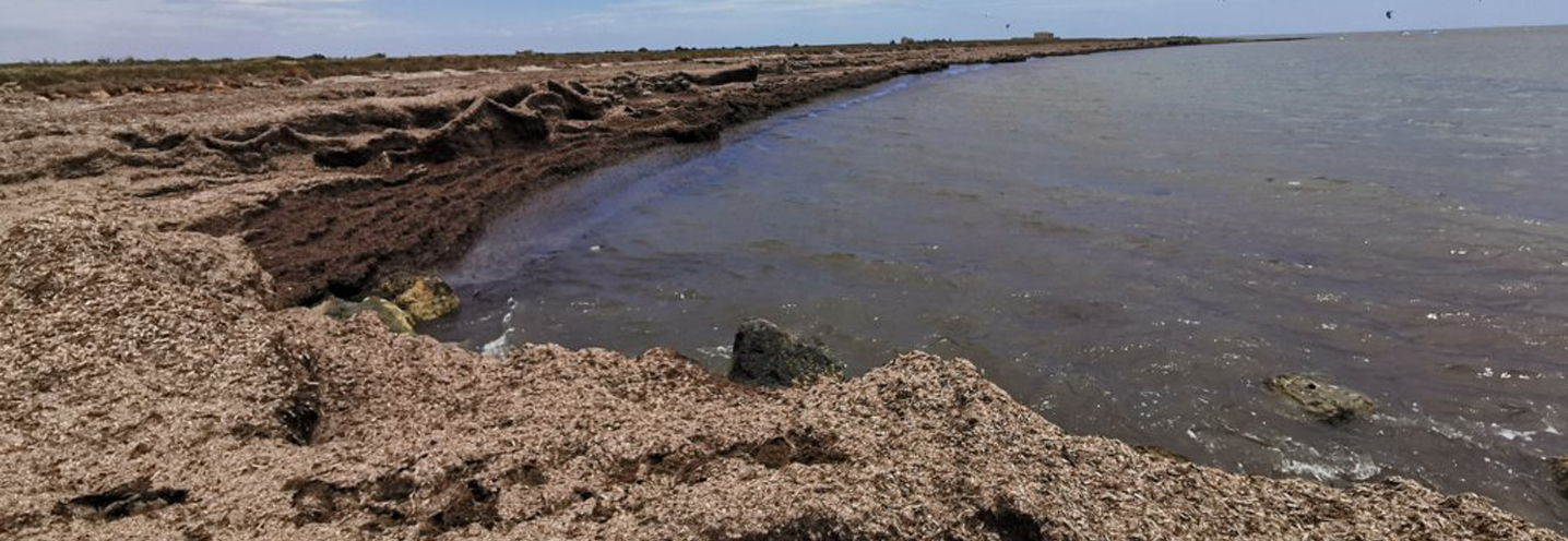
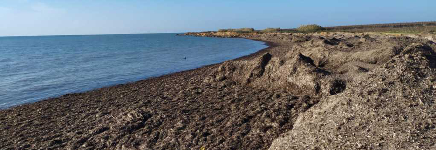
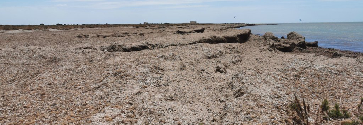
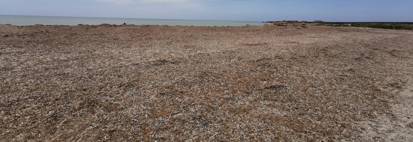
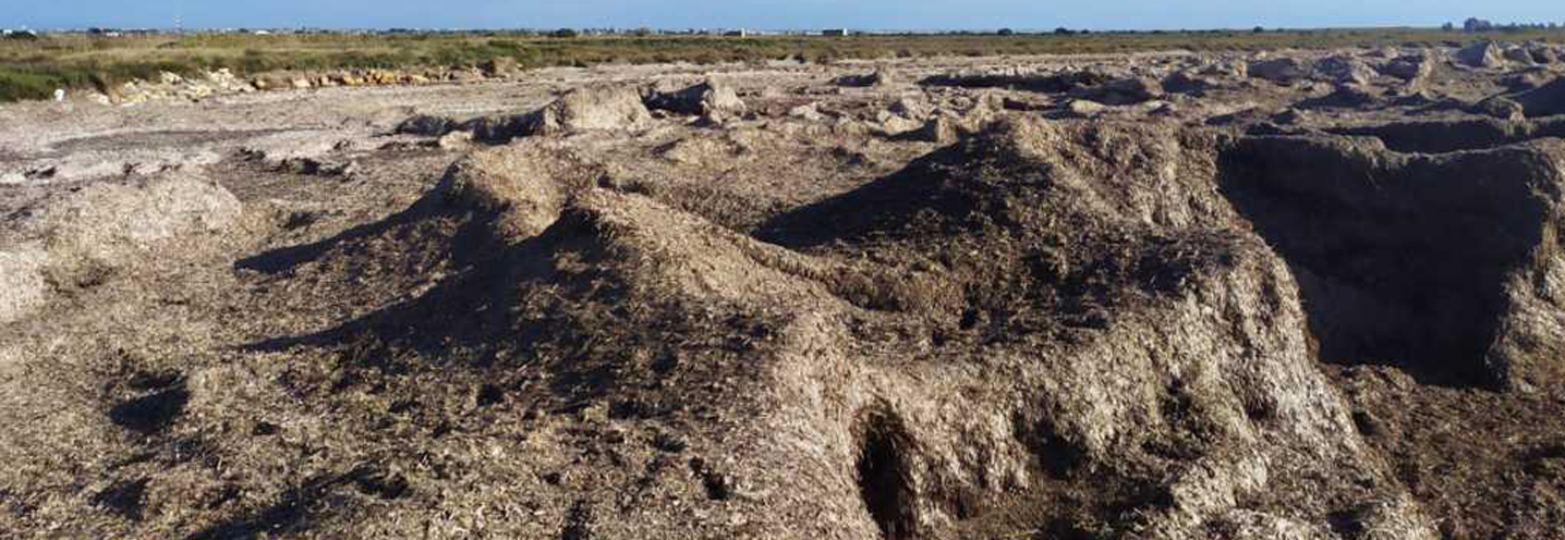
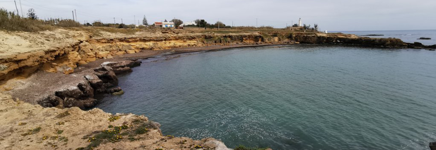
- Petrosino – Faro Capo Feto
Pocket beach code: SIC40TP14
The Pocket Beach (PB) is located in western Sicily, in the province of Trapani, and precisely in the municipality of Petrosino. It falls within the Physiographic Unit of PAI n 14, which has Capo Feto as its southern extremity and Capo San Vito as its northern extremity.
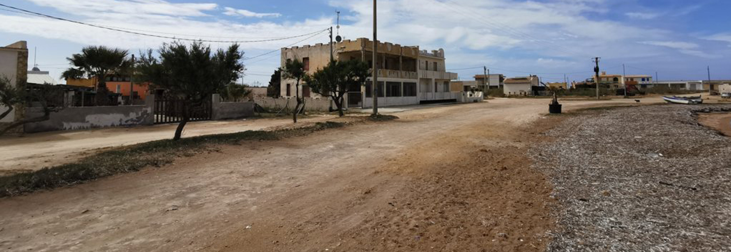
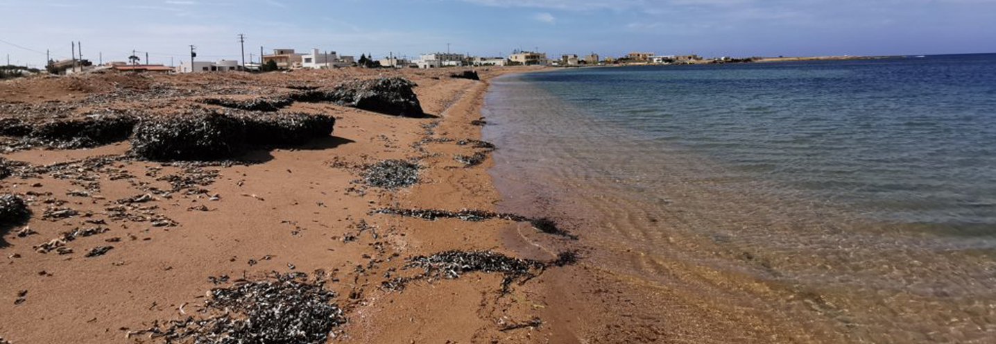
The PB is located immediately west of Capo Feto, and represents the southern limbo of a marshy area. There are no cliff or water courses.
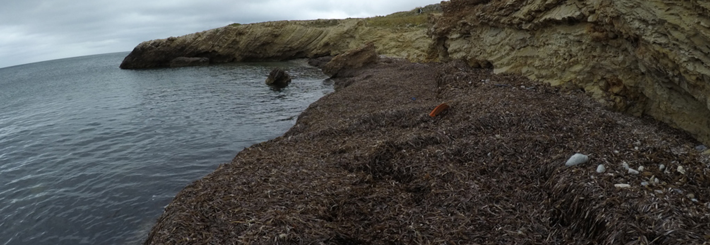
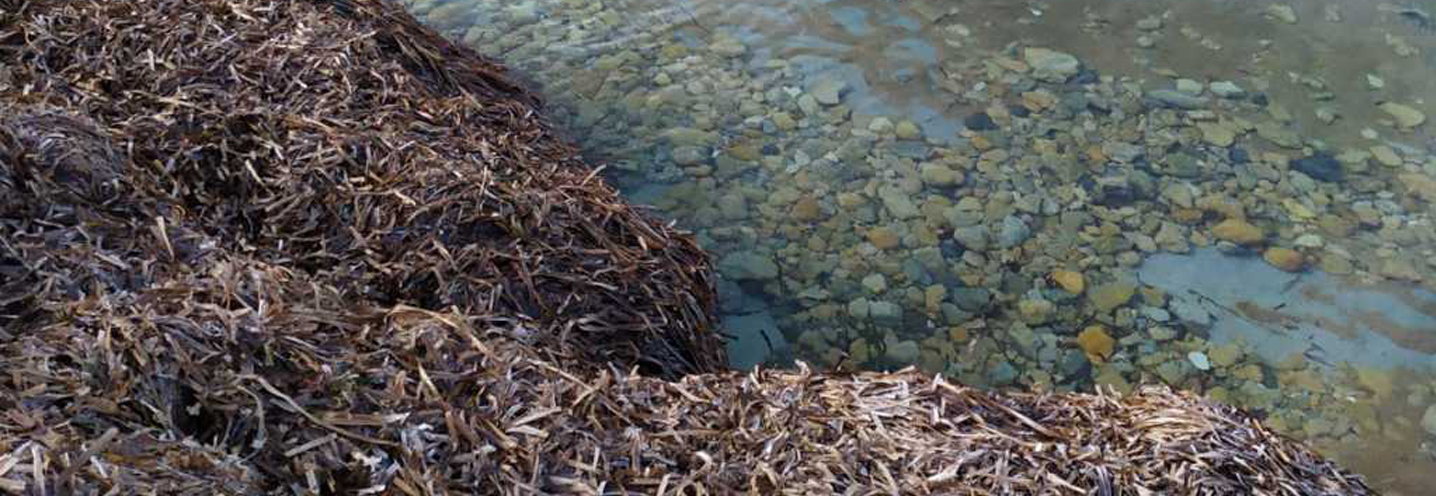
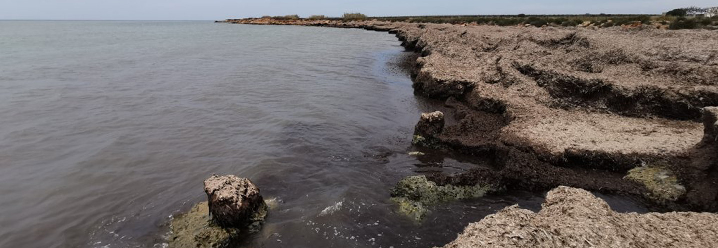
The beach in question is renowned because it represents one of the largest deposits of Posidonia oceanica, whose volume changes continuously in relation to the storms.
The smell of the imposing deposit of rotting organic material is very pungent and makes it unpleasant. It is mainly frequented by surfers due to the constant wind to which the area is exposed.
From a geological point of view, the northwestern sector of the PB consists of a terraced deposit consisting of yellowish calcarenite, while the south-eastern one consists of a marshy deposit of dark earth and greyish clays, more or less sandy.
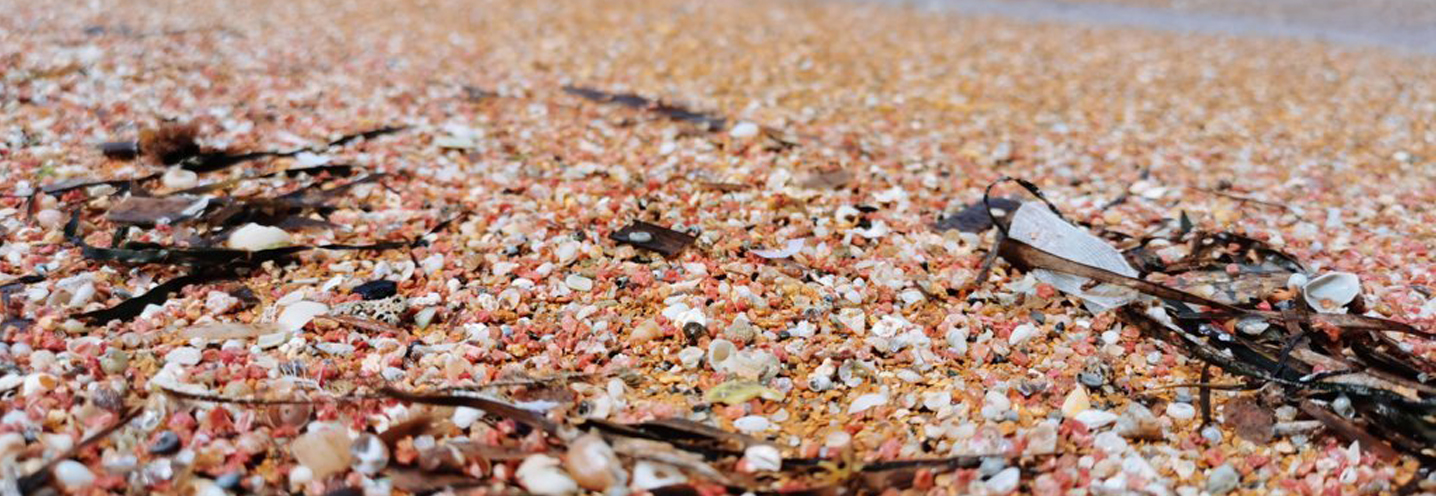
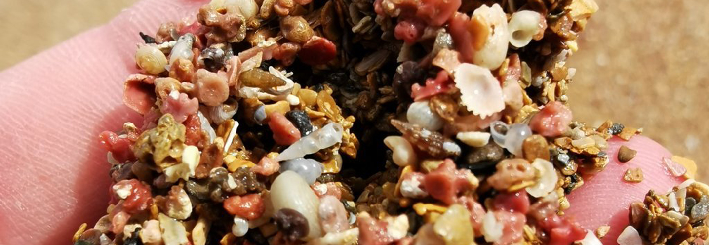
Sediments are represented by well-classified fine sands, greyish-white in color due to the organogenic component.
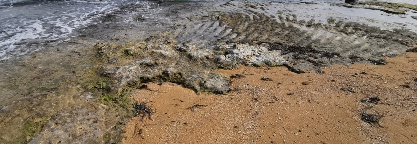
- Mazara Del Vallo – Torre Granitola Nord
Pocket beach code: SIC41TP15
The Pocket Beach (PB) is located in the western sector of Sicily and more precisely in the municipality of Mazara del Vallo (Province of Trapani), in Torretta Granitola. It is part of the PAI Physiographic Unit n13, whose northwestern extremity is Capo Feto and southeastern extremitiy is Capo Granitola.
It is delimited by two fairly accentuated promontories and has a cliff behind it, 5m above sea level, which is very unstable due to the numerous collapse phenomena.
The geological context is constant. In fact a shell breach emerges with associated clays and sands, with Pecten Jacobeaus and Ostrea Edulis.
At the base there are numerous blocks that derive from the collapse of the cliff behind it, and very few sediments. The sediments fall into the granulometric class of moderately classified coarse sands.
- Campobello di Mazzara – Torre Granitola Centro
Pocket beach code: SIC42TP16
It is the northernmost of the two Pocket Beaches (PB) in the municipality of Campobello di Mazara (province of Trapani), located in Torretta Granitola. It is part of the PAI Physiographic Unit n13, whose northwestern extemity is Capo Feto and southeastern extremity is Capo Granitola.
It is delimited by two fairly accentuated promontories and has a cliff behind it, 5m above sea level, which is very unstable due to the numerous collapse phenomena.
From a geological point of view, alluvial deposits emerge such as gravels and sea and river sands. On moving towards the hinterland, there are also shell breaches with associated clays and sands, with Pecten Jacobeaus and Ostrea Edulis.
The PB sediments have granulometries between medium sands and very coarse sands, well classified. The sediments derive from organogenic limestones.
- Campobello di Mazzara – Torre Granitola Sud
Pocket beach code: SIC43TP17
It is the southernmost Pocket Beach (PB) among those located in Torretta Granitola, in the municipality of Campobello di Mazara in the province of Trapani- (Western Sicily). It is part of the Physiographic Unit n.13 of the PAI, whose northwestern extremity is Capo Feto and the southeastern extremity is Capo Granitola.
The promontories that delimit the PB are quite accentuated and have a cliff at the back, 5 m above sea level, which is quite unstable due to the numerous collapse phenomena that make access to the beach very complicated.
Alluvial deposits such as gravels and sea and river sands emerge. On moving towards the hinterland, there are also shell breaches with clays and associated sands, with Pecten Jacobeaus and Ostrea Edulis.
The beach is made up of carbonate clasts with granulometry falling in the class of fine sands, very well classified.
- Favignana
Pocket beach code: SIC44TP18
The Pocket Beach (PB) is located on the island of Favignana (Egadi Archipelago, West Sicily), more precisely in Quattro Vanelle. It falls within the Physiographic Unit of PAI No. 24 relating to the Egadi Islands.
It is delimited to the southeast by Punta Burrone and to the northwest by a less pronounced promontory and represents one of the main attractions of the archipelago of the Egadi islands. There are no surrounding cliffs and waterways.
The geological context is very uniform; the portion of the island of Favignana, on which the PB is located, is made up of cross-layered white to reddish-yellow calcarenites and calcirudites. More internally, it is made up of conglomerates and cemented sands, consisting almost exclusively of well-rounded sediments.
The beach is of a very white color, due to the presence of predominantly carbonate sediments.