
Scientific Instrumentation – Sicily
- APR
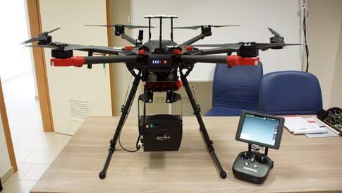
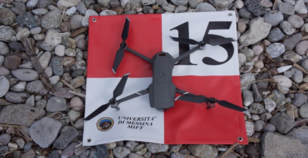
Matrice 600 Pro;
This aircraft, ENAC registered (Ref. 35702) for specialized non-critical and critical operations in standard scenarios S05 / S07, is equipped with a flight terminator and parachute, and has a “Triple Redundancy” flight controller. In fact, it has three GPS and three inertial attitude and altitude systems (IMU).
The Matrix 600 Pro is powered by 6 intelligent batteries and has a flight autonomy of about 30 minutes without any payload, therefore proportional to the load transported which can be a maximum of 5 Kg.
- Matrice 210 RTK;
This aircraft, ENAC registered (Ref. 35703) for specialized non-critical and critical operations in standard scenarios S03 / S05 / S07, is equipped with flight terminator and parachute, has upper, lower and frontal anti-collision sensors; has a sophisticated system (DJI Airsense) for signaling proximity to traditional aircraft (planes, etc.) by detecting the “transponder” signal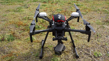 .
.
In addition to being waterproof (IP43), our Matrice 210 also features an RTK (Real Time Kinematic – Real-time Kinematics) system, one of the most sought-after technologies in the APR area, thanks to the countless application advantages it can offer.
- N°2 Mavic 2 Pro;
This small aircraft, ENAC registered (Ref. 35704/35705) for non-critical specialized operations, is equipped with an excellent video camera, with a one-inch sensor, the most advanced camera currently mounted on a DJI consumer drone. It has a closable frame and two powerful landing lights as well as anti-collision sensors on all sides. Mavic 2 Pro is a concentrate of high technology applied to stability, flight safety and miniaturization of electronics.
- Spark;
The DJI Spark is the new ultra-compact drone with GPS and GLONASS with a weight of only 300 grams. The 12 MP camera allows you to take 3968 × 2976 photos and FullHD videos.
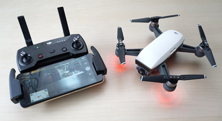
The integrated gimbal with pitch from 0 to 85 degrees allows you to have stable images and to frame the subject from every angle. The rear and front sensors allow you to carry out indoor flights, avoid obstacles and perform commands with simple gestures. The radio control available in the combo version, has a range of 500 meters. All the parameters of the drone, the recording, the live view and much more are displayed directly on the display of your smartphone thanks to the dedicated app.
- SENSORS
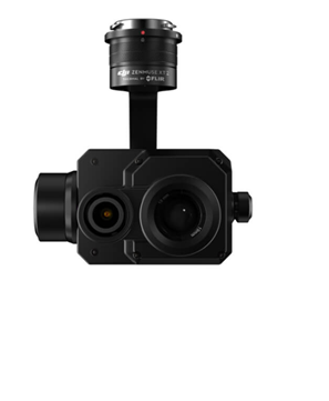
- Dji zenmuse xt2
DJI Zenmuse XT2 is a dual sensor thermal imaging camera built for commercial applications. Housed inside a weatherproof casing is a combination of FLIR’s advanced radiometric thermal sensor and a 4K visual sensor, all perfectly integrated with the powerful DJI enterprise drone systems.
- Zenmuse z30
This new Z30 camera offers an optical zoom of 30X. By multiplying its capacity by 6X, digitally it can become a 180X zoom, capable of considerably enlarging objects from a distance of 100 meters, and with a potential pull ten times higher. 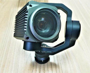 The Zenmuse Z30 was created for the Matrice drone series, and integrates perfectly with them. In fact, DJI defines the Zenmuse Z30 as the most powerful integrated zoom camera that there is currently on the market.
- Zenmuse x5s
Equipped with a Micro 4/3 sensor, the Zenmuse X5S has a dynamic range of 12.8 stops with a much improved ratio between signal and noise and color sensitivity compared to the X5R. It supports up to eight standard M4 / 3 lenses (including zoom lenses) with 9mm-45mm focal lengths (equivalent to 18mm-90mm on a 35mm camera), allowing for greater creative flexibility. 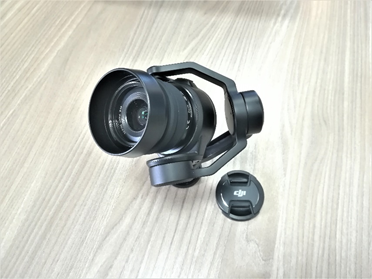 The new CineCore 2.0 image processing system on the Inspire 2 makes the Zenmuse X5S capable of capturing 5.2K 30fps CinemaDNG and Apple ProRes videos in addition to 4K 60fps using H.264 and 4K 30fps using H.265 (both at 100Mbps). Continuous shooting of DNG at 20 fps with 20.8MP images is also supported. The Zenmuse X5S was designed to keep up with the rigors of high-end professional aerial video footage.
- Micasense REDEDGE MX
This is a professional multispectral camera with incident light sensor designed specifically for agricultural operations. This version is fully integrated with our 210 RTK Matrix.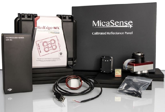
It allows you to make accurate and repeated measurements and collect other necessary data during each flight to get everything from basic plant health indices to advanced analysis.
- GPS
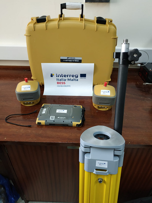
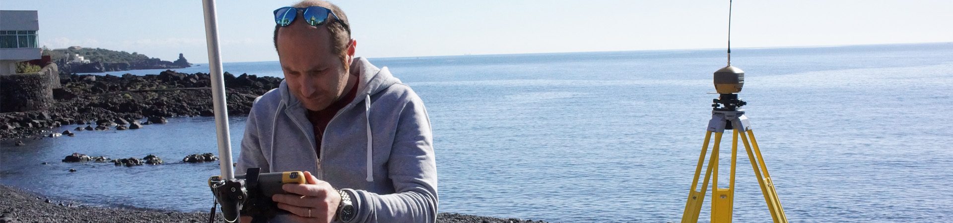
- HiPer VR GNSS BASE + ROVER receiver for surveying the coordinates of the targets
The HiPer HR GNSS receiver overcomes the challenges in the field with a unique blend of technologies. 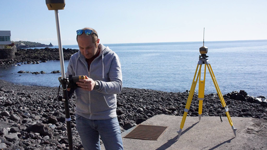
- Markers (Ground Control Points)
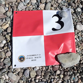
Ground control points (or GCPs) are points on the ground with known coordinates.
In an aerial mapping survey, GCPs are points which the surveyor can precisely pinpoint: with a handful of known coordinates, it’s possible to accurately map large areas.
- SOFTWARE
Pix4dmapper
Pix4Dmapper transforms your images into digital spatial models. It seamlessly processes your projects using the cloud or the desktop photogrammetry platform  Measure distances, areas, and volumes. It extracts elevation profile data and performs virtual inspections
- Globalmapper 19 with Lidar Module
Global Mapper is an inexpensive and easy to use GIS application that offers access to an unprecedented variety of spatial data sets.  It offers the right level of functionality to satisfy both experienced GIS professionals and novice users.
- Envi 5.5 with bomber module
ENVI allows a wide range of data processing possibilities from the classification to the relative water depth by passing to the spectral indices (Green Chlorophyll index, vegetation index, etc.).
The latest released version of the ENVI software is provided by Harris Geospatial Solutions Company with an improvement in image processing compared to the previous version. ENVI software is used by professionals and scientists working in the field of remote sensing and GIS who wish to transform raw image data into meaningful information.  With the evolution of technology and the increase in Earth observation data, this software is accessible on desktops, mobile devices and also works in a cloud environment. BOMBER stands for Bio-optical Model Based tool for estimating Water quality and bottom properties from Remote sensing imaging is a tool installed in ENVI 5.5 software capable of extracting optical information of water column and water bottom on remote sensing data acquired in shallow water. Initially designed to study the water of lakes, this tool is being tested in coastal areas.
- DIETRICH-FRUHLING CALCIMETER
Instrument to determine the fast contents of CaCo3 (calcium carbonate) according to the method Dietrich-Fruhling. Essentially consisting of a sample-holder, one serpentine for cooling and one graduated cylinder with readings on the result of reaction between calcium carbonate and diluted chloridric acid. Since the volume of Co2 (carbonic anhydride) is in relationship with CaCo2 (carbonate contained in the material) it shall be possible to calculate the percentage of CaCo3.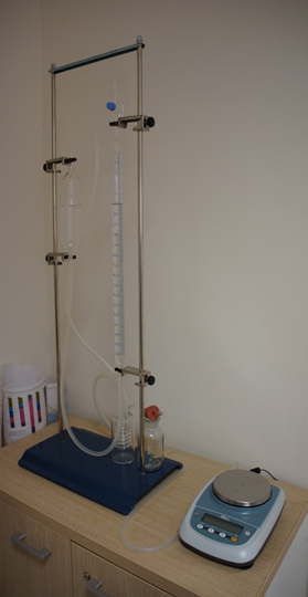
Scientific Instrumentation – Malta
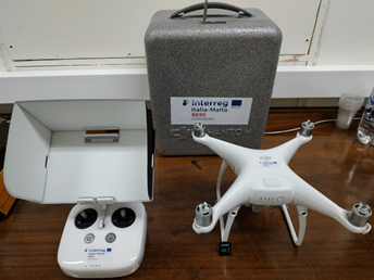
DRONE
- DJI Phantom 4 pro equipped with 20 Megapixel camera for aerial image acquisitions aimed at photogrammetry and 3D modeling of coastal areas.
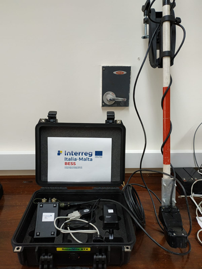
ECOSCANDAGLIO
- Ohmex Sonarmite BTX Single Beam depth sounder for detailed bathymetric surveys. The instrument is capable of operating up to a maximum depth of 75m with an accuracy of 2.5cm.
GPS
- Double GNSS TOPCON Hiper HR receiver consisting of Base + Rover for precision topographic surveys and used in the detection of ground reference points during the aerial photogrammetric survey by drone. In addition, this system is able to connect to the Sonarmite BTX sonar to provide geographic coordinates with sub-centimeter accuracy.