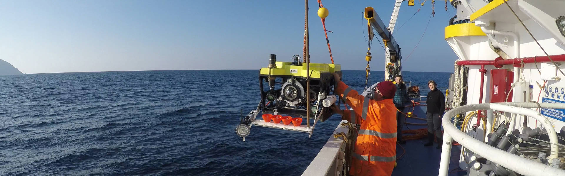
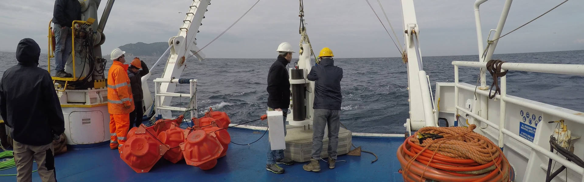
BESS

BESS

Pocket Beaches Remote Monitoring Systems
Pocket Beaches
WebGIS
BESS TV
Photo Gallery

The Project

“Bess” Pocket Beach Management & Remote Surveillance System is a project co-funded by the European Union, lasting 30 months, coordinated by prof. Salvatore Cuzzocrea, Rettore dell’Università di Messina (MIFT-UNIME). This project brings together two Maltese partners the Ministry of Godo and Euro-Mediterranean Centre on Insular Coastal Dynamics (ICoD)  togetherwith three Sicilian partners: l’Università degli Studi di Messina, Dipartimento di Scienze Matematiche e Informatiche, Scienze Fisiche e Scienze della Terra (MIFT-UNIME), l’Università di Palermo, Dipartimento di Scienze della Terra (DiSTeM-Unipa), l’Istituto Nazionale di Geofisica e Vulcanologia (INGV).

POCKET BEACHES (hereafter PB), literally “pocket-shaped” beaches, are small beaches limited by natural headlands, strongly jutting into the sea, free from direct sedimentary contributions that are not eroded from back-shore cliffs. Along the Maltese and Sicilian coasts are several PB, which depending on their isolation and level of exposure, preserve ecological niches of great value, and thus represent relic deposits, formed under different conditions from those currently experienced, suggesting a response naturally resilient to the effects of climatic changes.

These beaches are prized by tourist but often suffer the impact of human pressure and trigger risks to the safety of the same users.

It is proposed to map all the PB to create a remotely sensed monitoring platform (fix and satellite), based on the identification of specific geomorphological and sedimentological indices, in order to preserve this erosion sensitive environmental niche and ensuring continued tourist use. The project will equip Public Administrations with an erosion predictive instrument, and its subsequent management will be the responsibility of those who produced it, and who can provide on-demand support.

The project involves sharing with stakeholders of all its phases and will end with the production of a beach management manual and the drafting of two management plans on two sample locations. The MIFT-UniMe and ICoD provide experts on coastal geomorphology and development of the abiotic components of the project, while DiSTeM-Unipa will address those aspects related to biotic components, with particular reference to the analysis of the contribution of seagrass to the production of detritus accumulations on the coasts. INGV will integrate the product in its surveillance system network and the Ministry for Gozo will cover the communication aspects.

Objectives

POCKET BEACHES, literally “pocket-shaped” beaches, are small beaches limited by natural headlands, strongly jutting into the sea, free from direct sedimentary contributions that are not eroded from back-shore cliffs.

Along the Maltese and Sicilian coasts are several pocket beaches which, depending on their isolation and level of exposure, preserve ecological niches of great value, and thus represent relic deposits, formed under different conditions from those currently experienced, suggesting a response naturally resilient to the effects of climatic changes. These beaches are prized by tourist but often suffer the impact of human pressure and trigger risks to the safety of the same users. The BESS project will map all the pocket beaches in Malta and Sicily to create a remotely sensed monitoring platform, based on the identification of specific geomorphological and sedimentological indices and the evolution of beach-incident wave motion, in order to preserve this erosion-sensitive environmental niche and ensuring continued tourist use.

The project will equip Public Administrations with an erosion predictive instrument, and its subsequent management will be the responsibility of those who produced it, and who can provide on-demand support. The project involves sharing with stakeholders of all its phases and will end with the production of a beach management manual and the drafting of two management plans on two sample locations.

The MIFT-UniMe and ICoD; will provide experts on coastal geomorphology and development of the abiotic components of the project, while DiSTeM-Unipa will address those aspects related to biotic components, with particular reference to the analysis of the contribution of seagrass to the production of detritus accumulations on the coasts. INGVwill integrate the product in its surveillance system network and the Ministry for Gozo will cover the communication aspects.

The BESS Project is funded under the EU’s INTERREG ITALIA-MALTA Programme. It is partfinanced by the European Union’s European Regional Development Fund (ERDF), co-financing rate: 85%/75% EU Funds; 15%/25% National Funds.

Pocket Beaches
Pocket Beaches
Pocket Beaches
Pocket Beaches
Pocket Beaches
Pocket Beaches